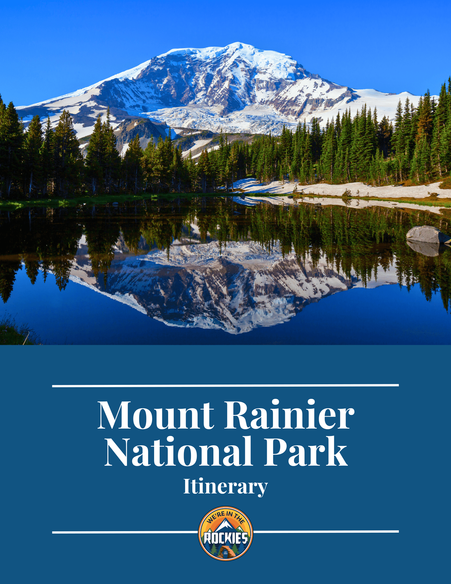
One day, I heard someone say “Why would I go hiking in Mount Rainier? All the hikes are on the mountain, right?”
I’m here to tell you that is wrong. Mount Rainier provides a diverse set of over 150 hiking trails from easy flat day hikes, to difficult full-day trails and mountaineering. I’ve made a list of the top 10 hikes in the park that I feel are the best hiking experiences for someone who wants to make the most of their trip to Mount Rainier.
My name is Lukas Gott and I spent a summer working at Paradise Inn at Mount Rainier in 2024. I used much of my free time hiking these trails and collected a lot of handy tips. Read on as I share how to approach the delicacies of the Mount Rainier trails and all that they have to offer.
Before we continue, here’s a quick answer guide to hiking in the park based on your skill level.
| Easy Hikes | Moderate Hikes | Hard Hikes |
| Myrtle Falls | Skyline Loop Trail | Camp Muir |
| Snow/Bench Lake | Mount Fremont Lookout | Gobblers Knob |
| Nisqually Vista | Comet Falls | Burrough Mountains |
Best Hike for Kids: Snow/Bench Lake Trail
Must Do Hike: Skyline Loop Trail
Hike at Sunset: Myrtle Falls/Nisqually Vista Trails
Best Mountain Hike: Burroughs Mountain Trail
Best Backcountry Hike: Gobblers Knob Trail
Best Waterfall: Comet Falls Trail
Best Mountaineering: Unicorn Peak
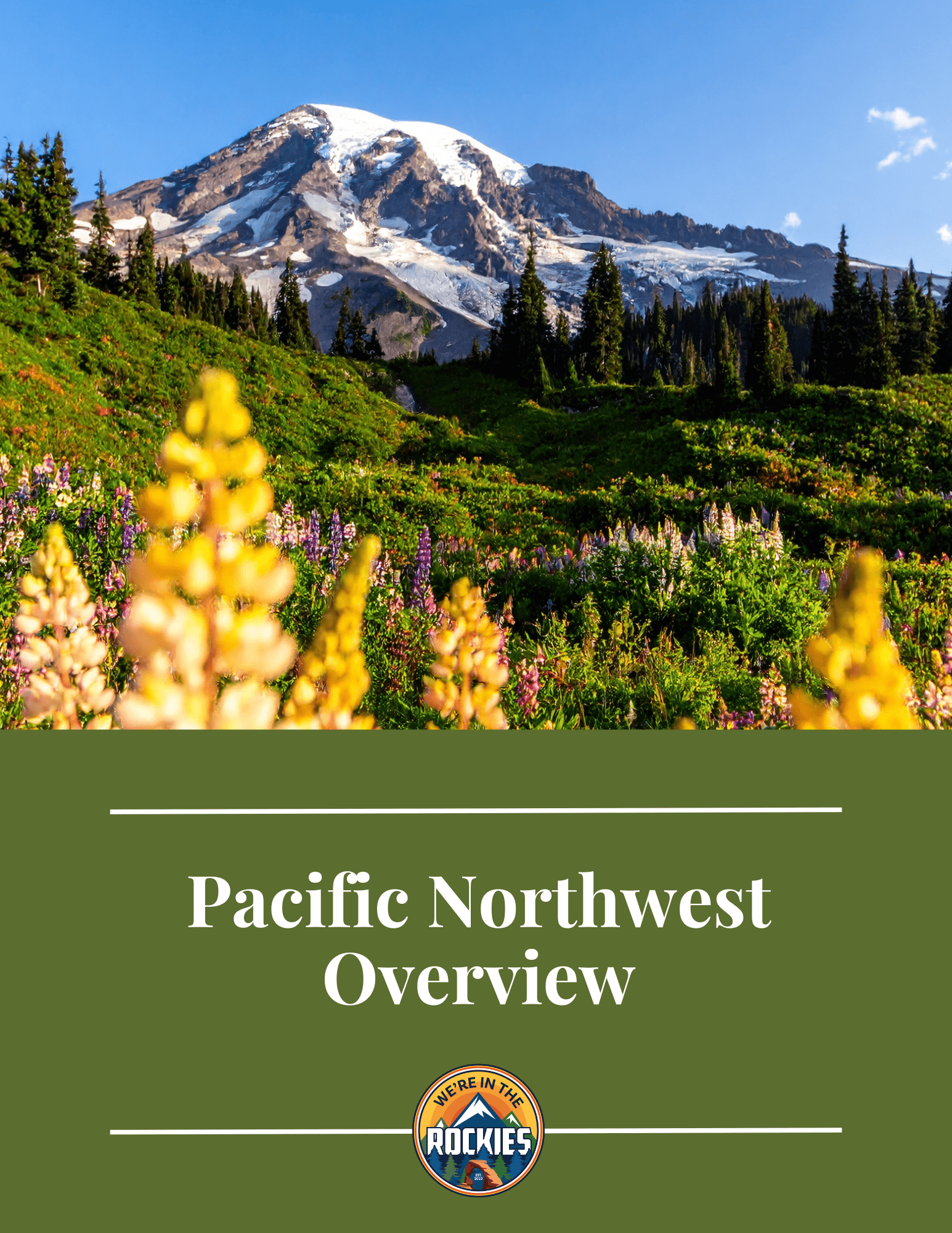
Mount Rainier is divided into two main areas: Paradise Corridor and Sunrise. Paradise is the more popular area of the park and most of the hikes mentioned are within this area. Sunrise is also beautiful and less visited.
Be aware that Mount Rainier does not have a bussing system. This means a car will be required to visit these hikes that are all located near or in the Paradise and Sunrise Corridors.
DISCOVER: Which Entrance Should I Use to Visit Mount Rainier?

Get our done‑for‑you, 2-3 day plan with exact drives and must‑see stops so you don’t waste time in traffic or miss the best views
Inside the guide:
*Step-by-step plan that will take you to the best hikes, drives, wildflowers, and waterfalls
*Exact time-frames and star-ratings so you can make the best use of your time and money
*Best Friend Guarantee: love it or get your money back
*Visiting more in the PNW? Save big $ and get guides for Olympic, Mount Rainier, the Oregon Coast and the Columbia River Gorge with our PNW Bundle.
Below are my very favorite hikes within the park, starting with my very favorite.
The skyline trail in Mount Rainier is the star of the show in the park. The trail begins in the Paradise parking lot, which will be nearly full by sunrise in July/August, so get there early. The trail features picture-worthy views of Mount Rainier, arguably the best wildflower experience in the park, and marmots running amuck. In short, this hike is why you come to Mount Rainier. It’s the full experience, so don’t skip it!
While gorgeous, this trail is more complex than a regular loop and will test most day hikers with its uphill nature. The full skyline loop hits Panorama Point, Myrtle Falls, Narada Falls, and Glacier Vista in one full loop. In my opinion, it shouldn’t be done in one day.


Quick Tip: Don’t forget the sunscreen! Even on a cool cloudy day, this high-elevation hike will roast you.
While I fully support taking the trail in one day if there are more activities ahead (maybe more of these hikes?), the Skyline trail should be done in two days for two reasons. One, to enjoy the views, trail, and wildlife. This trail should be done slowly, taking time to admire the views and snapping way too many pictures of the wildflower show and towering glacial mountain that stands before you.
Also, take half a second to watch the marmots. They each have their own individual personalities and will take just as much interest in you, as you in them. But PLEASE don’t feed them, as well as the chipmunks, who will be all up in your space with any food nearby.
Two, this trail is so expansive that a lot of hikes connect to the Skyline trail such as the Alta Vista Trail, the Nisqually Vista Trail, and the Reflection Lakes Trail. For now, I would recommend separating the loop into doing Nisqually Vista, Panorama Point, Glacier Point, and Alta Vista in one day, then doing Myrtle Falls, Narada Falls, and possibly Reflection Lakes on the second day.

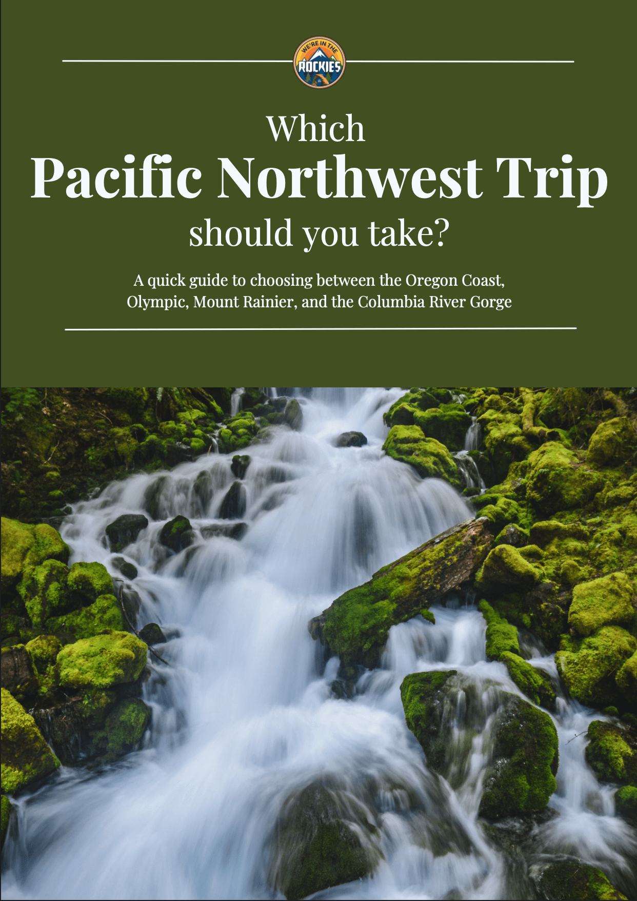
A quick guide to choosing between the Oregon Coast, Olympic, Mount Rainier, and the Columbia River Gorge
*See what you can realistically do in the time you have (3-13+ days)
*Choose the RIGHT regions for you. Do you like to hike, relax, eat good food, take scenic drives?
*Avoid the classic PNW mistakes that waste hours in the car
Myrtle Falls is maybe one of the best bang-for-your-buck hikes in the park. This hike begins at the upper parking lot of Paradise Inn, where you can either bank an immediate right at the Skyline Loop trailhead towards Myrtle Falls or walk to Paradise Inn and find the wooden staircase at the end of the loop parking lot.
Once on the trail it’s flat and self-explanatory until you arrive, where you will be met with a beautiful valley full of wildflowers and sunbathing marmots, as well as the towering myrtle falls going under your feet when you cross the bridge. This hike is simple and easy and with its short nature, it allows a cozy drink to be brought from the cafe, or a quick sunset trip without worrying about a long hike back in the dark.


When entering the park through the West entrance, the road passes by Cougar Rock campground and the trailhead to Carter Falls, a popular waterfall hike. Skip it, further up the road is the small roadside Comet Falls trailhead. Comet Falls is a 380 ft. waterfall that dwarfs Carter Falls and has far less tourist traffic.
This hike isn’t unnecessarily long, albeit longer than Carter Falls, but does have a small ladder climb that may make this trail a bit more difficult for some. The ladder is leaned against a hill and, unless wet, could be considered stairs. But if you’re up for it, this hike will lead to the best waterfall in the park, and one you can nearly stand under as well (don’t do it, there’s a lot of pressure from water falling 380 ft).
When I visited in early June (which I don’t recommend), I got a view of the waterfall with an ice cave built below. The experience in the cave was gorgeous, wet, and freezing.


VISITING MOUNT RAINIER AND NEED A GAME PLAN? CHECK OUT OUR ITINERARY.
Mount Fremont is our first hike in Sunrise or the northern section of the park. Sunrise is absolutely gorgeous and worth visiting, but if you’re visiting for the first time, I recommend visiting the Paradise side of the mountain first.
This trail begins on the Sourdough Ridge Trailhead and passes by Frozen Lake, both worth visiting in their own right but could be visited on the same trip. Now Mount Fremont, similar to Gobblers Knob, is one of the 4 remaining maintained fire towers in the park. I’m putting Mount Fremont above the Knob in my rankings. The hike and solidarity of Gobblers Knob make it my preferred fire tower, Mount Fremont has a far easier access point, easier hike, and a closer and arguably wider view of Mount Rainier.


The Snow/Bench Lake hike sits below Paradise Inn near the beginning of Stevens Canyon Road (the road that heads towards Sunrise), where there will be a pull-off after passing Reflection Lakes for parking. This 2-mile hike will lead you through the forest until you reach Bench Lake, which will give you beautiful picture opportunities to catch a reflection of Mount Rainier. Snow Lake is the real prize on this trail for me though, as the shallow, cold, yet swimmable lake sits in a bowl below Unicorn Peak and other members of the Tatoosh mountain range.
QUICK TIP: Be aware that this trail is full of shallow water and provides a good environment for mosquitoes to run amok. Bringing bug spray will make this hike more enjoyable.
Sign up for park updates, travel ideas, new guide releases, discounts, and stories of the West all in our weekly newsletter delivered to your inbox once a week.
Burroughs Mountain trail is one of the closest views of Mount Rainier and the most adaptable hikes in the park. This trail also begins on the Sourdough Ridge Trailhead and passes the Mount Fremont cutoff. Now, sadly, this hike is the one hike on this list I have not done, although I wish I had. This mountain trail takes you through a series of three peaks, each with a better view of Rainier. My friends have told me the third peak has the best view, but even the first peak would be worth the trek. While I’ve never participated, the pictures I’ve seen of this trail warrant a future visit for myself and for anyone visiting, with one of the best Mount Rainier Glacier viewpoints in the park.
This hike begins on the mostly well-maintained dirt Westside Road and eventually leads you to one of Mount Rainier’s 4 maintained fire towers. It is quite a long hike, but not overly challenging.
Lake George itself is a peaceful place, with fewer tourists on the west side of the park. Gobblers Knob is another mile from the lake and is much steeper than the first of the hike. This fire tower is far less touched than Mount Fremont Lookout and once you reach the top, from what I hear, the views are amazing and it is even possible to see Mount Hood, Mount St. Helens, and the Olympic Mountains on a clear day.


Nisqually Vista as mentioned earlier is connected in the same trail system as the Skyline Loop Trail and would be the best secondary option to the Skyline Loop as it will cover a lot of the same environment. The only difference, it’s less of a hike and more of a casual stroll.
The Nisqually Vista trail begins either in the lower Paradise parking lot or via the Skyline Loop Trailhead, but I recommend taking the lower parking lot as the skyline entrance can be quite confusing. This trail will give you an almost equal experience with Mount Rainier views and wildflowers with a far less strenuous hike.


Eagles
Pinnacle
Unicorn
For this section, I wanted to do a three-for-one to give everyone a fair share at climbing a peak in the park.
Eagles Peak is a long trail, but as far as peaks, it’s the least strenuous. It has beautiful views of the valley and Rainier on a clear day. This is still a peak trail though, so be aware the portion past the saddle is confusing and dangerous with the trail continuing through some bushes to the left of the face wall. When you come out of the bush, there will be a 15-foot wall in front of you, go to the left and follow the beaten path to the peak.
Pinnacle Peak is arguably the most popular peak in the park, with its easily accessible location above the Reflection Lakes parking lot. This hike is short and straight up until you reach the peak climb, which is also straight up. This climb is fully exposed to the backside of the mountain, and while the peak is breathtaking, don’t take any unnecessary risks when the hike is as gorgeous as it is.
Unicorn Peak is the hardest peak aside from Rainier in the park and sits above the Snow Lake trail. To reach the saddle you will need crampons and an ice axe for a vertical snowfield ascent. This is then followed by a transfer into mid-level mountaineering with a finishing peak that requires Class 5 scrambling. I label this as my top hike for mountaineers to visit.
Camp Muir is the base camp for climbing Mount Rainier via the Disappointment Cleaver, the most popular route of the mountain. I am NOT recommending climbing the mountain unless you have mountain experience, proper research, and some good buddies with similar skill sets.
Mount Rainier is the 3rd tallest mountain in the lower 48 states and requires emergency crevasse rescue training for its crumbling glaciers, as well as full mountaineering gear in preparation for ascent. People train for Mount Everest on this route, don’t take that lightly. The easiest way to ascend the mountain if interested would be to join the experts, and book a climbing group through Whittaker Mountaineering.
Now on the other hand, Camp Muir is an easier (not easy) option if you’re looking to push your body and possibly get some views of the mountain face. Make sure to talk with the Rangers about weather and snow conditions before attempting, as nasty storms form quickly near the mountain.
This hike begins on the Skyline Trail and then after reaching Panorama Point, it immediately provides a snowfield that will test your hiking ability. The snowfield looks as though it’s gradually going uphill, but amid the hike it appears as several hills, the next hill unseen behind the current.
Camp Muir itself is a small castle-looking camp that provides a one-night home for those summiting that night. Talk to a few climbers and observe Rainier from directly below in its most terrifying state.
FIND OUT: Best Places to Camp In and Around Mount Rainier

The Silver Falls loop sits about halfway between Paradise and Sunrise, making it hard to slip into a weekend schedule. But because of its awkward location, it’s also less hiked and receives far less snow at lower elevations, making it an ideal early-season hike.
This trail follows the Ohanapecosh River, which is built like a canyon, with waterfalls dropping at several locations. One of the pros of this hike is that the river has quite a few rock outcroppings that make for an ideal picnic or sunbathing spot. Overall, it’s a relaxing hike that is ideal for a short day to enjoy natural beauty.
Get our done‑for‑you, 7‑17 day route with exact drives, maps, and must‑see stops so you don’t waste time in traffic or miss the best views
Inside the guide:
*Day‑by‑day plan for Olympic, Mount Rainier, the Oregon Coast, & the Columbia River Gorge
*Details you need: Time frames, driving routes, and where to sleep each night to reduce back-tracking
*Best Friend Guarantee: love it or get your money back
I’d like to tell a cautionary tale that applies to all these hikes, but in this case, took place at Gobblers Knob, hike 7 on this list. Gobblers Knob is on my list of hard hikes, and one weekend my friends and I attempted to approach it as a backpacking trip.
QUICK TIP: Backcountry camping permits are easily acquired at the Ranger station in Paradise or Longmire.
After hiking 2 to 3 miles, we felt a slight drizzle, but were relatively unalarmed, as it had become quite a normal occurrence to us since arriving a month ago. On this hiking trip, we did have high-quality rain jackets, but the drizzle became a sideways downpour!
GOOD TO KNOW: In the early summer season of Mount Rainier, May through June (sometimes July!), the weather is truly unpredictable with wild snow storms, strong alpine winds, and lots (and I mean lots) of rain. Plan for unpredictable weather reports by bringing multiple layers and a strong waterproof cover to protect you and your valuables from a surprise shower.
And while soaked and a bit distorted from the wind, we did take a lot of pleasure in viewing what could have been no less than 8 small waterfalls forming on the walls of Mount Wow (a lot of Owen Wilson “Wow” impressions are necessary here). The hike to Lake George continued as a gravel road, then became an example as to why the western half of Mount Rainier can be considered a temperate rainforest; it brought plenty of mushroom identification and moss poking.
That night the downpour continued and we became frigid in our now-soaked clothing. Our only savior, a ranger-built hut to keep us out of the rain.
The next morning we climbed toward Gobblers Knob still soaked. The trail entailed several switchbacks around the backside of Lake George until, poof, the trail was gone. Snow covered everything except a few bare patches here and there.
QUICK TIP: Up until early July there is a chance snow could remain on any number of trails, especially at higher elevations. And don’t forget, even when it’s foggy and snow is on the ground, wear sunscreen. Sunburns are unforgiving in Mount Rainier.

We got lucky, as after wandering for an hour, we found ourselves back on the trail. Upon reaching the top of Gobblers Knob, we found the firetower boarded up and our view was covered by clouds and fog. I imagine from pictures I’ve seen that this is one of Rainier’s most underrated hikes with a grand view from a beautiful fire tower. But if I still highly recommend this hike after hiking in the rain for two days and without seeing the view, it must be a pretty darn good hike in the middle of summer.
Although we had a tremendous amount of fun freezing our butts off, it was a true lesson for us and anyone reading: early-season hiking in Mount Rainier is not ideal. For the most part, mid-summer days will provide perfect hiking conditions, yet no matter what trail and what time of the year, you should always be prepared for the worst weather in Mount Rainier.
Most travelers want to visit the most popular sites and still avoid the crowds. We have a detailed itinerary that gives you a step-by-step game plan so you can get to the best places at the right times.
MOUNT RAINIER TRIP PLANNER: To read or watch all of our content about Mount Rainier National Park, check out our Mount Rainier Homepage.
THINGS TO DO: Don’t miss all that Mount Rainier has to offer in the Paradise and Sunrise areas, including hiking and the beautiful wildflowers.
WHERE TO EAT: Don’t miss the best places to eat in Mount Rainier National Park
KNOW BEFORE YOU GO: Find out which is the best entrance to use, the best time to visit, and all about driving around Mount Rainier