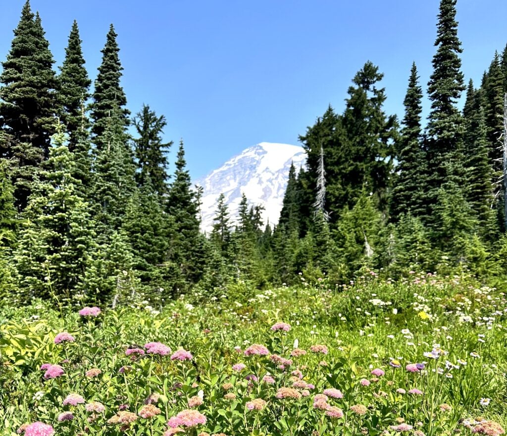
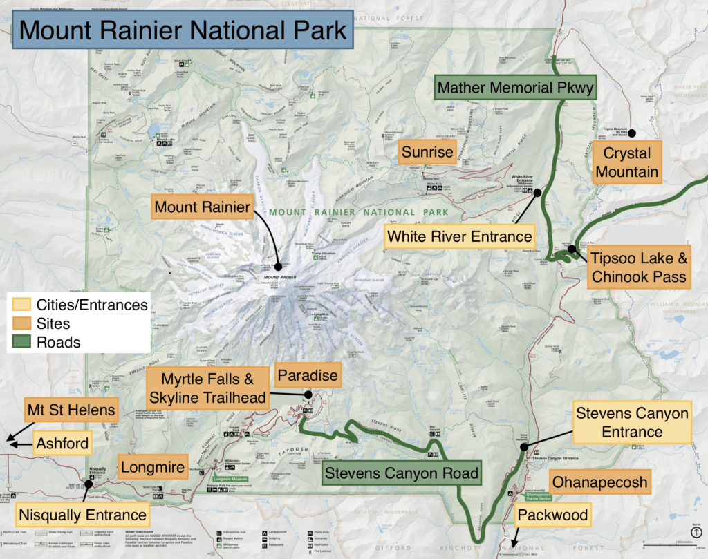
Mount Rainier was the fifth national park, created in 1899. The peak itself is over 14,000 feet and has the highest prominence (floor to peak) in the Lower 48 states. The size will blow you away as you visit the park! But the park is more than just Mount Rainier – it’s bordered by the Tatoosh Range and full of old-growth forests, rivers, lakes, glaciers, and the ultimate cherry on top: fields of wildflowers.
Get our done‑for‑you, 2-3 day plan with exact drives and must‑see stops so you don’t waste time in traffic or miss the best views
Inside the guide:
*Step-by-step plan that will take you to the best hikes, drives, wildflowers, and waterfalls
*Exact time-frames and star-ratings so you can make the best use of your time and money
*Best Friend Guarantee: Love it or get your money back
*Visiting more in the PNW? Save big $ and get guides for Olympic, Mount Rainier, the Oregon Coast, and the Columbia River Gorge with our PNW Bundle.


Get our done‑for‑you, 7‑17 day route with exact drives, maps, and must‑see stops so you don’t waste time in traffic or miss the best views
Inside the guide:
*Day‑by‑day plan for Olympic, Mount Rainier, the Oregon Coast, & the Columbia River Gorge
*Details you need: Time frames, driving routes, and where to sleep each night to reduce backtracking
*Best Friend Guarantee: Love it or get your money back
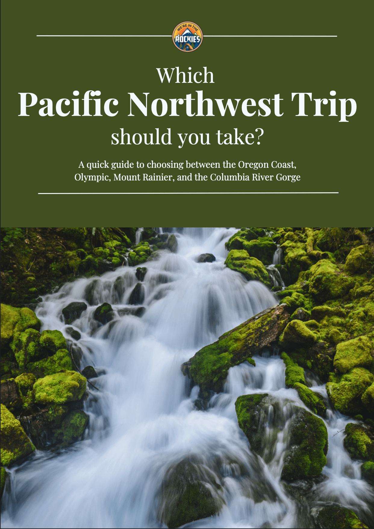
A quick guide to choosing between the Oregon Coast, Olympic, Mount Rainier, and the Columbia River Gorge
*See what you can realistically do in the time you have (3-13+ days)
*Choose the RIGHT regions for you. Do you like to hike, relax, eat good food, take scenic drives?
*Avoid the classic PNW mistakes that waste hours in the car
