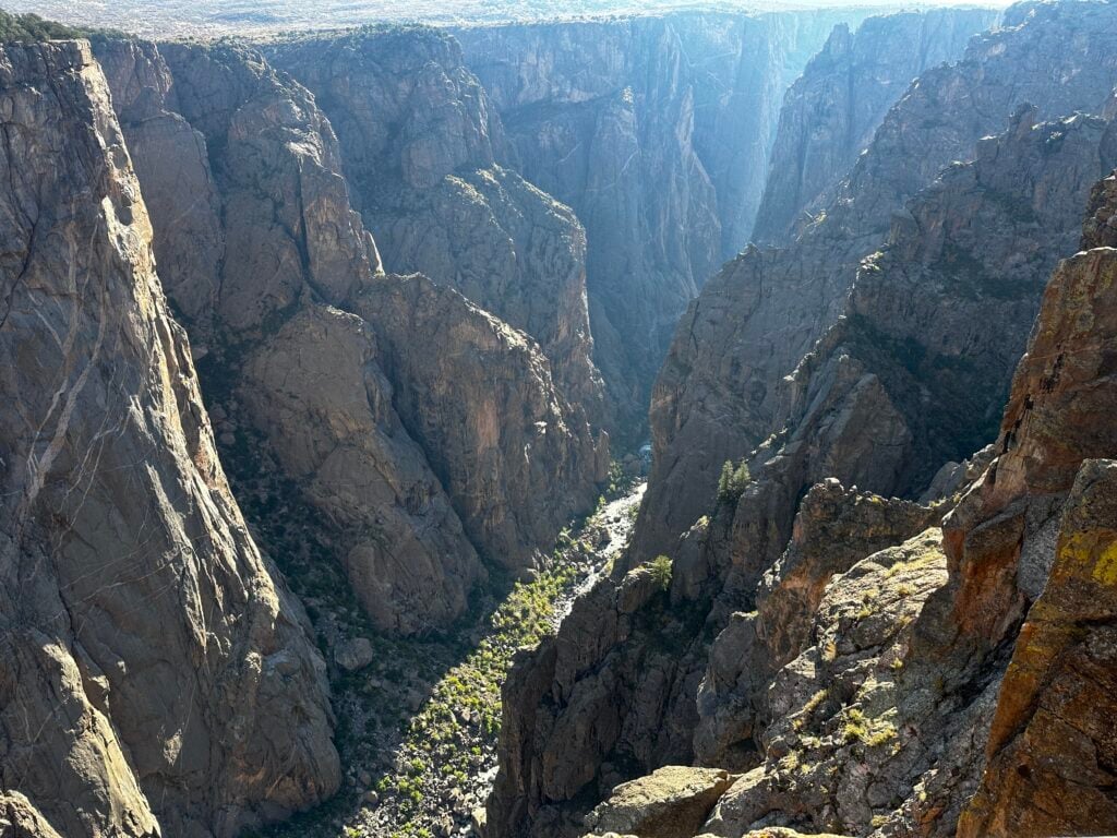
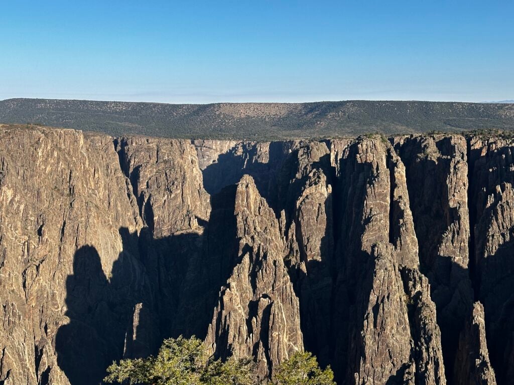
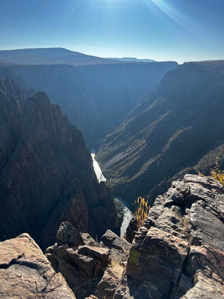
Black Canyon of the Gunnison National Park is a narrow canyon that is over 2,000 feet deep. It’s so deep and narrow that some areas never get sunlight. This, as well as the walls being dark, has given it the name Black Canyon. This is a 1/2 day park for most people. It’s mostly a drive along the South Rim with a few stops for awesome viewpoints, but there are a few more things you can do if you have more time.
I’m Cheryl and have been writing about traveling in the West since 2020. I live in Utah and spend a couple of months every year exploring new places and visiting some of my old favorites. Colorado is near and dear to my heart, and I can’t wait to share with you the exact things I share with my family and friends when they make their first trip to the Black Canyon of the Gunnison.
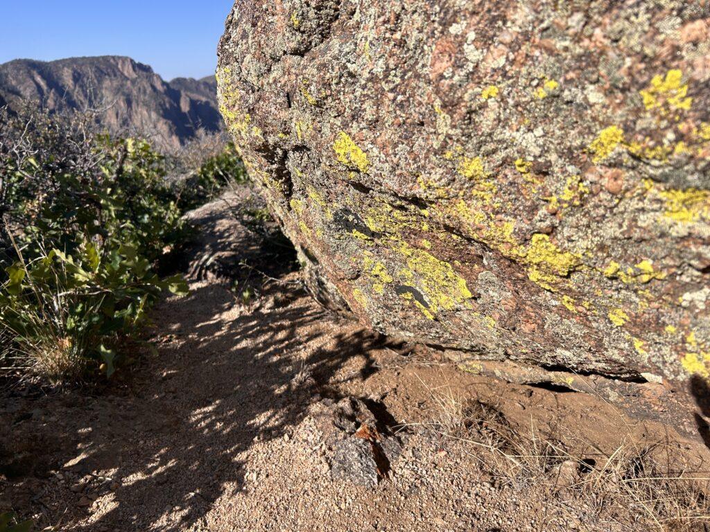
It actually reminds me of Zion National Park, except the rocks are black or darker in color with narrow pink streaks running vertically, horizontally, and diagonally. There is even a lookout where the pink streaks look like a dragon!
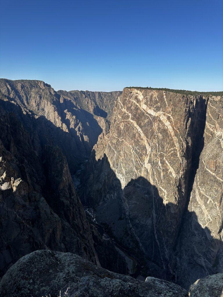
FUN FACT: The pink streaks that run through the Black Canyon of the Gunnison are called pegmatite and are made of molten rock.
I love the slight breeze, hearing the Gunnison River, and feeling the crunchy dirt as I hike. The sky is really blue and you can see the landscape for a long way in the distance because there are few trees to block the view.
The canyon rocks are covered with bright green moss, and towering rock spires are scattered throughout the canyon.
Without further ado, here are my very favorite things to do at Black Canyon of the Gunnison National Park.
Best Hike: Warner Point Nature Trail
Best Drive: East Portal Road
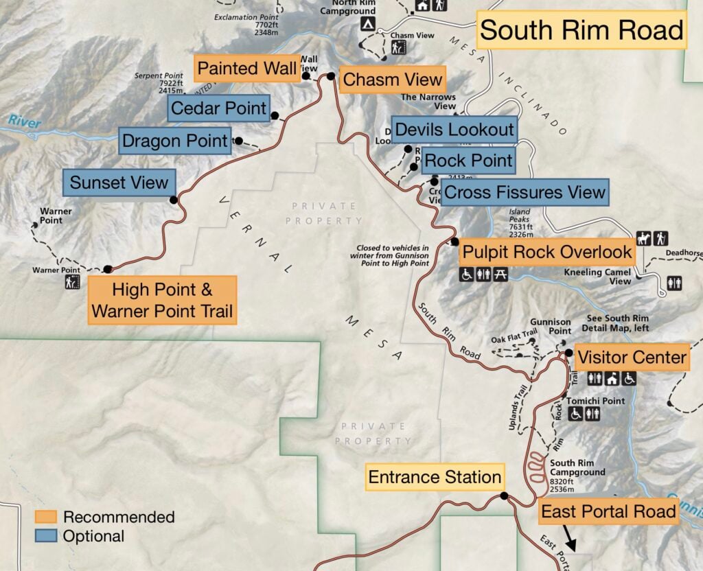
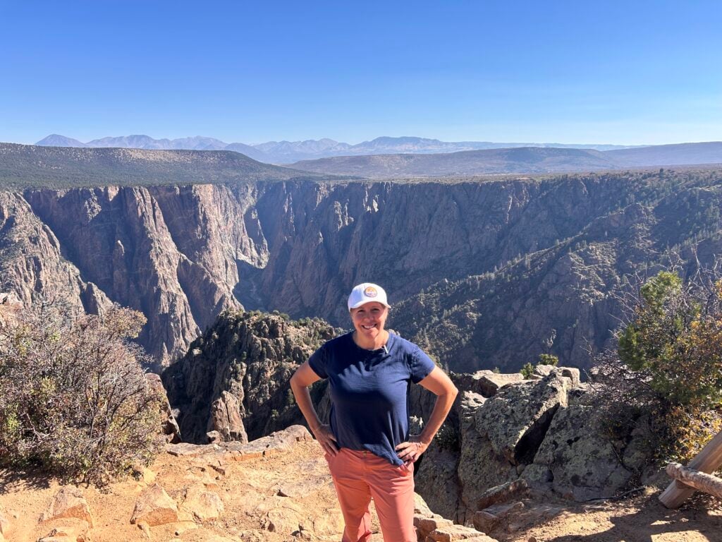
Best Viewpoints: Gunnison Point (my fav), Pulpit Rock
(my husband’s fav), and Dragon Point is cool too
Favorite Spot in the Park: The walk along the Gunnison River
Best Bathrooms: South Rim Visitor Center
This visitor center has the displays you would expect in a typical national park visitor center: displays of how the canyon was formed, taxidermy of animals found in the park, a ranger desk where you can ask questions, a small gift shop (no food though), flushing toilets, and a spot where you can fill up your waterbottle.
What I like about this visitor center is that it has a great platform out back with one of my favorite views of the canyon, Gunnison Point. This is a low-effort, high-reward spot because it’s just a short, accessible walk to get you your first views of the Black Canyon of the Gunnison! From here, you can easily see the Gunnison River below as well as some impressive spires!
Get our done‑for‑you, 7‑14 day route with exact drives, maps, and must‑see stops
so you don’t waste time in traffic or miss the best views
*Day‑by‑day plans for Colorado’s national parks and mountain towns
*Details you need: best activities, hikes, drives, and where to sleep each night to reduce back-tracking
*Best Friend Guarantee: love it or get your money back
I list this one next because you can begin this hike from the South Rim Visitor Center. It’s one of the few opportunities at the Black Canyon of the Gunnison to get below the rim. The rest of the hikes to do this require a backcountry permit. It’s a 1.4-mile loop that takes most people 45 minutes and is moderate/strenuous. Go counterclockwise to avoid the steep climb at the end.
MY TAKE ON HIKING AT BLACK CANYON: I LOVE to hike, but most hikes at Black Canyon are unappealing to me. Most are steep, strenuous, exposed, and incredibly rocky, with plenty of loose gravel that I am afraid of sliding and falling. Because Colorado is a hiker’s paradise, I save my hiking steps for other areas in the state. But, there is one hike in Black Canyon that I think is worth it, Warner Point Nature Trail, that I’ll talk about later.
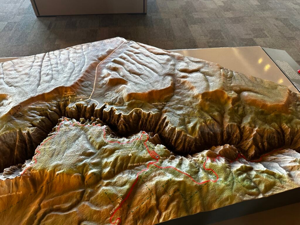
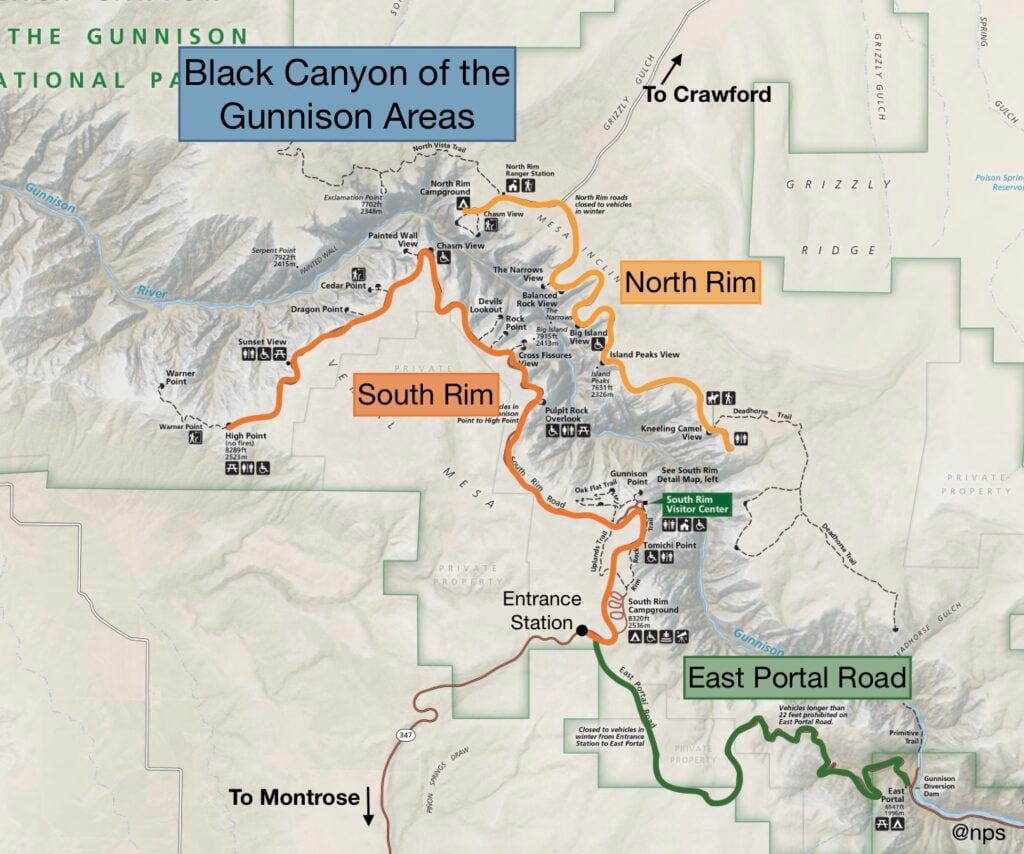
This is the main thing to do. It’s a 7-mile drive along the South Rim with multiple overlooks– some of which require short hikes/walks to get to. This usually takes 1-2 hours. Unless I state otherwise, assume each of these is an easy, dirt/gravel trail with a couple of steps. Also, know that there are very few trees in the area, so all the trails are very exposed.
If you have never attended a ranger program, you are missing out! They are a wonderful way to learn more about the park, including the geology, history, and wildlife. I once asked a ranger how they come up with their presentations and they told me that they are often assigned a topic, but they come up with their own way of teaching the material. I’ve never regretted attending one and have found that I appreciate the park more after attending.
When you stop by the visitor center, they will have a calendar of the events going on in the park that day. See if you can make your schedule work with attending one.
GOOD TO KNOW: A 30-minute ranger talk on the geology of the Black Canyon of the Gunnison is often given at 10:00 am at Pulpit Rock.
1.5-mile round-trip hike, 420 ft elevation gain. This moderate hike is my favorite in the park. The trail begins at the High Point, the last overlook of the South Rim Trail. At first, I didn’t think it was very interesting, but after the first quarter mile, the views opened up and I could see the green valley below. It was so pretty and I had views of that for most of my hike.
There are 14 markers that go along the trail and you can use a brochure that you can grab at the trailhead that has a little bit written about each of the signs you encounter. Overall, I just enjoyed and found it satisfying as I passed each marker.
At the end of the trail are views of the Black Canyon of the Gunnison. I didn’t think they were any prettier or more impressive than the other viewpoints, but I still liked it. It did have some straight-on views of the canyon with the San Juan Mountains in the background and was a lovely photo op.
HOLY SMOKES! As I was returning to my car after completing the Warner Point Nature Trail, a black bear darted across the trail in front of me. I couldn’t believe my eyes because I had seen no signage around the park warning visitors that this was bear country. When I got cell service and looked it up, I found that there are bears at the Black Canyon of the Gunnison. You’ve been warned – don’t be a knucklehead like me and hike alone without bear spray!
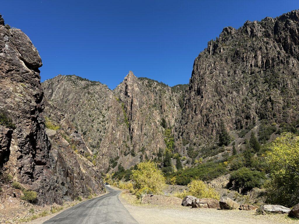
Most people skip this, but if you have a craving for adventure, why not drive the STEEPEST ROAD IN COLORADO- some of the sections have a 16% grade! This will take you 1-2 hours to drive to the bottom of the Grand Canyon of the Gunnison and back. It’s fun, windy, and has great views along the way.
This road departs from the main road near the Entrance Station. The road is paved and wide enough for two-way traffic, but vehicles longer than 22 ft, including trailers, are not allowed. It’s a 5.4-mile (one way), slow-going, brakeburner of a road (gear down!).
Your reward is the view from the bottom of the canyon, a stroll along the Gunnison River. Although it’s not the steepest part of the canyon, the views are great and it’s a peaceful area.
The East Portal Road ends at the bottom of the Black Canyon of the Gunnison. It’s my happy place. The Gunnison River sparkles in the sun and there are very few people to share the views with. There is a primitive trail that goes along the edge of the river and you can hike into the canyon a little way. I enjoy watching the fly fisherman and listening to the sounds of the water flowing down the canyon.
There is also a small campground, the Curecanti National Recreation Area. It’s very pretty and peaceful. There are picnic tables and pit toilets here. Reservations are first-come, first-served.
There are a few trails on top of the canyon and one primitive river trail on the East Portal Road that was covered above, but if you want to hike down into the canyon from the rim, you’ll need to get a permit. These hikes are on unmarked trails and require scrambling on loose rock, sometimes with the use of ropes. There are three trails into the canyon. I haven’t done any of these, and don’t plan on it, but if this interests you, see nps.gov/blca/planyourvisit/innercanyon.htm for more details.
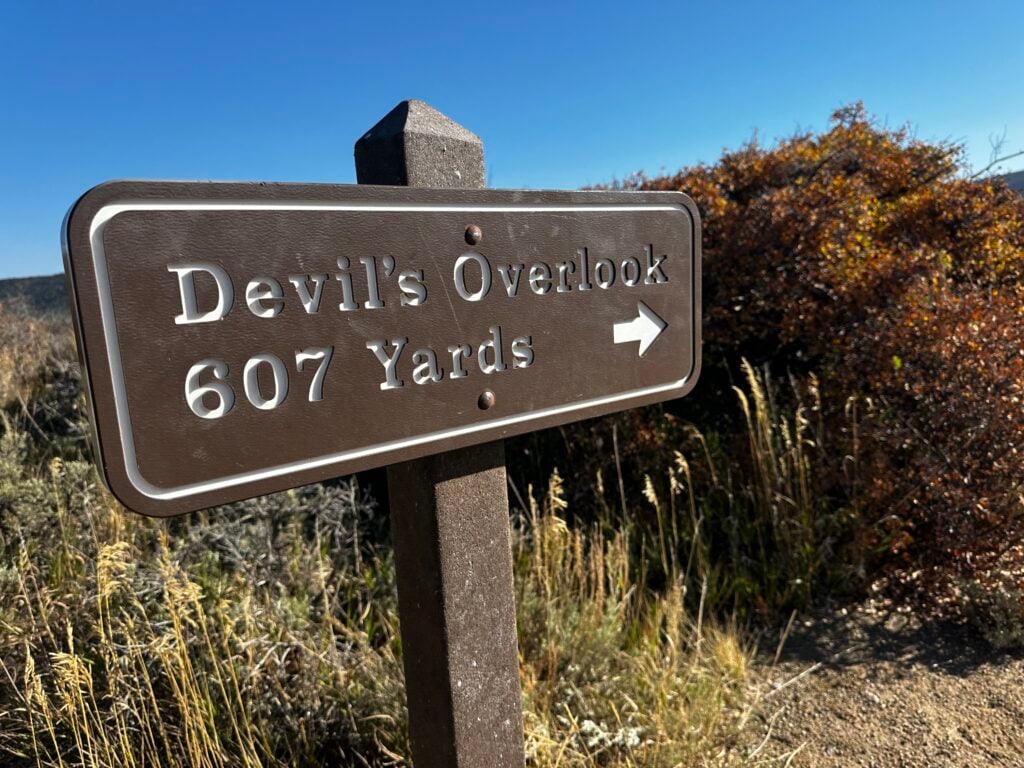
Admittedly, it’s hard to get a straight-on view of the Black Canyon of the Gunnison from the South Rim. However, if you are willing to drive on a gravel road (passable by cars and RVs), an extra hour and a half each way to the less-visited North Rim – go for it! There are more viewpoints and short walks along this rim, plus fewer crowds. It has the best views of the canyon: the Narrows and Exclamation Point (3-mile hike required).
We feel that the views from the South Rim are just fine and give you permission to skip the extra driving. But, if you want to say you have seen both rims, it’s best to see this on your way to or from Glenwood Springs (if that is part of your travel plans).
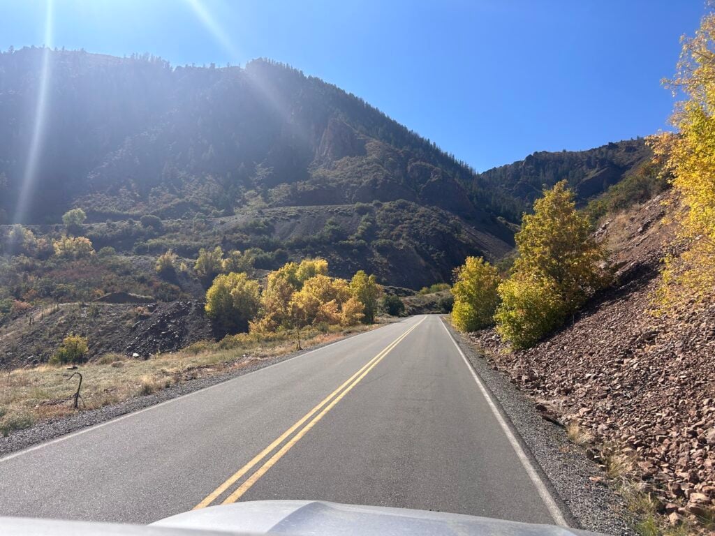
If you are heading north from the Black Canyon of the Gunnison, there are some amazing things to do, including Rifle Falls (a wonderful hike) and the very fun mountain town of Glenwood Springs.
We once spent an entire week in the Glenwood Springs area soaking in the hot springs, biking, rafting, hiking, seeing an amazing amusement park on top of a mountain, and attending an incredible Vaudeville show.
If you are heading south, you’ll hit some of the most scenic mountain towns of Colorado, Ouray and Telluride. Plus, you can drive the Million Dollar Highway with some of the prettiest views you’ll ever see!
CHECK OUT: One Perfect Day in Aspen, Colorado: Maroon Bells, Walking Tour, and Independence Pass
There are 3 main areas of the Black Canyon of the Gunnison. The most popular is the South Rim because it has several viewpoints, paved roads, and is the easiest to get to. The North Rim is less crowded and offers the most direct views of the canyon. The East Portal Road actually leaves the park, but it does get you to the bottom of the canyon.
–When to Start Your Day: There are few crowds here, so parking isn’t an issue. If you are visiting in the summer, you may want to start your day earlier in the morning
because there is little shade in the park and it could get hot.
–What to Wear: A hat, sunglasses, sunscreen, and maybe even a sunshirt.
Check out our recommended gear page for more.
–Weather Conditions: Unlike much of Colorado, this is desert country. It’s hot and dry.
–Cell Phone Service: There is limited to no cell service.
–Bring Your Doggo: This is one of the more pet-friendly national parks. Leashed dogs are allowed on the trails to the viewpoints, in campgrounds, and in parking lots.
–Services: There are no gas stations or restaurants in the park.
–RV Restrictions: RVs can go on any road in the park except the East Portal Road,
which limits the total length of your vehicle to 22 ft.
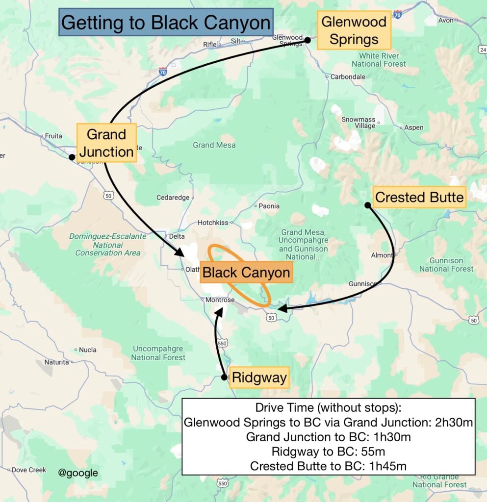
The Black Canyon of the Gunnison is a bit of a commitment because it’s not that close to many of the more popular stops in Colorado. See the map above for some of the more popular towns and driving routes nearby.
Montrose is the closest gateway town to Black Canyon. It’s a large city with many chain hotels and affordable lodging options (book here). Otherwise, there isn’t anything interesting to see in the town.
Country Lodge is a basic motel, but well taken care of and has a pool and hot tub.
Get our done‑for‑you, 7‑14 day route with exact drives, maps, and must‑see stops
so you don’t waste time in traffic or miss the best views
*Day‑by‑day plans for Colorado’s national parks and mountain towns
*Details you need: best activities, hikes, drives, and where to sleep each night to reduce back-tracking
*Best Friend Guarantee: love it or get your money back
Colorado is an incredible state filled with beautiful mountains and rivers, lakes, scenic drives, gondolas, mine tours, ziplines, theaters, hikes, charming mountain towns, four national parks, and more. Because Colorado is so big and there is so much to do, planning a trip there can be tricky.
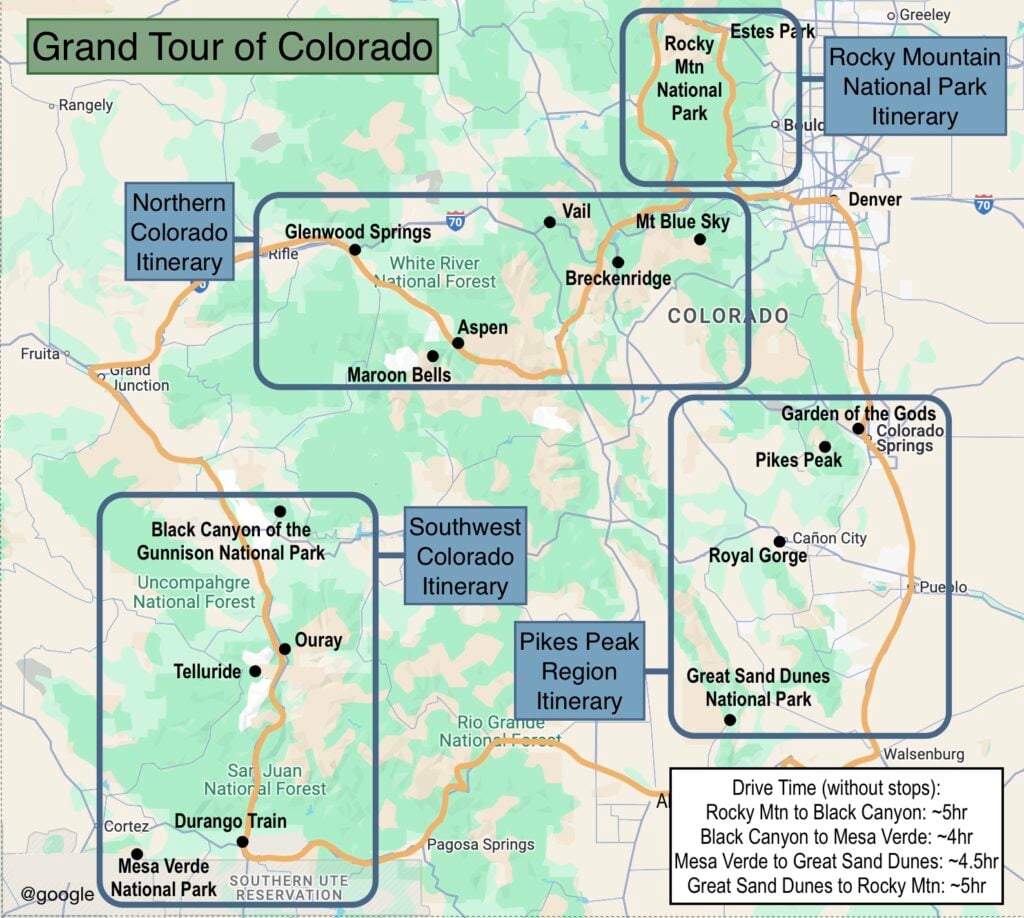
We have written five guides to help you see the best of Colorado, including the Grand Tour that will take you around the entire state in 7-14 days!
Each guide includes
Rocky Mountain Trip Planner Page
How To Spend One Day In Estes Park, Colorado
One Perfect Day in Aspen, Colorado: Maroon Bells, Walking Tour, and Independence Pass
The Durango & Silverton Narrow Gauge Railroad: Our Full Review + Helpful Tips
Should You Visit Glenwood Hot Springs Pool? An Honest Review