Yosemite National Park is an absolute bucket list destination. The landscapes and views are unbeatable, and at almost 1200 square miles, there is so much to see and do. Over 3.9 million travelers take in its beauty each year, and you can too. But before you can experience it all, you must figure out how to get there.
The best airport for most travelers is Fresno Yosemite International. You will have quick access to Yosemite’s West and South entrances, and it is conveniently located in the closest big city to the park.
Mammoth Yosemite Airport is ideal for anyone exploring the East entrance. San Francisco and Los Angeles have international airports that serve as great starting or ending points for road trips.
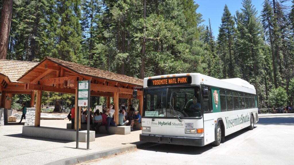
Visitors should consider getting a car (whether renting or bringing their own) to explore Yosemite. This is the most efficient way to see the park. If that is not something that interests you, there are regional shuttles to, from, and around the park. They also connect to local Amtrak and Metrolink stations outside the park.
I’m Juliana, and I’ve lived in Yosemite for two summers. I’ve driven well over 3,000 miles in and around Yosemite, and know the best ways to get to the park. Keep reading to learn what forms of transportation make the most sense for your trip, and some handy tips to make your travels run smoother.
If you want to fly into Yosemite, you have a few options.

Make your trip planning EASY, avoid the crowds, and see places most people don’t know about
Inside the guide:
*Step-by-step plan that will take you to the best hikes, viewpoints, drives, and must-do stops
*Exact time-frames and star-ratings so you can make the best use of your time and money
*Best Friend Guarantee: Love it or get your money back
*Stay in the right spot with our area recommendations to reduce time driving and waiting in entrance lines
| Airport | Code | Distance to Yosemite + Driving Time | Notes |
| Fresno Yosemite International Airport | FAT | 65 miles; 1.5 – 2 hrs | Closest major airport; best for domestic travelers |
| Merced Regional Airport | MCE | 70 miles; 1.5 – 2 hrs | Small airport; limited flights but very close |
| Mammoth Yosemite Airport | MMH | 45 miles; 1.5 hrs (road closed in winter) | Closest physically but seasonal access |
| San Francisco International Airport | SFO | 170 miles; 3.5 – 4.5 hrs | Major international airport |
| Los Angeles International Airport | LAX | 280 miles; 5-6 hrs | Large international hub; often cheaper for international flights |
This is the best and likely cheapest option for domestic travelers.
This small, regional airport is the closest and most convenient option for most domestic travelers. Located in Fresno, you will have access to city luxuries (like reliable internet to get your bearings), while also being on the closest path for both West and South Entrances.
Because you fly into a big city, once you arrive, you can cheaply fill up on gas, grab snacks, and anything else you may need for a fraction of the price compared to anywhere near Yosemite. It takes roughly 2 hours to get to the park via Highway 41 or 140, depending on which entrance you want to visit first.
Although you may need a connecting flight, it is still worth it for its prime location.
Merced Regional is easy and fast to navigate due to its small nature. It is located around 70 miles away from Yosemite’s Big Flat Oak Entrance on Highway 140, which takes around 1.5 to 2 hrs. Regional buses into Yosemite, known as YART,S are also located here, so no car is necessary to make it into the park.
Allegiant and United Airlines both fly into this airport for fairly affordable prices, but it is highly likely you will need a connecting flight.

This is the closest airport to Yosemite…as long as you are not traveling in winter. At only 45 miles away, it takes around 90 minutes from exiting the airport to enter the park. Mammoth is perfect for travelers who want to start their trip in Tuolumne Meadows and the surrounding High Sierras, but it is a bit far of a drive to Yosemite Valley – the heart of the park.
The main road (Tioga Road) that connects the Tioga Pass entrance to the rest of the park closes from November to early June each year. During this time, Mammoth Yosemite Airport is not convenient to enter Yosemite, as you must drive all the way around the park to the West or South entrances.
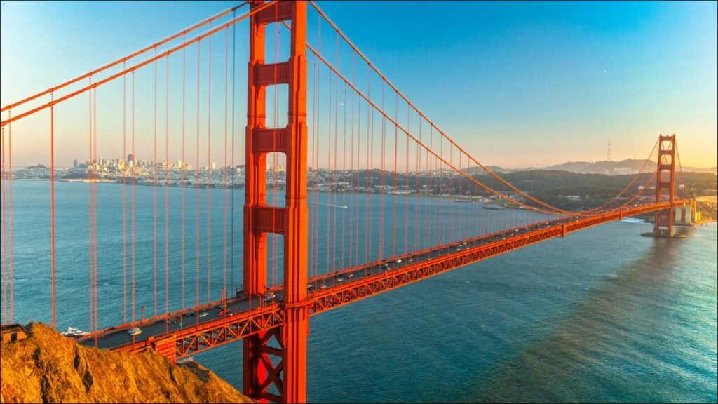
SFA is located around 3.5 to 4 hours from Yosemite’s West and South entrances. This is a great airport to consider if you are doing a larger road trip or don’t mind doing a bit of scenic driving on your way to Yosemite. You also can’t go wrong with adding a few extra days to your trip to explore the beauty of San Francisco.
If you choose to drive, make your way onto the 5 freeway and take the exit for Highway 41.
This is likely the cheapest airport for international travelers.
LAX is considerably far from Yosemite, but it is often the cheapest airport to fly into. At close to 300 miles away, it takes roughly 5-6 hours to drive directly. You can always get a connecting flight to FAT from here, but Los Angeles is a fantastic hub for larger road trips.
If you are flying internationally, it may be the cheapest to find a flight to LAX and make your way up to Yosemite via car, bus, or train. I recommend taking an Amtrak train up to Fresno or road tripping with a few stops along the way.
If you fly into any of the airports mentioned above, there are quite a few options for car rental companies to choose from, except for Merced Regional Airport. They have limited rental options, so be sure to book in advance.

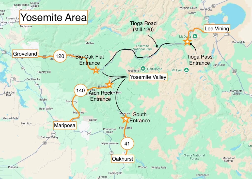
Keeping track of which highways go to which entrance and areas can be confusing. Here is my little cheat sheet to help you remember where each of them goes.
| Highway | To Which Entrance | Closest Areas to Stay In |
| Highway 140 | Rock Arch (West) | El Portal; Inside the Park |
| Highway 41 | South Entrance | Oakhurst; Fish Camp; Wawona |
| Highway 120 | Tioga Pass (East) | Tuolumne Meadows; Lee Vining |
If you want to get to the West or South Entrances, you will inevitably end up in Fresno first before branching off to either entrance. This is the case for anyone traveling from San Francisco, Los Angeles, or anywhere west of Yosemite.
DON’T MISS: Driving in Yosemite: 10 Things You Need to Know
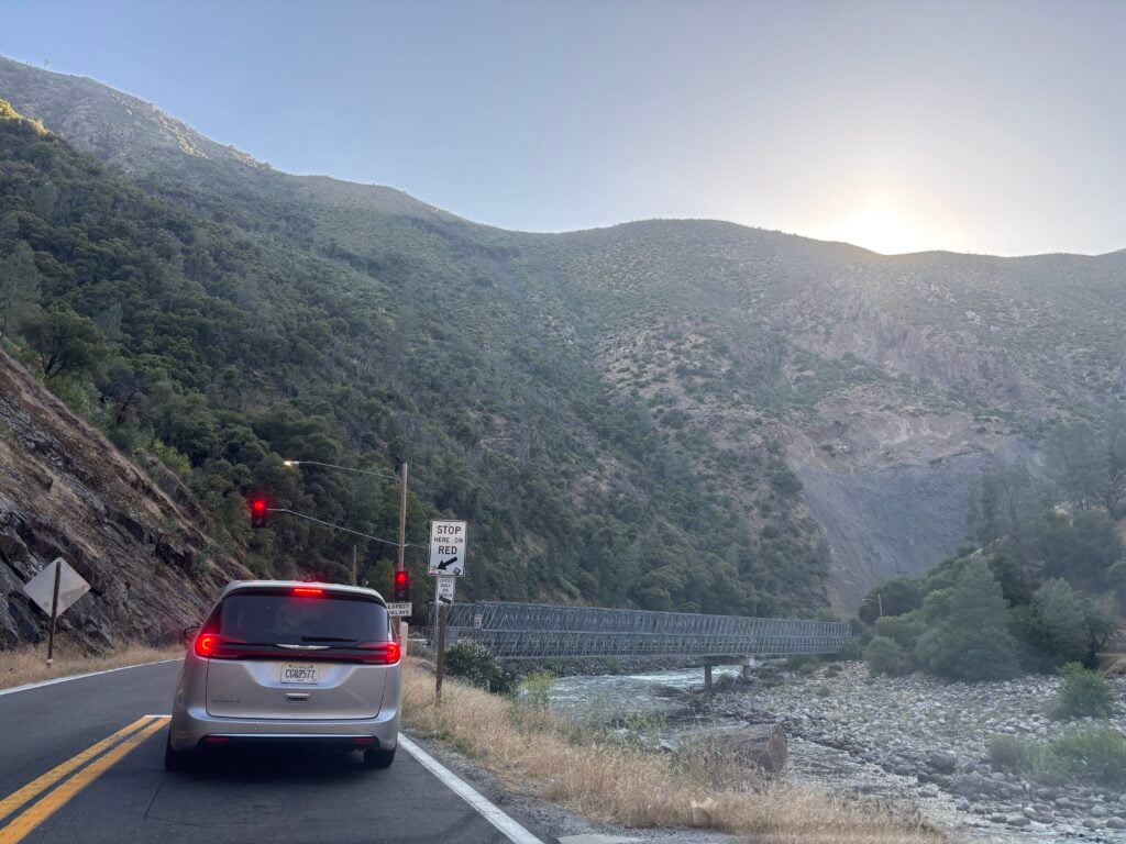
Scenic? Extremely! This road follows the Merced River into Yosemite’s West Entrance. There are plenty of cool rock formations as you are in a valley, and the rushing water is fun to watch.
Open: Year Round
Things to Keep In Mind:
This road is incredibly safe and well-maintained, but you need to be aware of your surroundings.
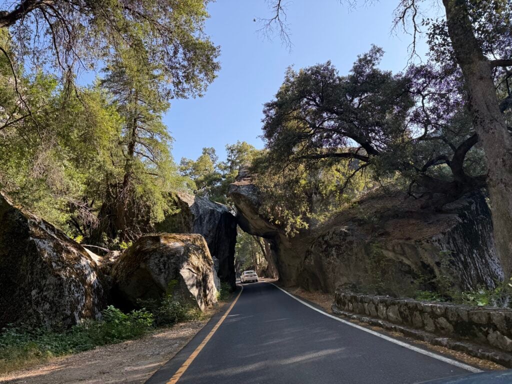
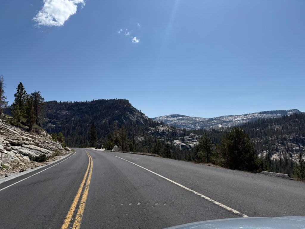
Scenic? Definitely! This route passes through the Sierra National Forest and has some incredible views along the way.
Open: Year Round
Things to Keep In Mind:
This can be daunting for inexperienced drivers, but be sure to use the pullouts as needed. The section of Highway 41 outside the park is very tame, while most of the tight, curvy sections are inside the park.
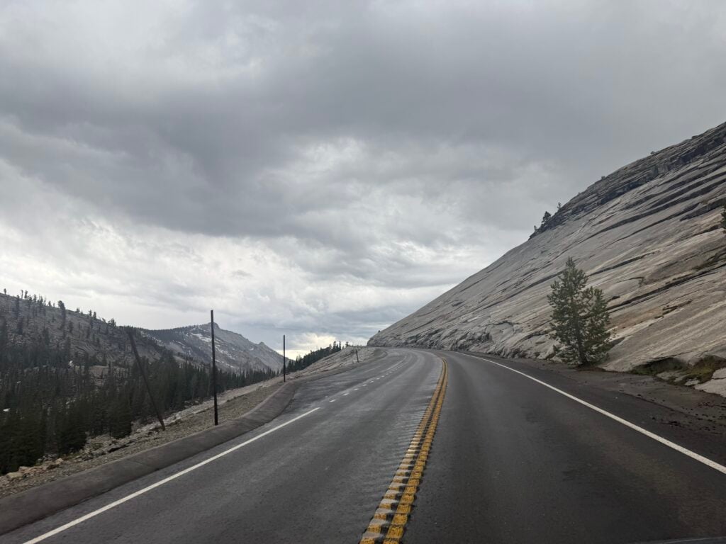
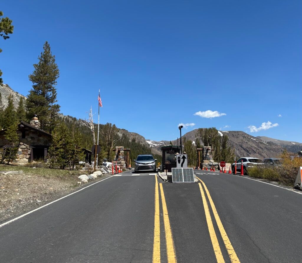
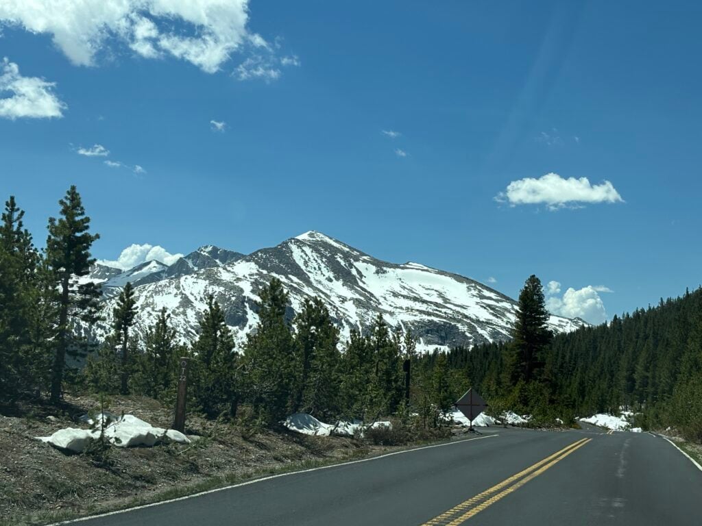
Scenic? Of course! You are in the High Sierras and drive by many alpine lakes, mountains, and forests.
Open: June to November (exact dates vary each year)
Things to Keep In Mind:
This is quite the opposite of Highway 41. The steeper, curvy sections are located outside the park, while the more tame section is located inside the park. I did not find this road scary at all, but I have only ever driven the section inside the park.

13 road trip ideas across the West so you know where to go, how long to stay, and what to see
*Sample routes from 4–31 days across national parks and hidden gems
*Driving times + best stops so you don’t miss the good stuff
*Season + weather notes to avoid closed roads and peak‑crowd days
*Lodging ideas in the right spots so you cut backtracking
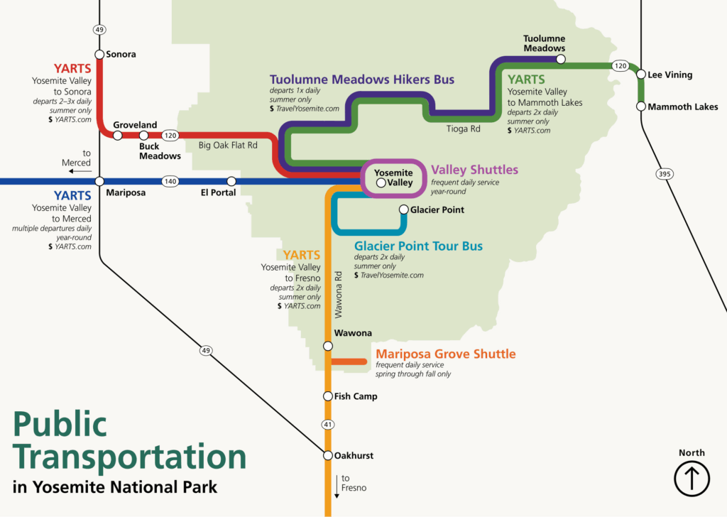
YARTS is Yosemite’s regional public transportation service that connects surrounding communities to the park itself. They operate four seasonal routes and one year-round route that allow you to get into Yosemite National Park without driving yourself.
| Route Name | When Running | Key Stops |
| Highway 140 | Year Round | Merced, Catheys Valley, Mariposa, Midpines, El Portal, Yosemite Valley |
| Highway 41 | May 23 – September 15, 2025 | Fresno, Oakhurst, Fish Camp, Wawona, Yosemite Valley |
| Highway 120 (Sonora) | May 23 – September 30, 2025 | Sonora, Jamestown, Groveland, Buck Meadows, Yosemite Valley |
| Highway 395/120 East | July 1 – September 30, 2025 | Mammoth Lakes, June Lake, Lee Vining, Tuolumne Meadows, Yosemite Valley |
| Highway 120 North | Mid-May – September | Sonora, Jamestown, Groveland, Buck Meadows, Yosemite Valley |
With YARTS, you can easily connect to other forms of transportation, such as:
You can buy tickets online or in person for one-way, roundtrip, or multi-day trips. Each route and stop is priced differently, so check out the tickets and pricing page on yarts.com to estimate how much your trip will cost. Roundtrip tickets can cost between $10 to $50.
Most of the routes operate at a few different times each day. When I checked their website out, they had two options in the morning and two options in the evening for the Highway 140 route. These may vary, but check out their website for more information. There are exact departure and arrival times, so be sure to make it on time to the pickup/drop-off spot.
There are so many possible road trip itineraries that work well with Yosemite. From short, local trips around California to month-long endeavors around the West Coast, Yosemite is a great stop on any road trip.
For California road trips, there are a few popular routes. Most start with a home base in San Diego, Los Angeles, or San Francisco because they are large cities with international airports.
Depending on your time frame and what you want to accomplish, you can do a loop that goes up the coast and down through the forests, deserts, and mountains. You can also choose to explore just the southern half or just the northern half. Yosemite is smack in the middle of California, so you can easily visit with either route.
My favorite road trip starts in Los Angeles as my home base, and I work my way up the coast to San Francisco. I make my way through Ventura, Santa Barbara (and Channel Islands), Big Sur, Santa Cruz, and eventually San Francisco. Going back home, we will hit Yosemite, Kings Canyon, and Sequoia.
We never drive more than 3-4 hours a day, except for the last day coming home, and hit four different national parks along the way. This takes anywhere from 10 days to 2.5 weeks, depending on how long you stay in each place.
You can easily combine Yosemite with at least a few other national parks. Within a 5-hour drive from Yosemite, there are 4 additional parks. Those include:
Kings Canyon and Sequoia National Parks are the most commonly combined with Yosemite due to their close proximity.
If you want to explore California and its 9 national parks, 19 national monuments, or 18 national forests, check out California National Park Road Trip Itineraries to find the best route for you. They have some of the more popular ways to see the state, depending on what you want to see in the time frame you have.
If you are trying to plan out your summer vacation during winter, keep in mind that Google and Apple Maps may give you wonky routes to take due to their seasonal road closures. Tioga Road and Glacier Point are only open from May/June to October/November each year and will appear impassable or closed on maps if you attempt to map your trip in the winter/spring.
DISCOVER: Best (and Worst) Times to Visit Yosemite National Park
Service is incredibly spotty anywhere in or around the park, and it is SO NICE to have downloaded online maps. Make sure to do this before you leave and when you are connected to the internet.
It is so easy to get distracted by Yosemite’s beauty while in the park, and it can be easy to accidentally miss your exit. Instead of designating someone to give directions, leave it to your phone to guide you through the park.
I know Yosemite very well, but even when I am with my family, trying to navigate Yosemite Valley with a handheld map is a bit difficult and asking for trouble. We have accidentally missed our trailhead two times in a row and wasted an extra 45 minutes because we focused too much on the scenery and not on where we had to go.
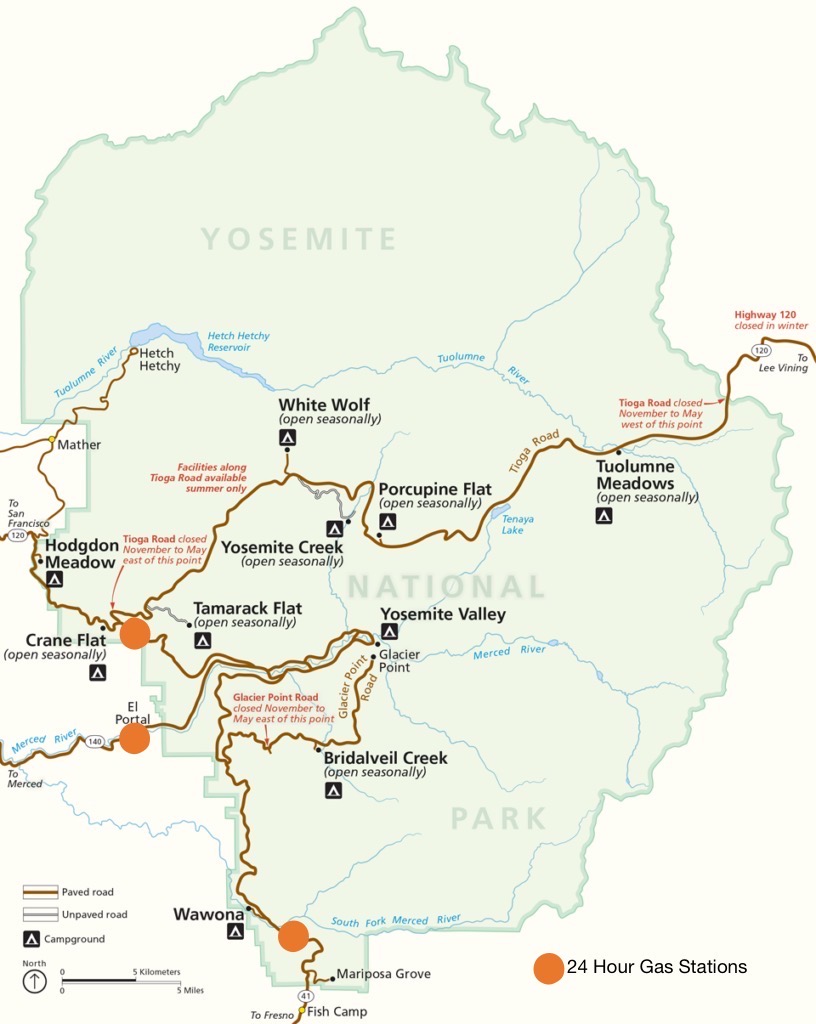
Gas inside and outside the park is incredibly expensive. Be sure to fill up in Fresno if it is on your way, as you will easily pay $1-2 more per gallon the rest of your time in the park. Gas stations are also few and far between in the Yosemite area, so don’t let your tank get under a quarter full.
The cheapest gas I’ve found closer to the park is located in Oakhurst and Mariposa. If you are on a budget, consider checking these areas out at least once during your trip to pick up groceries, get gas, or find cheaper accommodations.
Yosemite’s reservation system has been up in the air for months now, and they have finally decided to do away with it for 2026. Check the NPS website for the most up-to-date information.
Whether you are flying/driving in, don’t plan to do too much on your travel day. Unless you get to your accommodation before 1 pm, don’t try to pack in a hike or activity inside the park on your first day.
Instead, explore the area where you are staying or have an early night. You will feel so much more refreshed for your first full day in Yosemite. It is also a much better experience to enter Yosemite early, so keep that in mind as well.
No matter how you choose to get to Yosemite, we hope you have a smooth and scenic commute. From planes to shuttles to the good old classic car ride, there is a travel method for everyone. Safe travels, and I’ll see you in Yosemite!
CHECK OUT: 7 CAN’T MISS Hikes in Yosemite National Park
Make your trip planning EASY, avoid the crowds, and see places most people don’t know about
Inside the guide:
*Step-by-step plan that will take you to the best hikes, viewpoints, drives, and must-do stops
*Exact time-frames and star-ratings so you can make the best use of your time and money
*Best Friend Guarantee: Love it or get your money back
*Stay in the right spot with our area recommendations to reduce time driving and waiting in entrance lines
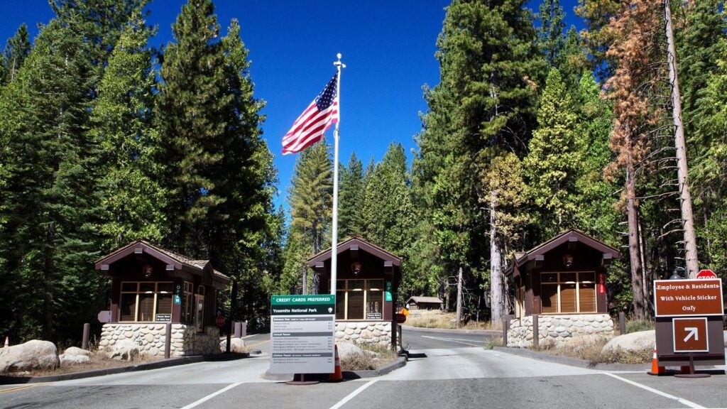
The most popular entrance is the Rock Arch Entrance on the West side of the park. This is because it is a 5-minute drive into the Valley once you enter the park. Although it is the most popular, it may not be the best entrance for you. My article on What is the Best Entrance to Yosemite? Yosemite’s 5 Entrances can help you decide which is best for your trip.
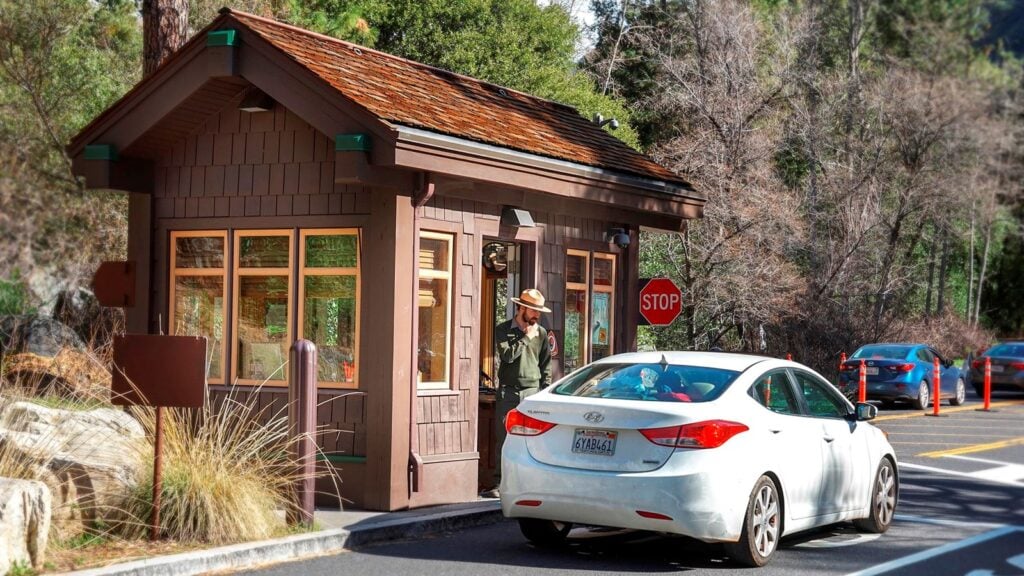
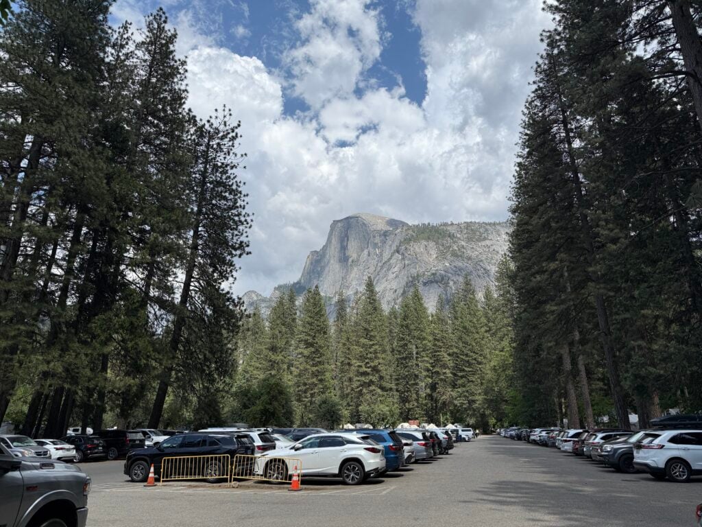
There is however, it is incredibly limited for how many people visit the park during the summer. Enter early to find a good parking spot and don’t leave it unless you absolutely have to. Entrance lines and parking become an issue after 7-8:00 am in the morning and don’t really clear out until 4-5:00 pm in the evenings.
This is not a major issue from November to January and March.
The West and South entrances are about a 1-hour drive apart, and the East entrance is closer to 2 hours away from the West entrance, and 3 hours away from the South entrance.
We’ve written a step-by-step guide for visiting Yosemite National Park. This guide contains 49 pages, including over 70 maps, charts, and images to keep you on course. We provide you with a 4-day itinerary featuring the best areas, waterfalls, hikes, scenic drives, and dining recommendations.
YOSEMITE TRIP PLANNER: To read or watch all of our content about Yosemite National Park, check out our Yosemite Homepage.
THINGS TO DO: Don’t miss all that Yosemite has to offer, including hiking, things to do in Yosemite Valley, and floating the Merced River.
WHERE TO EAT: Don’t miss the best places to eat in Yosemite National Park
WHERE TO STAY: Learn all you need to know about where to stay inside and outside the park
KNOW BEFORE YOU GO: Find out how to get there, the best time to visit, which is the best entrance, and all about driving around Yosemite.