Southwest Desert landscapes don’t get any better: Zion, Bryce Canyon, Capitol Reef, Arches, and Canyonlands National Parks make for one epic road trip! Most people know they want to visit these parks but aren’t sure how many days to plan for their trip, how many days to spend in each park, where to stay, and the best driving route to piece this whole trip together.
It takes a minimum of 5 days to see Utah’s national parks, but 7 days is ideal. This allows visitors to spend one day in Bryce Canyon, Capitol Reef, Arches, and Canyonlands and two days in Zion, with an extra day to see a state park of their choice or an additional day in the Arches and Canyonlands area. Driving Scenic Route 12 between Bryce Canyon and Capitol Reef is a must that visitors often miss. Travelers should switch lodging locations most nights, with the exception of Arches and Canyonlands (because they are right by one another), to minimize driving time and backtracking. People who do not hike can see this area in 5 days; people who hike will need seven or more days.
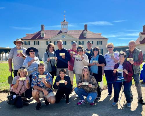
I’m Cheryl, and my husband, Matt, and I have lived in Utah our entire lives. We have written 26 guides to help people have amazing trips to the West and spend 70 days a year on the road. The Utah parks are in our backyard and we visit at least one of them every single year. Read on for the exact plan we give our friends and family who are exploring these parks for the first time.

Utah’s national parks are the BEST of the Southwest – towering canyons, crazy formations, expansive scenery, arches, legendary hikes, and insane scenic drives. Each park offers something different, and the variety will continue to surprise you as you work your way from park to park.
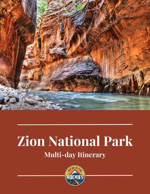
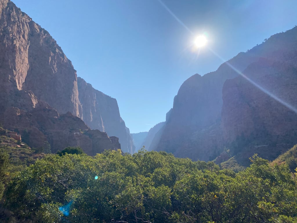
Zion. Zion is Utah’s most popular national park, known for its towering red cliffs, lush green valleys, and amazing slot canyons. Zion Canyon is the highlight, which includes the famous hikes of the Narrows and Angel’s Landing.
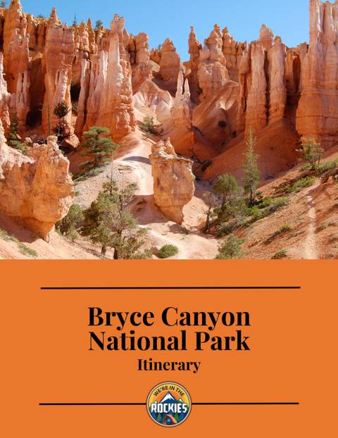
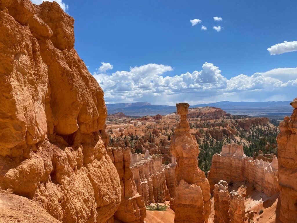
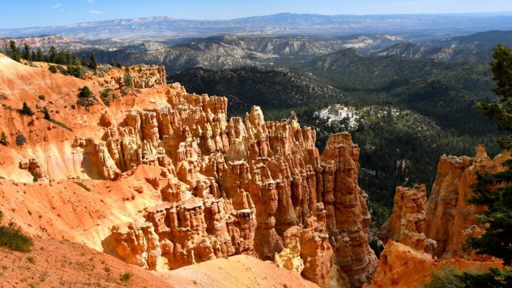
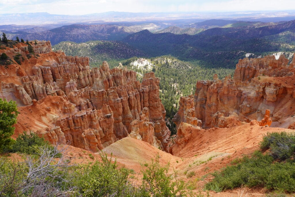
Bryce Canyon. Bryce Canyon is a small park, famous for having the biggest concentration of hoodoos in the world. It is a surreal landscape that glows at sunrise and sunset.
Capitol Reef. Capitol Reef is Utah’s most underrated national park. It has an impressive mix of towering red cliffs, arches, and canyons, but the fruit orchards within the park are the most unique. Plus, it has the best scenic drives of all the parks.
Canyonlands. Canyonlands is the largest of Utah’s national parks. It’s rugged and is divided into two main districts. The Island in the Sky District offers jaw-dropping views of canyons carved by the Colorado and Green Rivers. The remote Needles District is a hiker’s paradise, with fun formations and wildflower meadows.
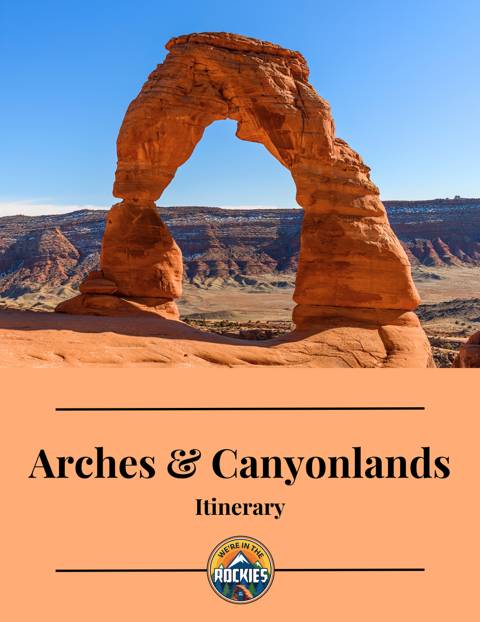
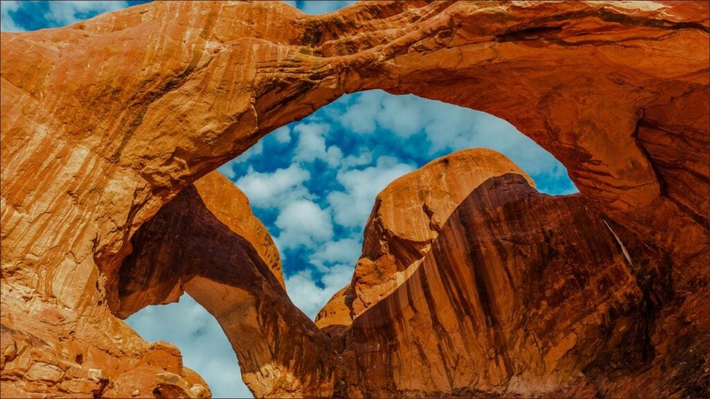
Arches. Arches is home to over 2,000 natural stone arches, making it one of the most unique parks in the world. A great scenic drive and several easy hikes make this a place for all ages.
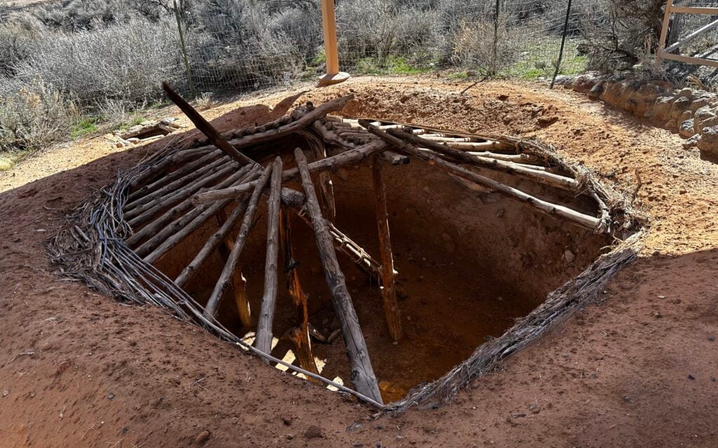
State Parks. Don’t forget about the land in between the national parks! Some of the coolest places are state parks (we love Goblin Valley and Petrified Forest State Parks!) and part of the Grand Staircase Escalante National Monument.
BONUS: The North Rim of the Grand Canyon is a stop you can make if you have an extra day. It’s a 2.5-hour detour between Zion and Bryce Canyon. It’s not as big as the South Rim, but it has beautiful views and minimal crowds. It’s only open from mid-May to mid-October, and it’s worth it!
Best Hike: The Queens Garden/Navajo Loop in Bryce Canyon or the Narrows of Zion
Best Drive: Scenic Route 12 connecting Bryce Canyon to Capitol Reef
Best Arch: Delicate Arch. It really does live up to the hype
Best Outside the Parks Activity: A Jeep ride in Moab (right outside of Arches)
Best State Park: Goblin Valley has a valley full of mini hoodoos that kids love to explore
Best Place to Eat: Burr Trail Grill along Scenic Route 12 (we never miss it!)
Best Place to Stay: Slot Canyon’s Inn B&B in Escalante. Lovely spot to recharge mid-trip
Get our done‑for‑you, 5-7‑day route with exact drives, maps, and must‑see stops so you don’t waste time in traffic or miss the best views.
Inside the guide:
*Day‑by‑day plan for Zion, Bryce Canyon, Capitol Reef, Arches & Canyonlands to get you to the best hikes, drives, and activities
*Details You Need: Time frames, driving routes, and where to sleep each night to reduce back-tracking
*Includes audio stories to listen to as you drive
*Best Friend Guarantee: love it or get your money back


This itinerary is written for the first-time visitor who wants to see each of Utah’s parks properly and enjoys a bit of variety as well. We’ll also share where we like to eat and stay, and give you a few insider tips that only regulars know.
We think this road trip works best going from West to East (Zion to Arches), so that is the order it is written. However, it is just fine to do it in reverse order.
Because this area is so big, you must see the top sites in the most efficient order. Each of these parks is 1.5 to 2.5 hours apart from one another. You will need to switch where you stay each night unless you are spending more than one day in each park (don’t shoot the messenger-you’ll thank me later!)
Because switching lodging each night can be exhausting, we recommend a down day in the middle of the trip if you can afford the time.


![Epic 8-day Road Trip to Utah’s National Parks [Zion to Arches]](https://i.ytimg.com/vi/hPAYZzEuz98/0.jpg)
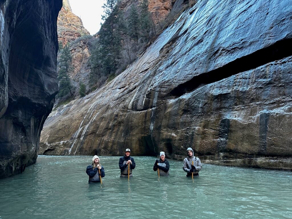
The Riverside Walk and the Narrows are two halves of the same hike. The paved Riverside Walk goes for about a mile, then dead-ends because the canyon gets so narrow that there isn’t room for a sidewalk. That’s where the Narrows hike begins. This will take you around 2-4 hours. The Riverside Walk is 2 miles round trip and is a paved and easy trail; the Narrows varies in length and goes through a river.
The Riverside Walk is absolutely gorgeous: cottonwood trees contrasted with red rock walls. Hanging gardens, waterfalls, the Virgin River, and possible deer or bird sightings await. Many people enjoy a picnic while viewing the river here (no picnic tables, though). Even if you don’t plan on hiking the Narrows, try to do this.
The Narrows is one of the most unique hiking experiences we’ve ever had. You are sandwiched between thousand-foot red rock walls as you wade through the Virgin River, sometimes chest-deep! It’s absolutely stunning and really fun.
Turn around whenever you like. Here are common places to turn around, along with the round-trip mileage from the Temple of Sinawava (mileage includes the Riverside Walk):
We like to set a timer for the amount of time we want to hike and then turn around. The canyon is so fascinating that it’s hard to know when to stop exploring. Keep in mind that you are quicker on the way back because you aren’t working against the current. Read our post, Zion Narrows and Riverside Walk, to learn how to do this awesome hike.
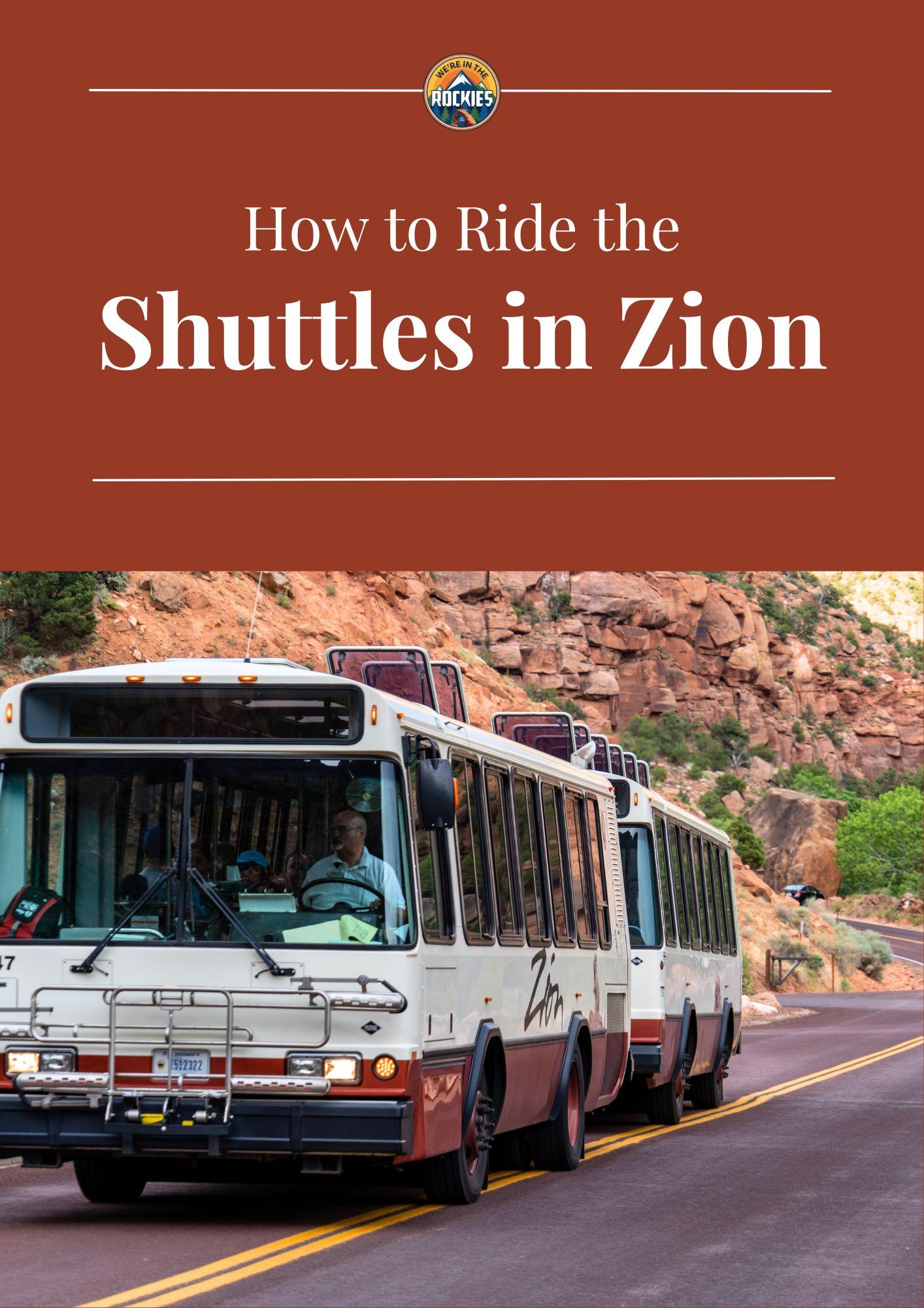
GOOD TO KNOW: You must use the Zion Shuttles to access Zion Canyon. Zion Canyon contains the most popular sites in the park, including the Narrows, Angels Landing, Emerald Pools, and Zion Canyon Lodge. You can learn more on our blog posts How to Use the Zion Shuttle System and What to Expect at Each Shuttle Stop of Zion Canyon. You get off at Shuttle Stop #9, the Temple of Sinawava, to do the Narrows.
Free PDF: which shuttle to take, where to park, and what to do at each major stop
Inside the guide:
*Zion Canyon & Springdale shuttles explained in plain English
*Exact parking + timing so you avoid full lots and long lines
*Simple map you can follow even without cell service
*What to do at each main stop so you don’t waste time guessing
Depending on your energy level, you can choose to do another hike or see a ghost town.
Kolob Canyons is a series of towering slot canyons (our favorite is the South Fork Trail, a 2.6-mile round-trip hike). It’s much less crowded, and yet it still has wonderful scenery. However, if you’re not going to hike or if you’re not staying on the west side, it’s probably too long a drive just for the viewpoint. NOTE: Kolob has its own exit off the I-15 freeway. Once in Kolob, it’s a short drive to the top overlook, Kolob Canyons Viewpoint (about 10 minutes).
Grafton Ghost Town is a cool little place. It has been called the most photographed ghost town in the West. It’s Instagram-worthy due to the church, a few other buildings, and a cemetery, all with Zion in the background. To get there, leave Springdale and turn left in Rockville (there will be a sign for Grafton). Head out on the dirt road for about 12 minutes to the end.
Add some variety to your trip by catching an evening show! The Tuacahn Amphitheater offers Broadway-quality plays that take place under the stars with a backdrop of Utah’s beautiful desert and red rock. They sell out, so book your tickets as soon as you know your travel dates. There are many other great activities to do in nearby St. George, UT. Learn more at How to Spend 1 Day in St George.
Sleep: Spend the night at the Zion Canyon Lodge, Springdale, La Verkin, Hurricane, or St. George.
IMPORTANT: If hiking isn’t your thing, we suggest combining Day 1 and Day 2 of your Zion Itinerary. Do the Riverside Walk (Day 1) and the Zion-Mount Carmel Tunnel (Day 2) on your way into Bryce Canyon.
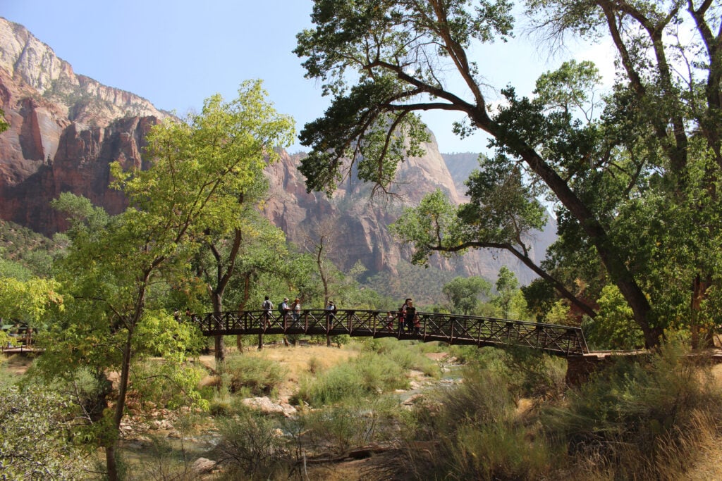
Stop #1: Emerald Pools or Angels Landing Hikes
Start your day by catching the Zion Shuttle and heading back into Zion Canyon. You can choose the easier Emerald Pools Hike (great for children) or the adventurous and scary Angels Landing!
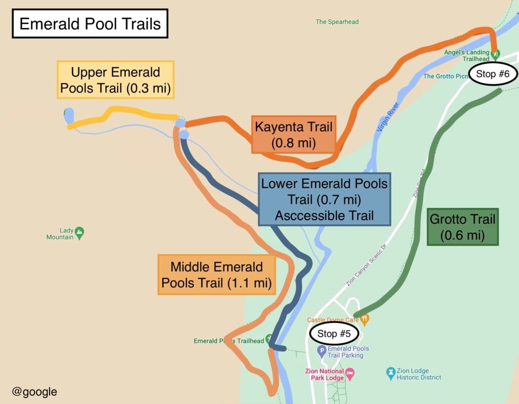
Emerald Pools. 1 to 2.6 miles of hiking, depending on your route. The Emerald Pools are nice, but typically, they are quite small and not emerald in color. Although the hike is named after the pools and you get to walk under a misting waterfall, the highlight here is being surrounded by sheer red rock walls. You must go to the Upper Pools for the best views.
Just think of this as a triangle. You can do the whole triangle or any side of the triangle you would like. And you can do it in any order or direction. The entire triangle is 2.6 miles of paved trails with mild/moderate elevation changes, though it does get steeper going from Middle Pools to Upper Pools. For more, visit our How to Do the Confusing Emerald Pools Hike.
Angels Landing is 5 miles and 1500 ft elevation gain; permit required. This is one of the most famous hikes in the world. Some people come to Zion solely for this hike. There are two main reasons to hike Angels Landing: the incredible view it provides, looking straight down the canyon, and the thrilling experience of the Hogsback. I’ve hiked this 6 times and it never gets old! However, it is intense, especially when you reach the Hogsback, where you hold on to chains as you walk across a narrow ledge with a 1000-foot drop below you. Read more at How to Hike Angels Landing.
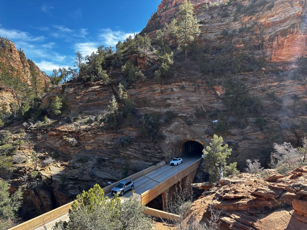
The Zion-Mt Carmel Highway extends from Springdale to the town of Mt Carmel on the east side of the park. You’ll encounter six switchbacks, a one-mile tunnel, and then wind through some amazing desert scenery. You’ll need your own car to do this and there are restrictions on RVs.
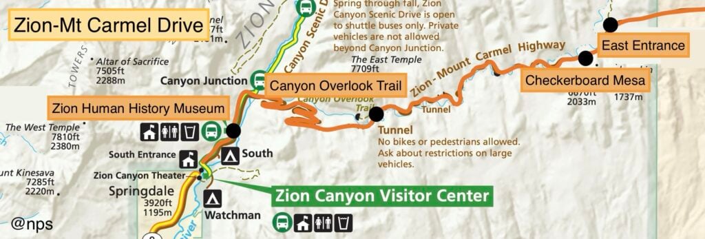
Some of our favorite stops along this 45-minute drive include
Sleep: Spend the night at the Bryce Canyon Lodge, Ruby’s Inn, or in Bryce Canyon City. Learn more at Best Places to Stay at Bryce Canyon.
Today, you are going to experience Utah’s smallest and mightiest national park! The first time I saw the Grand Canyon, I gave it an “8” because I didn’t think it was as beautiful as Bryce Canyon.


Start your day with a famous Bryce Canyon Sunrise. There’s a lot of debate as to where the best place to watch a sunrise is, but we believe that Sunrise Point, Sunset Point, and Bryce Point are all great. You can read more about it in our blog post, Where to Watch a Sunrise and Sunset at Bryce Canyon.
What makes the sunrise so amazing at Bryce is not just seeing the sun rise on the horizon, but the light and shadows on the hoodoos as the sun changes positions in the sky. It’s one of the best sunrises I’ve ever seen (and I am a professional travel writer-that’s saying something).
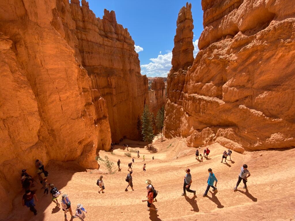
Approximately 3-mile loop, moderately strenuous. This hike is the best bang for your buck in the park. It’s short, not too difficult, and will get you to the Bryce Amphitheater, where you can walk among the hoodoos! Start this hike from SUNSET Point. It’s actually a combination of two trails, but it’s the most common way of doing it. The trail provides stunning views of the hoodoos and a nice variety of looks.
Right next to Sunset Point, take the path for the Navajo Loop. After the switchback, try to spot Thor’s Hammer to your left. You can then continue into the canyon one of two ways. We recommend Wall Street, but either path is fine; both have switchbacks down into the canyon.
GOOD TO KNOW: There are water spigots, restrooms, and picnic tables at the trailhead.
Just make sure when you get to the bottom of Navajo Loop that you follow the signs for Queens Garden Trail. Then, make sure to take the little side trail to see the Queen. Walk to the interpretive sign (as shown in the photo) and spot the Queen. The sign tells you about the Queen and shows you how to find her. NOTE: She sits perched on top of a hoodoo, and she’s smaller than you think!
IMPORTANT: Bryce Canyon also uses a shuttle system. This shuttle is OPTIONAL, but we like it! Read more about it Bryce Shuttles: All You Need to Know.
This 18-mile road takes 30-40 minutes to drive if you don’t make any stops. But… it takes most people 2-3 hours to do this drive properly because there are some great look-outs, including:
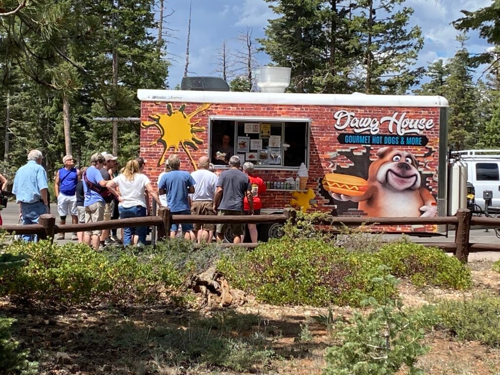
This little strip mall (Old West-themed) is across the street from Ruby’s Inn. They have a rock shop, Native American Art, and some fun things for kids, like a jail. It might be a nice place to visit after dinner, as they also have an ice cream and candy shop that is quite popular. Ebenezer’s Barn and Grill Dinner Show is also quite popular. For around $50, you are treated to an old west cookout with all the fixins (steak, chicken, potatoes, salad, cornbread, coffee, dessert), and you get to watch Bryce Canyon Wranglers perform covers for some famous cowboy songs, plus a few originals.
The rim of the canyon isn’t the best spot for sunsets because the sun sets at your back as you face the canyon, and since the hoodoos are lower than the canyon rim, they quickly get swallowed up in the shade.
But there is one place in the park that has a west-facing wall. And that place is… Mossy Cave.
The Mossy Cave section of the park is not linked to the main Amphitheater. You can read more about how to do this on our blog post, Where to Watch a Sunrise and Sunset at Bryce Canyon.
PRO TIP: The parking lot here is small, and people are starting to catch on that this is a cool thing to do. There is a larger overflow parking lot further down the road if the closest parking lot is full.
Optional Stop: Star Program. Bryce Canyon does some incredible evening programs. Bryce, as well as other national parks in Utah, is known for being one of the vanishing “dark spots,” meaning it’s an amazing place to see the stars. We attended a program a few years ago, and the ranger took us outside and used a special flashlight to show us the constellations in the sky and the great stories behind them. It was unique and I’ve never done anything else like this within a national park. Here are some details on some of the evening programs offered. You can check out what is going on during your visit at the NPS website.
Sleep: You can choose to stay at the same place you stayed last night, or if you don’t mind skipping the sunset and stars, you can move on to the town of Escalante tonight. We highly recommend Slot Canyons Inn B&B (book here). There are petroglyphs on the property and the owner, Joelle-Marie, will make you the most incredible breakfast.
Get our done‑for‑you, 5-7‑day route with exact drives, maps, and must‑see stops so you don’t waste time in traffic or miss the best views.
Inside the guide:
*Day‑by‑day plan for Zion, Bryce Canyon, Capitol Reef, Arches & Canyonlands to get you to the best hikes, drives, and activities
*Details You Need: Time frames, driving routes, and where to sleep each night to reduce back-tracking
*Includes audio stories to listen to as you drive
*Best Friend Guarantee: love it or get your money back
Even though you won’t be viewing a national park today, it may be one of the most memorable days of your trip! Plus, it’s a great opportunity to recharge your batteries and visit some less crowded sites. There are several hikes and stops you can do along the way; I’ll give you our absolute favorites.
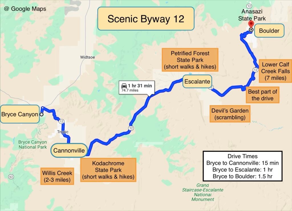

This is a 3-mile round-trip hike through a slot canyon, flat with some scrambling. This is one of our all-time favorite hikes. The walls aren’t towering or bright red in color, but it’s beautiful and is such an adventure. It reminded us of Antelope Canyon in Page, AZ, but better because we could hike through it instead of standing around on a tour. A small creek usually runs through it, which means you will get your feet wet unless you are perfect at jumping and scrambling across rocks. Note: there are two slot canyons to hike through. When you finish the first, you’ll think it’s done. But if you continue on, it will take you through another canyon. Turn around when you’re through it or whenever you’d like.
To get there, turn at BLM 500 and follow the main dirt road (use GPS to be safe). The road to get there is an “unimproved” dirt road, which means it’s a little rough and can be washed out if it rains. Do not drive this road or do this hike if rain is predicted. It’s a good idea to check with the BLM office in Cannonville before going.
There isn’t much to do here besides a few short walks and a drive through the park, but you’ll be surprised at the amazing resemblance the rock formations have to a male body part. The Nature Trail is a nice walk. Their visitor center also has bows you can rent to shoot at wooden animals.
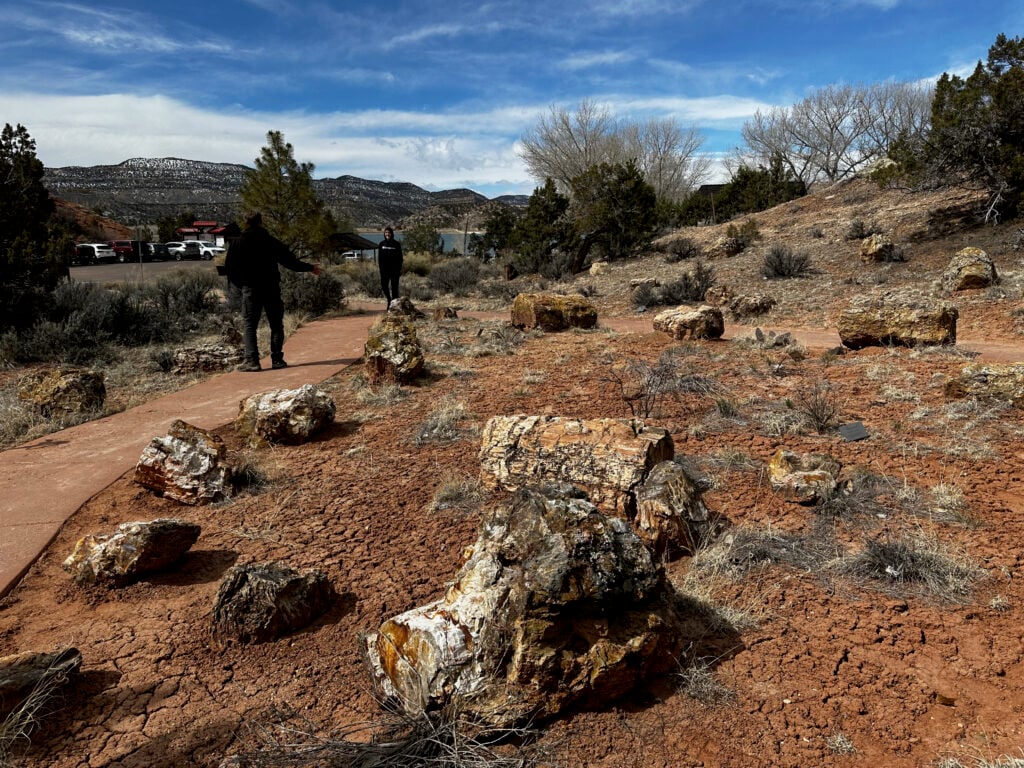
We really loved this stop because you don’t have to walk far to see some overlooks and really cool petrified wood. We particularly liked the Petrified Wood Cove Trail (10 min, very short and paved walk). We also did the longer Petrified Forest Trail (~ 1 hr, 1-mile loop, moderately challenging), which leads to a nice overlook.
This is a fun little stop to climb around on strange rock formations! You have to drive on the Hole in the Rock road (dirt) for 12 miles, which takes about 30 minutes. It is doable in a car, but don’t do it if the road is wet or if it might rain.
Stop #5: Anasazi State Park and Museum
There are Native American Ruins here, but we think there are better places to see them in the West, so we usually skip this site.
The small town of Boulder, UT, is a hub for great food. Try their French dip! I love their tofu sandwich- but it’s not for everyone.
You have finished your long (but scenic) drive. The sunset will be the cherry on top! You can choose between Panorama Point and Sunset Point. The best part of the sunset is seeing the light hit the canyon walls. Make sure to check when the sun will be setting today and arrive at least 45 minutes (an hour is better) before sunset. The small parking lot will fill up! Arrive early, settle in, and relax.
Sleep: Torrey, UT, is the main place to stay when visiting Capitol Reef. If you are camping, the Fruita campground is wonderful.
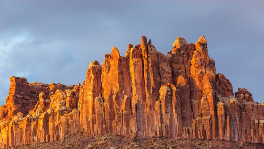
Capitol Reef National Park is Utah’s most underrated but possibly our favorite. We love that this park has deep red colors, arches, bridges, towering walls, great hikes, history, and some really great scenic drives.

There’s nothing wrong with eating pies for breakfast, right? One of the reasons Capitol Reef was preserved as a national park was because there were real working orchards within this desert oasis. The Fruita Historic District preserves these buildings. A fun tradition the park service carries on is to serve fruit pies and cinnamon rolls at the Gifford House. If it’s too early for pie for you, take it to go!
While you are in the area, explore the other sites, including the blacksmith shop, the Ripple Rock Nature Center, and the fruit orchards!
GOOD TO KNOW: You can pick your own fruit in Capitol Reef during certain times of the year (usually June-October). For more about the fruit picking season, visit their website.
If you aren’t a hiker, this is your chance to experience a slot canyon from the comfort of your car. It’s a 10-mile-long dirt road that ends at the Capitol Gorge Trailhead (which is an ok hike, but there are better ones in the park). NOTE: Your vehicle must be under 27 feet long. Always be aware of the weather and road conditions before driving on a dirt road here!
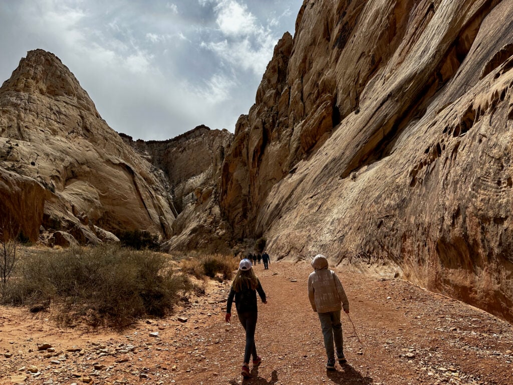
2.2 miles one-way, easy. This hike takes you along the river’s wash between the towering walls of Capitol Reef. It has incredible scenery. Our whole family, including our kids and grandparents, love this. Because there are two trailheads, one on the scenic drive and one on Hwy 24, this hike is best if you can shuttle. If you can’t shuttle, start on Highway 24 and turn around when you are ready.
2 miles, round trip, moderate. You’ll see an impressive arch at the end, a mini arch along the way, and some great panoramic landscape views. The Fremont Petroglyph Panel is just 0.75 miles west of Hickman Bridge and has a nice boardwalk where you can view several Petroglyphs. The Grand Wash hike is our favorite but this is a close second. If you have time, do both!
You will take Highway 24 to connect to Arches and Canyonlands. Along the way, you can turn off in Cainsville to do the Cathedral Valley Drive to see the Temples of the Sun and Moon. These are some of the most famous landmarks in Capitol Reef, but it’s a graded dirt road to get there. The entire Cathedral Valley Drive can take an entire day (which we haven’t done). We just turned around at the Temples of the Moon and Sun and got back on Highway 24.
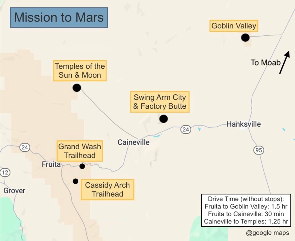
If you are traveling with children or teens or are young at heart yourself, Goblin Valley might be your favorite adventure of the trip. It’s famous for the thousands of human-sized hoodoos that look like goblins. The big thing to do here is to go to the Goblin Overlook. You have great views of this out-of-this-world landscape. If you are up for an adventure, you can free hike through the hoodoos. Our family loves to play hide and seek.
You’ve had a full day of travel and now it’s time to fill your belly. Ray’s Tavern, of Green River, is a hole-in-the-wall bar. Their burgers and their salmon are both great. If you are staying in Moab, Pasta Jay’s is one of our favorites. They serve pizza and pasta and you can’t go wrong with either, but the pasta is what we usually order.
Sleep: Good news! This is where you will sleep for the next 3 nights! Most people visiting Arches and Canyonlands stay in Moab, UT. There are tons of great places to stay and it’s the biggest gateway town of all of Utah’s national parks. Our family usually stays in Green River because the lodging is so much cheaper. You can check out our blog post, Where to Stay When Visiting Moab, Arches, and Canyonlands, to help you decide which is best for you.
Today, you will visit a portion of Utah’s largest national park, Canyonlands. This is the least developed national park and is known for its rugged beauty, viewpoints, and hikes. If you are a hiker, you could spend more than a week doing all the backcountry hikes here, but since we are visiting all of Utah’s parks, we’ll show you the best things to do in the most popular area of the park, the Island in the Sky District.


This is the prettiest view you will see today, but you’ll have to pay a state park entrance fee (~$20). It’s a small area with a few viewpoints that you can walk between. You’ll see the canyon with the Colorado River flowing through it, as well as the Potash Ponds (which are a unique turquoise color!). There are plenty of other great views once you get into Canyonlands National Park, so you can decide if Dead Horse State Park is worth it to you. To learn more, read How to Visit Dead Horse State Park.
There are several of these as you drive through the Island in the Sky District. A few of them require some scrambling or short hikes to get to them. Below we have a map for you as well as some short descriptions of some of our favorites.
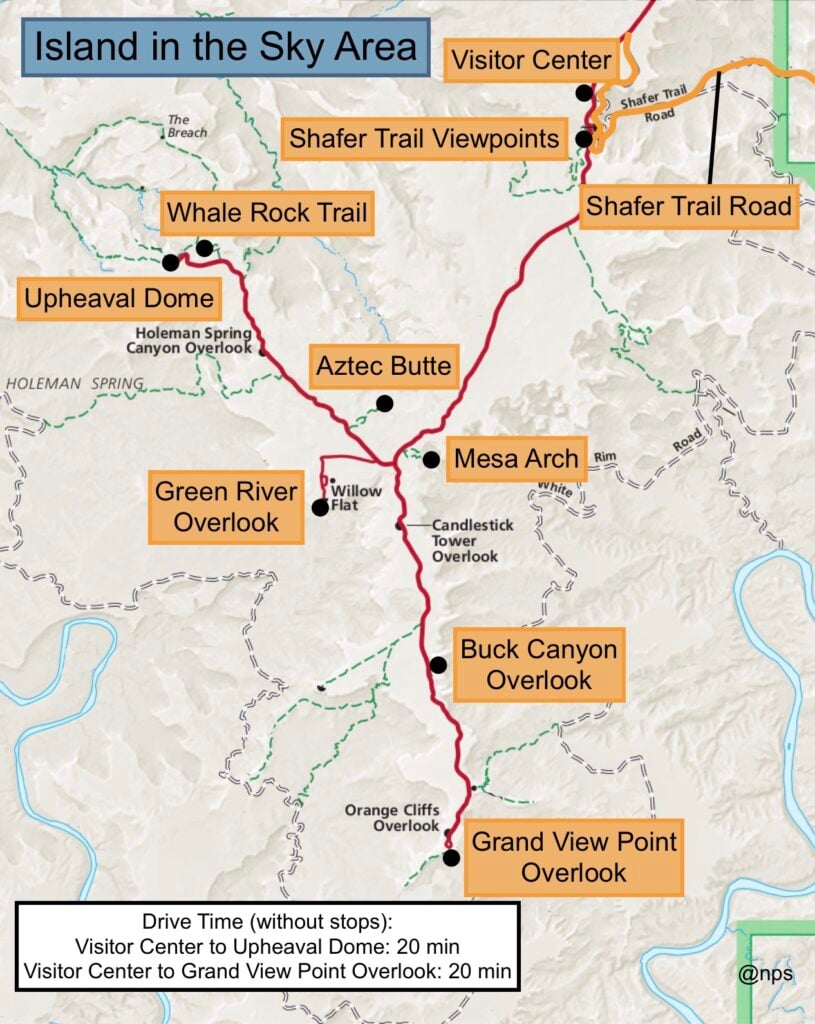
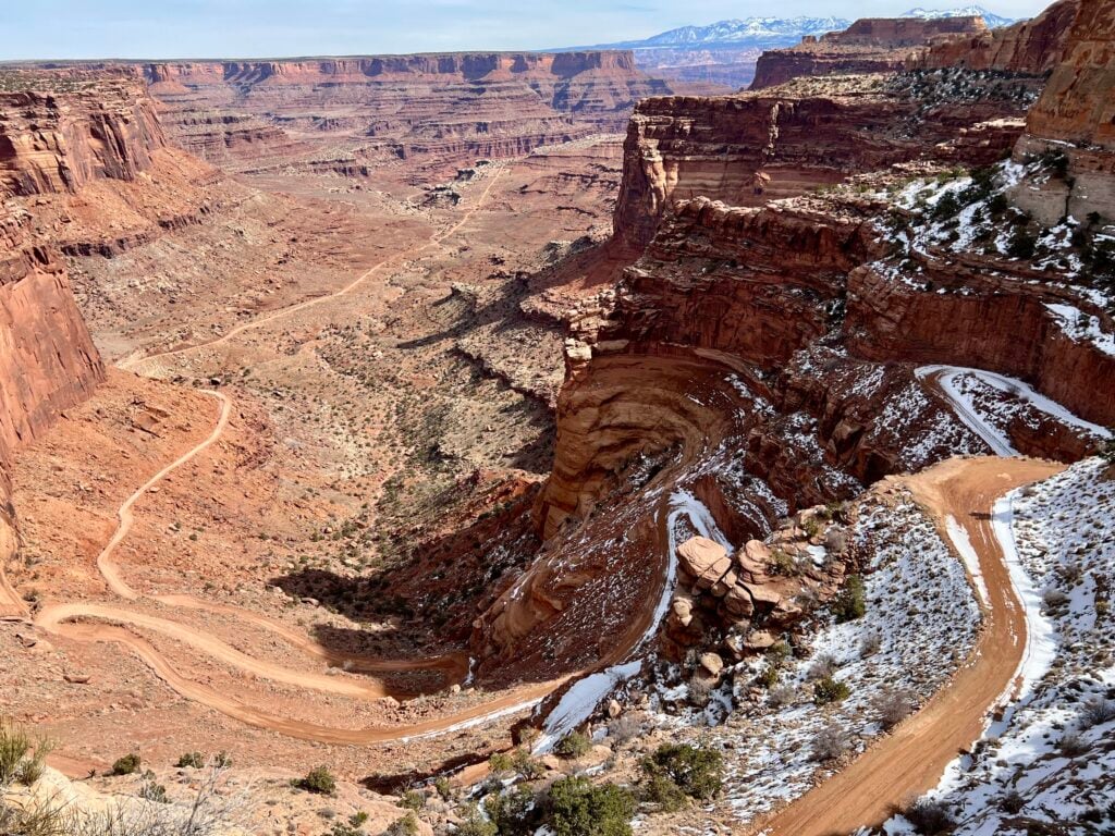
The Shafer Trail is the scariest drive we’ve ever done! It’s a dirt road that hugs the canyon wall with switchbacks that are so tight, they sometimes require a 3-point turn! You don’t have to do this 2 + hour drive, but it’s pretty fun if you are feeling brave. You have our permission to skip it, but you should at least check out the overlook and watch other cars drive it!
GOOD TO KNOW: The Shafer Trail and Potash Road connect. Be aware that it’s a bumpy ride once you reach the bottom of the canyon.
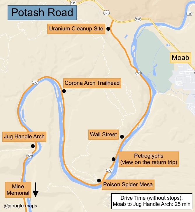
Potash Road follows the Colorado River below Dead Horse Point State Park. It is a nice scenic drive with some interesting stops and a well-known hike, Corona Arch. It takes 1.5 hours to drive and will take you back to Moab. You can learn more in our blog post, Things To Do Along the Potash Road.
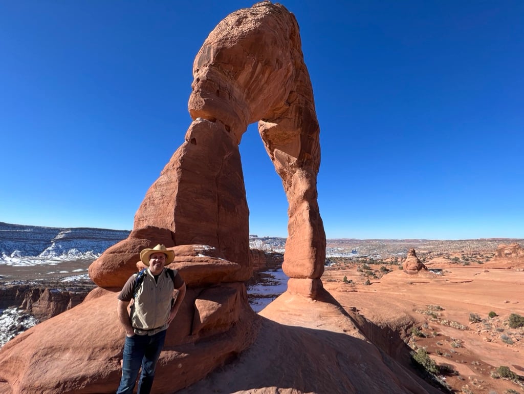
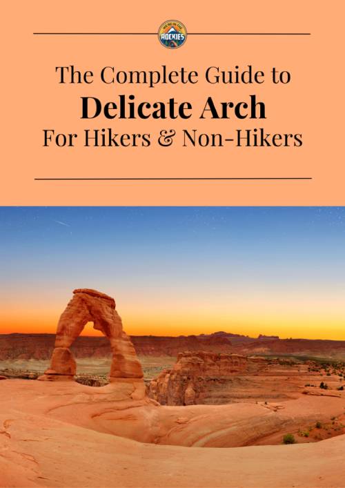
3 miles round trip, strenuous. You may want to call it a day after all the cool things you’ve done at Canyonlands, but if you’ve got the energy, we recommend heading into Arches National Park to catch a sunset at Delicate Arch. We often say this is the worst hike in the park with the best payoff. Delicate Arch is so beautiful that it is on Utah’s license plate. It’s 46 feet tall and truly is a wonder of nature. You can read How to Hike Delicate Arch for more info on how to do this hike and the other cool sites nearby.
5-page Printable – Exactly how to see Delicate Arch, with or without the full hike, plus when to go and what else to do nearby
Inside the guide:
*5-page Printable – Exactly how to see Delicate Arch, with or without the full hike, plus when to go and what else to do nearby
*Best times of day to go so you avoid the worst heat and crowds
*What to combine with Delicate Arch so you know what else to do in Arches that day instead of guessing
GOOD TO KNOW: Arches National Park does require a timed entry reservation for certain hours of the day. You can see the details on the NPS website. If you follow this itinerary, you won’t need a timed entry today because you’ll be arriving later in the day. BUT, you will need one for tomorrow!
Sleep: Same place as last night.

There are over 2,000 arches within the park. Some are only a couple of feet high and others are towering! Landscape Arch has an opening of 306 ft! Arches National Park is actually quite small in size, just 119 square miles. This makes the park super easy to navigate…but it can create crowding. It doesn’t take too many people to make this tiny park feel full. The timed entry, though inconvenient, has really helped with parking issues, and we are grateful it is in place.
All of the stops for today are along the Arches Scenic Drive, the main road that goes through the park.
This is a quick pull-off that provides some nice views of the Courthouse Towers area to the north (see the interpretive sign for the names of the formations), as well as the La Sal Mountains to the east.
FUN FACT: The La Sals were named by the Spanish because they looked like they had salt on top.
This is a short stop to see a famous and quirky formation. Most people just drive around it, but there is a 0.25-mile walking path that goes around it. It’s easy but has a few stairs.
We love this section of the park because you can see 4 really great arches and only have to hike 1 mile total to see them.
If you followed the plan yesterday, you got to see the magnificent Delicate Arch up close. We don’t think the viewpoints are great because the arch is so far away. If you don’t want to hike to it, we recommend the lower viewpoint.
4-8 miles round trip, moderately strenuous, some scrambling involved. Devils Garden contains many fins and arches. The hike consists of three stages, each getting progressively harder. The second stage is our favorite section and we highly recommend it if you’re able.
This is a beautiful canyon with towering walls on each side, perfectly named because it looks like a skyscraper-lined street. We love this viewpoint, but we prefer to do this on the way out of the park because it’s lovely when the evening sun hits the canyon wall.
Sleep: Same place you have slept the past two nights


Get our done‑for‑you, 5-7‑day route with exact drives, maps, and must‑see stops so you don’t waste time in traffic or miss the best views.
Inside the guide:
*Day‑by‑day plan for Zion, Bryce Canyon, Capitol Reef, Arches & Canyonlands to get you to the best hikes, drives, and activities
*Details You Need: Time frames, driving routes, and where to sleep each night to reduce back-tracking
*Includes audio stories to listen to as you drive
*Best Friend Guarantee: love it or get your money back
We think the best times to visit are late April through early May and October through November. March/early April and November are coat weather and less crowded, but they aren’t as pretty because the foliage and wildflowers aren’t blooming, and Bryce can still be covered in snow. November and March are typically the lowest crowds, and June, July, August, and even September are HOT. We’ve done it in summer, but be prepared to sweat. Snow-covered parks in winter are pretty and quiet, but we still prefer the green foliage to the white snow.
If it’s hot out, start your hikes EARLY, before it warms up too much. If you’re hiking late in the day, consider bringing a jacket because when the sun goes down, your sweat and the cool air can be chilly.
What to Wear. It will most likely be hot when you visit. A hat, sunscreen, and sunglasses are a must! Bring a jacket after the sun sets. It gets cool in the desert.
What to Bring. A good water bottle or Camelbak and your camera. See our recommended gear.
For Your Safety. Bring salty sacks too! It’s amazing how much you sweat in the desert
and your electrolytes need to be replenished, too.
Road Conditions. A regular car is all you need to navigate these parks. Some roads have RV restrictions, and we prefer to have a high-clearance 4-wheel drive vehicle
on Cathedral Valley Drive (Capitol Reef) and the Shafer Trail (Canyonlands).
Cell Phone Service. These parks are in remote areas. Don’t count on having great reception.
Services Within the Parks. None of these parks has gas stations within them. Arches and Canyonlands have nowhere to eat. Bryce Canyon and Zion have a couple of
restaurants at their lodges, and Capitol Reef has pie at the Gifford house.
The two most common airports for this road trip are Las Vegas and Salt Lake City. Las Vegas is closer to Zion, and Salt Lake City is closer to Moab. It’s most efficient if you can fly into one city and out of the other. If the rental drop-off fee is too expensive, we just recommend using whichever option has the cheapest flight plus a rental car combined. You’ll spend the same amount of time driving whether you begin in Las Vegas or Salt Lake City.
Visiting Utah’s National Parks is truly incredible. We hope that this blog post has been a good resource to help you start planning your trip.
If you want to make planning your trip to Utah’s National Parks a breeze, check out our easy-to-follow, step-by-step itinerary.
Itinerary includes:
Zion National Park Trip Planner
How Many Days to Visit Bryce Canyon: 1 & 2 Day Itinerary + Maps & Must-Sees
How Much Time Do I Need to Visit Capitol Reef National Park?
Perfect Itinerary for Arches, Canyonlands, and Moab (2-5 Days)
Grand Canyon Beginner’s Guide: Itinerary + Lodging & Tips