Observation Point is one of those hikes that has gotten really popular online—especially as a backup plan for Angels Landing. So I went and did it (via the East Mesa Trail, which is the main way people access it right now), and I’ve got thoughts.
This is a review of Observation Point via East Mesa Trail in Zion. It’s a quiet, mostly flat, forest hike that ends with a commanding, straight-on view of Zion Canyon… but it comes with a big catch: getting to the trailhead, and the fact that the payoff is basically all at the end.
DISCOVER: How to Visit Utah’s National Parks: Epic 5-7 Day Itinerary
| This Hike is a Good Fit if… | This Hike is NOT a Good Fit if… |
|---|---|
| You want to get away from people | You can’t (or don’t want to) hike ~7 miles |
| You like flat hikes | You’re trying to see Zion in an efficient way |
| You want a backup to Angels Landing because you can’t get a permit or don’t want to do the chain section | You want a hike with variety and constant scenery (this one is mostly forest until the end) |
| You just like hiking for hiking’s sake, and you’re fine with a long walk for one big payoff | You don’t want to deal with the trailhead access situation (more on that below) |
My Quick Summary: If you’re a first-timer trying to hit Zion’s greatest hits efficiently, this probably isn’t your move.
Guide includes the Springville Shuttle, Zion Canyon Shuttle, What to Do at Each Stop, Handy Tips + Maps
This trail is actually pretty darn easy because it’s very flat. If 7 miles of hiking intimidates you, think of this as 7 miles of walking instead.
The biggest concern is the heat. I did it in spring on a beautiful day, so it was fine. In summer, this could feel like a long, hot walk. (Although this is on top of the canyon, and is generally much cooler than inside the canyon).
You used to be able to get to Observation Point from the bottom of Zion Canyon from Weeping Rock. But due to a few rockslides, the trail has been closed for several years.
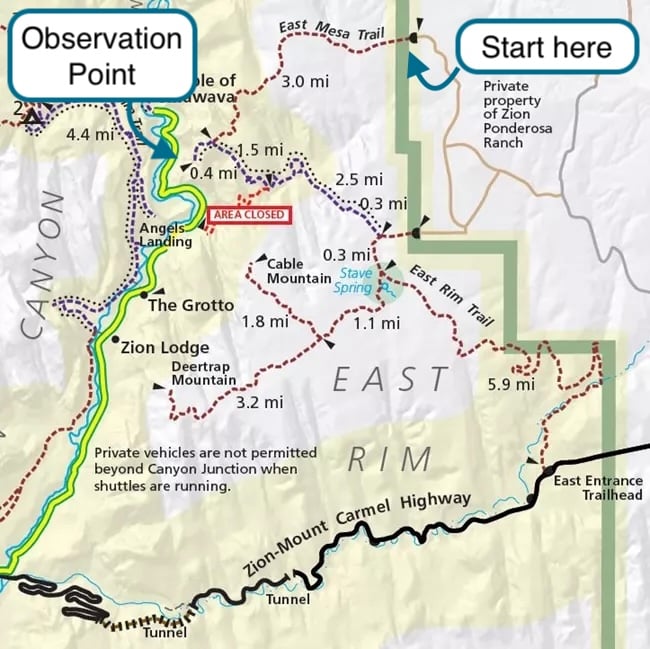
To reach Observation Point now, you need to hike the East Mesa Trail. This begins on the east side of the park.
To reach the trailhead, you must leave the park. It’s located on land owned by Zion Ponderosa Ranch Resort, about 25 minutes outside the East Entrance to Zion.
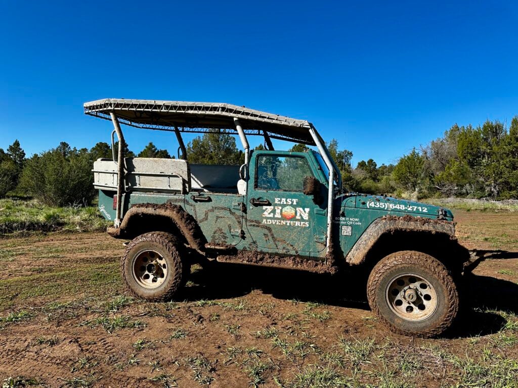
The road to get there is owned by Zion Ponderosa Ranch Resort, and it is a rough dirt road. They warn you that it could be muddy or rough, and a high-clearance vehicle is suggested. And if you get stuck, a rescue tow can cost hundreds of dollars.
I visited in the spring, on May 8, and it had rained the day before. The road was very muddy and slick.
East Zion Adventures, in conjunction with Zion Ponderosa Ranch, offers a shuttle service to the trailhead in one of their Jeeps. I booked this in advance on their website. When I visited, it was ~$7.
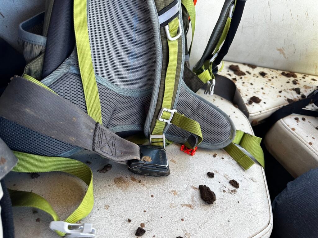
When I got on the Jeep, it had mud all over the seats and they didn’t bother to clean them off for us.
The road was so bad they couldn’t even make it to the trailhead themselves, and they dropped me off about half a mile away. I slipped and slid my way down the road to the trailhead, somehow staying on my feet.
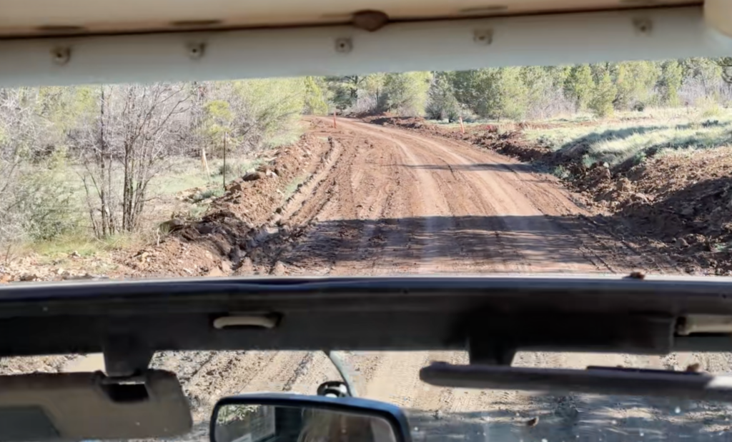
When I got to the parking lot, I was surprised to find a few vehicles that had not only braved the road but made it! (Note: on the way back, in the afternoon, the mud had mostly dried up and it was easier to walk or drive on the road).
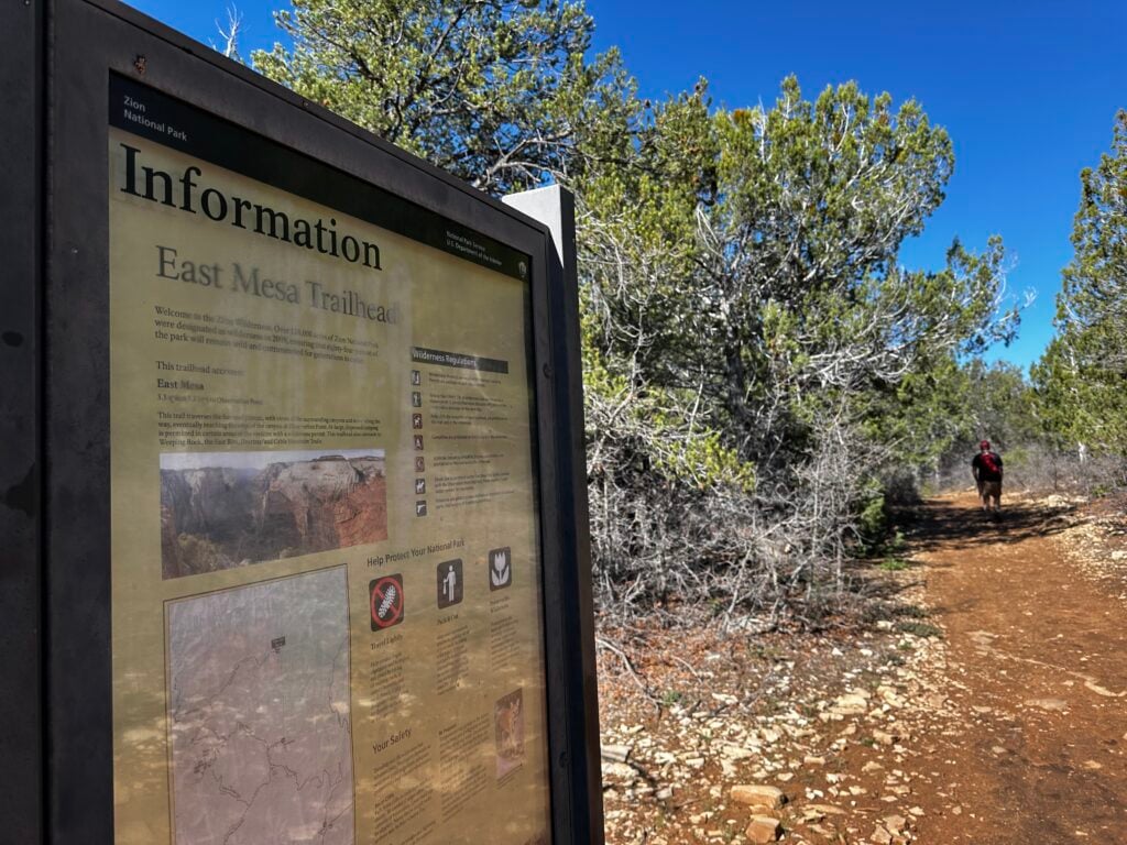
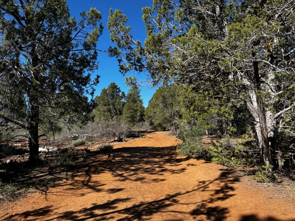
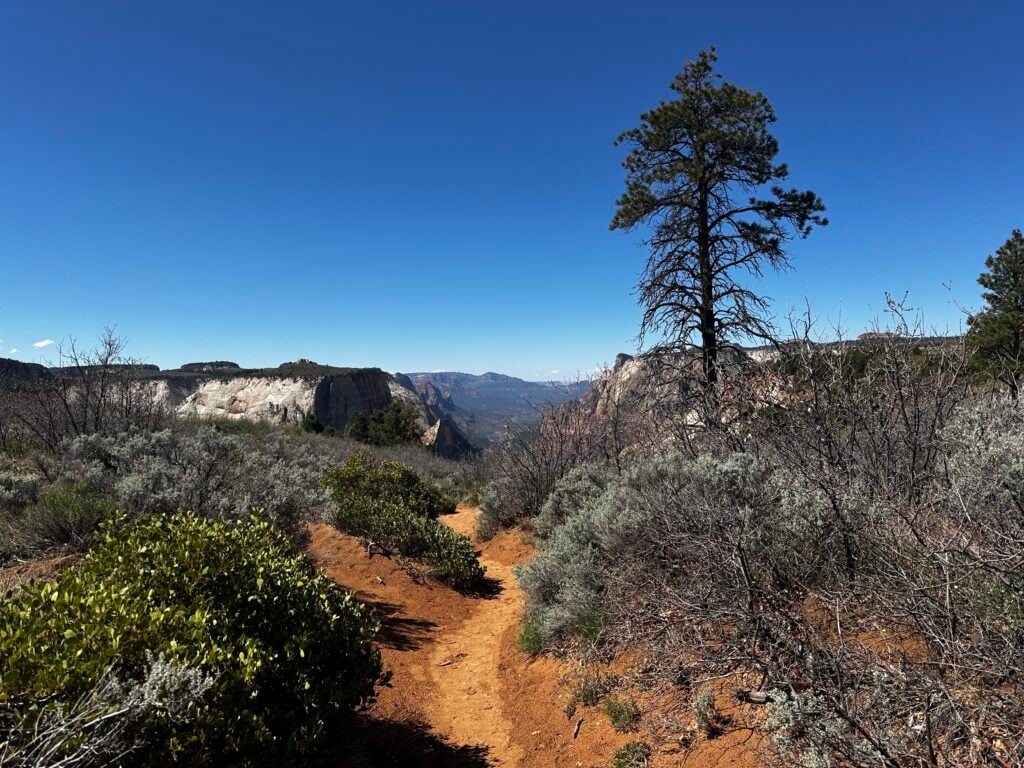
From the parking lot, you enter the national park at the trailhead. Once you finally start hiking, it’s calm.
My experience: hardly any crowds. It felt remote. You’re walking through the forest and ponderosa pines.
I’ll be honest, I thought the hike itself was kind of boring. It’s just not classic Zion Canyon scenery until the very end.
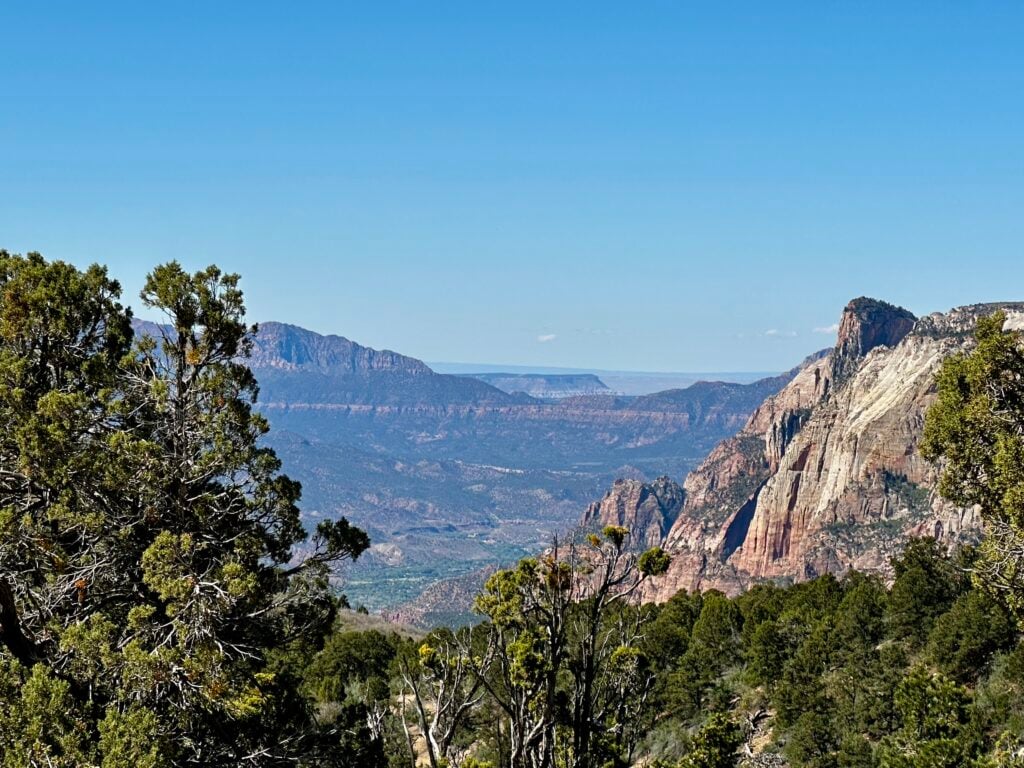
About halfway through, you start getting a few glimpses into side canyons. Nice, but it still feels like you’re waiting for the main event.
Mostly, the trail just continues through the forest.
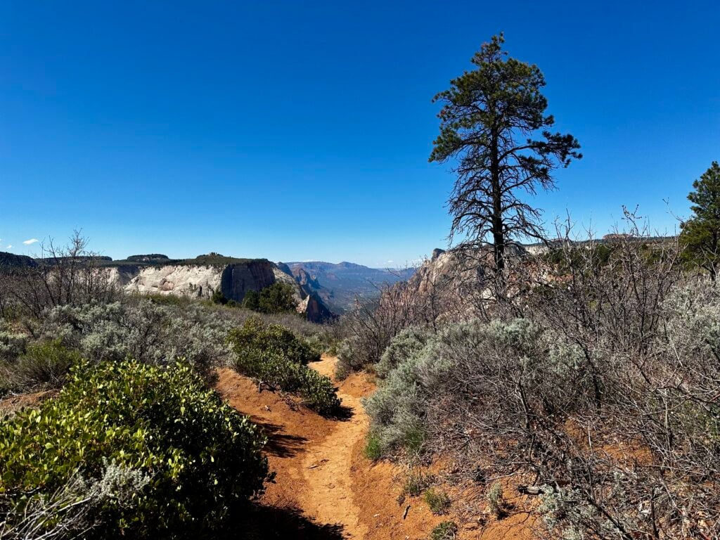
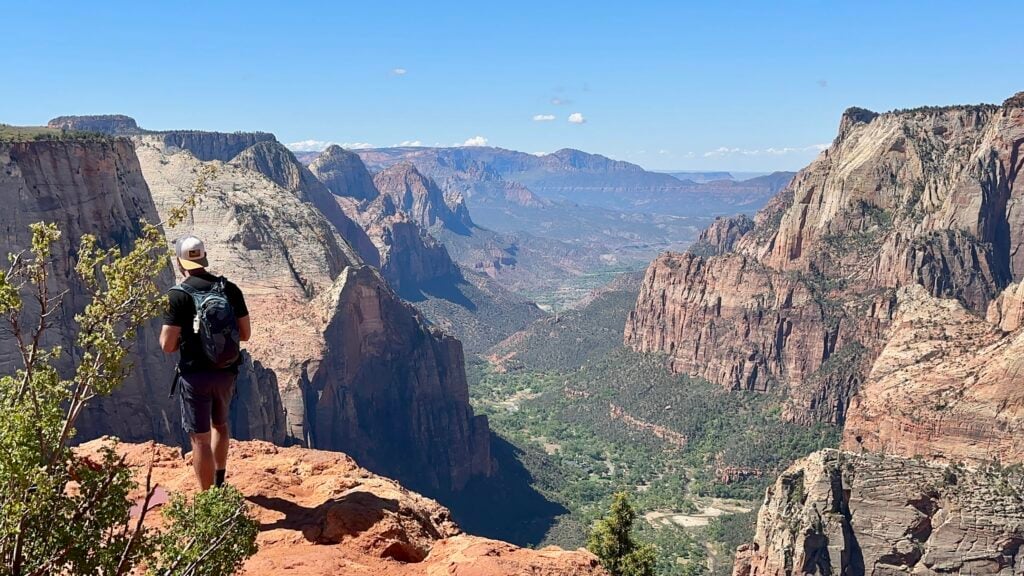
The best part is when you break off the East Mesa Trail and join the Observation Point Trail.
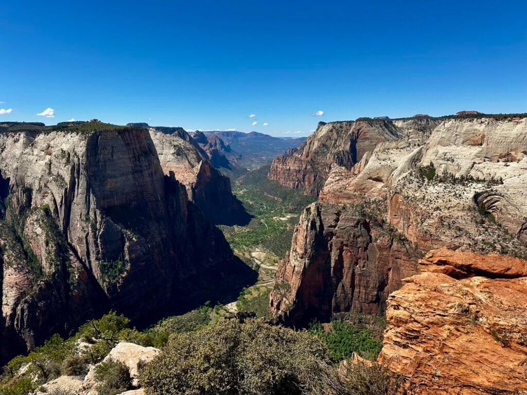
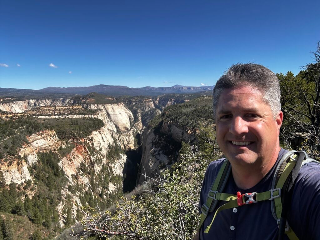
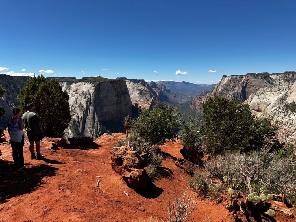
This is where it gets exciting because you can see Zion Canyon out in the distance, and as you walk along a ridge, you can tell you’re getting very close. Then the viewpoint just kind of appears, and it’s wonderful.
You can also see the old route coming up the canyon wall (the one from Weeping Rock / East Rim). That was cool to see.
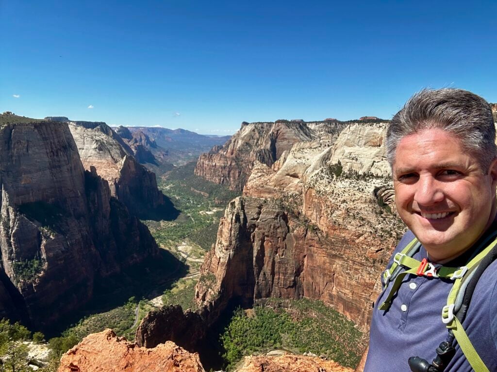
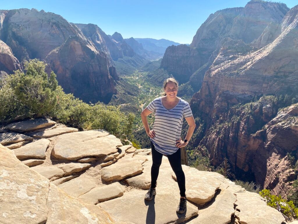
Let’s talk about the viewpoint.
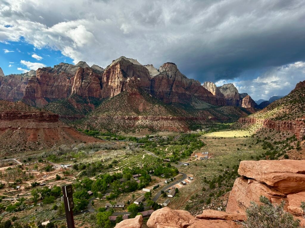
From Observation Point, you get a straight-on view down Zion Canyon, and you’re way up there, over 2,000 feet above the canyon floor.
There’s no denying this is AWESOME. From here, you can actually see Angels Landing below, and it looks tiny (it’s 1,200 feet above the canyon floor).
But the funny thing is, I still liked the view from Angels Landing better because it was more intimate.
I compared it to the Eiffel Tower: the second level is considered better than the top because you’re closer to the city and it feels more immersive.
So does the payoff match the effort? For me, not really. It’s a lot of mileage (plus the trailhead hassle) for one viewpoint at the very end.
And just to be clear: it’s still hard not to say “wow” when you get there. It’s Zion. My all-time favorite canyon. I love this place, and everything about it. But there are more enjoyable hikes without the big time commitment.
I think this hike has become kind of a backup to Angels Landing because Angels Landing requires a permit via a lottery process, which isn’t guaranteed.
This is an acceptable backup if you can’t get the Angels Landing permit, providing the only other straight-on view of the canyon.
But it’s definitely NOT an equivalent. Angels Landing has spectacular views throughout, memorable switchbacks, an adventurous climb on Hog’s Back, and a similar but better payoff. It’s also shorter.
If you can get the permit for Angels Landing, that is absolutely the hike to do!
DON’T MISS: The Best (and Worst) Times of Year to Visit Zion National Park
The two big ones:
My advice: bring a snack or lunch. Once you get there, you don’t want to immediately turn around.
CHECK OUT: Our Zion Recommended Gear and our Recommended Gear for Hiking
If you’re mainly doing this hike because you want that “looking down into Zion” experience, but you’re not sure this one is worth the time, here are my go-to alternatives:
| Do this hike if… | Skip this hike if… |
|---|---|
| You want to get away from people | You can’t (or don’t want to) hike ~7 miles |
| You like flat hikes | You’re trying to see Zion in an efficient way |
| You want the straight-on canyon overlook and you’re willing to work for it | You want a hike with variety and constant scenery (this one is mostly forest until the end) |
| You just like hiking for hiking’s sake, and you’re fine with a long walk for one big payoff | You don’t want to deal with the trailhead access situation (more on that below) |
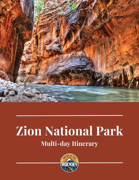
Hiking Observation Point is just one way to experience this incredible park. If you want to take your trip planning to the next level and save 10+ hours (instead of being buried in blog posts and Google Maps), see the best sites to avoid crowds, plus see some cool things only locals know about, check out our Zion itinerary. It walks you through it step by step, with maps, timing advice, and honest recommendations based on real experiences.
It’s designed to save you hours of planning—and help you have a smoother, less stressful visit to Zion National Park.
ZION TRIP PLANNER: To read or watch all of our content about Zion National Park, check out our Zion Homepage
THINGS TO DO: Don’t miss all that Zion has to offer including Emerald Pools, Angel’s Landing, The Narrows, and Kolob Canyons
WHERE TO EAT: Check out the best places to eat in and near Zion National Park
GREAT CITIES TO STAY OR CHECK OUT: Learn where to stay or camp when visiting Zion and explore some amazing cities nearby including St. George, Kanab, and Cedar City
KNOW BEFORE YOU GO: Find out if you need a reservation and how to use the shuttle system as well as if you can drive in Zion, which entrance to use, and how to avoid crowds
WATCH: Enjoy videos of gorgeous Zion National Park while learning our best tips for visiting by watching our Zion YouTube Playlist