Olympic National Park is known for its dense forests and dramatic ocean views. There are over 200 hiking trails in the park, each offering a different perspective. Whether you’re looking for old-growth forests, beach hikes, or mountain views, Olympic National Park has something to satisfy every traveler.
I’ve been traveling to Olympic National Park for years, hiking many of the trails and falling more in love with every visit. I’ve become an expert on the park, and while many hikes will leave you inspired, I’m going to share with you my favorite ones.
Most Beautiful: Hurricane Hill, Cape Flattery, Second Beach
Best for Kids: Quinault Rain Forest Nature Trail, Sol Duc Falls, Hole-in-the-Wall
Most Accessible: Quinault Rain Forest Nature Trail, Sol Duc Falls, Spruce Railroad Trail
Get our done‑for‑you, 2-5 day plan with exact drives and must‑see stops so you don’t waste time in traffic or miss the best views
Inside the guide:
*Step-by-step plan that will take you to the best mountains, beaches, rainforests, and lakes
*Exact time-frames and star-ratings so you can make the best use of your time and money
*Best Friend Guarantee: love it or get your money back
*Visiting more in the PNW? Save big $ and get guides for Olympic, Mount Rainier, the Oregon Coast and the Columbia River Gorge with our PNW Bundle.
VISITING OLYMPIC AND NEED A GAME PLAN? CHECK OUT OUR ITINERARY.
Before visiting Olympic National Park, it’s helpful to understand just how big this park is. Most of these trails are spread out from one another. The drive time between locations could be anywhere from 30 minutes to 2 hours. The park can be driven in a loop or as an out-and-back drive. If you complete all 7 of these hikes, you’ll get to explore different beaches, venture into the old-growth forests, and stand at the top of a sub-alpine mountain top. These hikes give you a chance to experience every ecosystem within the park.
DON’T MISS: Driving in Olympic: 10 Things You Need to Know
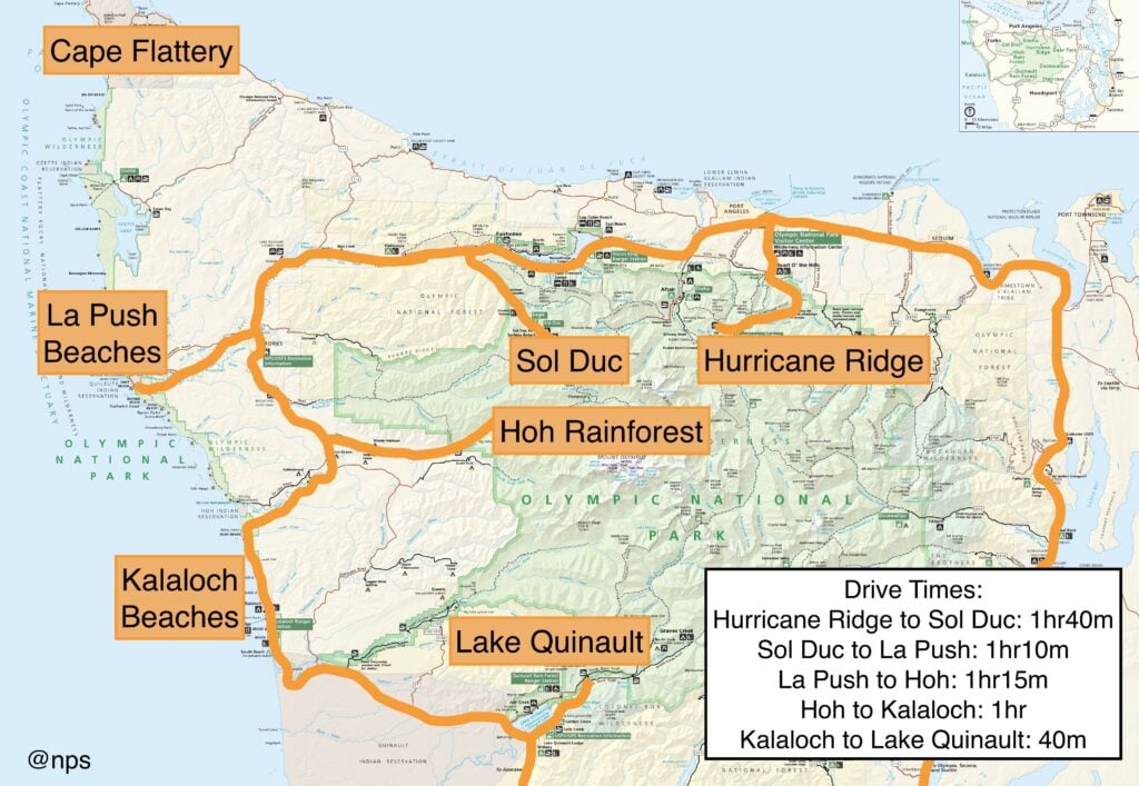
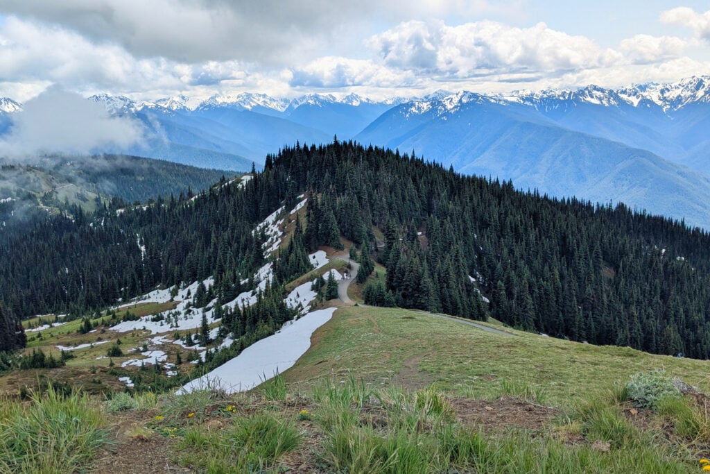
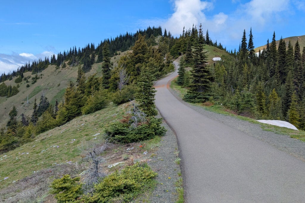
Hurricane Hill is located at the top of Hurricane Ridge, 18 miles from Port Angeles via Hurricane Ridge Road. Once you arrive at the main parking lot at Hurricane Ridge, keep driving for about another mile; the road will end at this trailhead. RVs and trailers are not recommended on the further section of the road because it is quite narrow and windy.
It’s honestly hard to find words to describe how magical this trail is. It feels like stepping into a fairy tale. With an abundance of wildlife, epic views, and flower-covered meadows, this hike is everything you could ask for from a subalpine adventure. The walk is fully paved and starts off fairly flat, then begins climbing after half a mile. As you climb higher, you surpass the tree line and are met with incredible views from every direction.
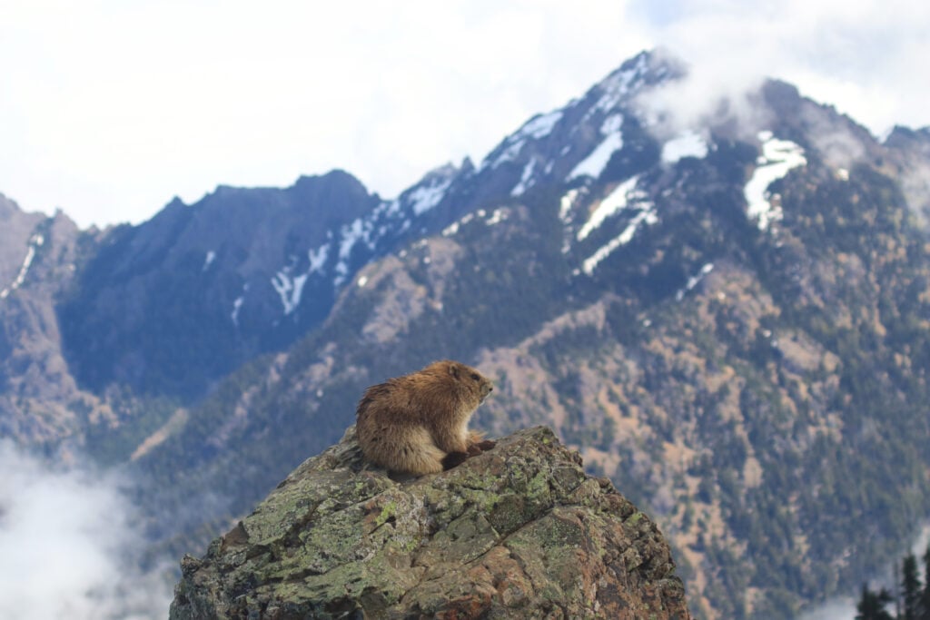
At the end of this hike, you are standing at the top of a mountain with views of the Strait of Juan de Fuca, Lake Crescent, and the Olympic Mountain Range. You’ll also most likely be greeted with marmots playing in the meadows and deer walking the trails. There have also been a fair number of bears spotted on the distant cliffside. While this trail has some elevation gain, I’ve seen people of all ages making the trek.
Hurricane Ridge does not have any amenities at the top besides a restroom. You will need to bring water and food with you. The nearest gas station and restaurants are in Port Angeles. There are benches and resting areas along the trail.
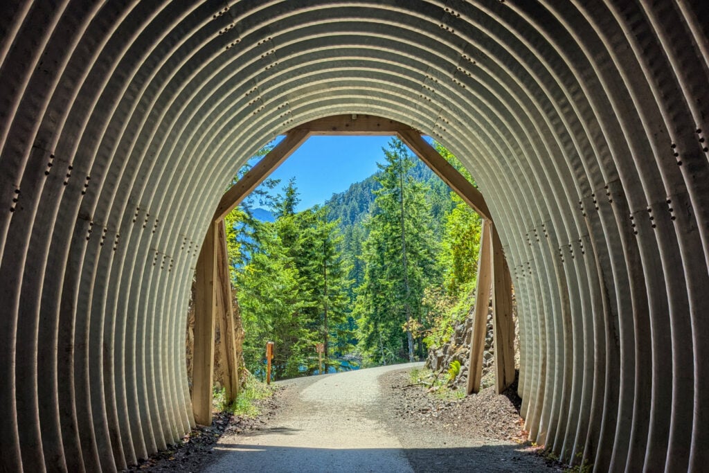
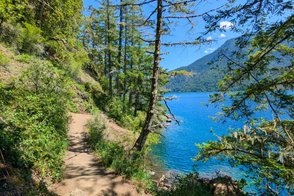
The Spruce Railroad Trail is located on the northeast side of Lake Crescent. While there are two starting points for this trail, I recommend using East Beach Road to access the hike. You can access East Beach Road off of Highway 101, and you’ll continue on for 4 miles. The trailhead is well marked, so you can’t miss it.
While the entirety of the Spruce Railroad Trail is quite lengthy, one perk to this hike is that you can turn around at any point. I recommend hiking to Devil’s Punchbowl, which is about 1.2 miles into the hike. Devil’s Punchbowl is a deep swimming spot along Lake Crescent with beautiful turquoise blue water.
The Spruce Railroad Trail is a paved path taking you along the lake, surrounded by water and a thriving forest. You’ll walk along the old railroad route, even going through some railroad tunnels. The tunnels can be lengthy and dim, so bringing a flashlight would be a good idea. This is also a popular biking path; if you don’t have your own, you can rent a bike from the Log Cabin Resort.
There is a vault toilet at the trailhead as well as one 4 miles into the hike. The nearest gas station and market are at Shadow Mountain RV Park, on Highway 101 near the turn-off for East Beach Road.
A quick guide to choosing between the Oregon Coast, Olympic, Mount Rainier, and the Columbia River Gorge
*See what you can realistically do in the time you have (3-13+ days)
*Choose the RIGHT regions for you. Do you like to hike, relax, eat good food, take scenic drives?
*Avoid the classic PNW mistakes that waste hours in the car

Second Beach is one of the three beaches located in La Push. This hike-to beach is my favorite in the area and well worth the journey! Second Beach is located about a mile before the town of La Push and 14 miles west of Forks. There is a parking lot for this trail on the left side of La Push Road.
The Second Beach trail is 0.8 miles one-way. The hike is relatively flat until you reach the end, where you will have to navigate over large tree roots and climb a set of stairs. You’ll cross over a wobbly bridge before reaching the beach.
The hike takes you through a dense coastal forest, on a well-maintained dirt path. The walk can get a little muddy, especially towards the end. You’ll start getting glimpses of the seatacks and ocean below you before the descent down to the beach. What I love about this beach is the smooth black sand and tide pools you can access at the nearby rocks. Second Beach is fairly quiet and is often visited by locals. To get the most out of this beach, I recommend visiting around low tide.
There is a questionable porta-potty in the parking lot. All other amenities can be found in La Push or Forks, like gas and restaurants. River’s Edge Restaurant in La Push is a great spot to grab brunch or dinner.
PRO TIP: If you are looking for a shower while visiting the area, the Lonesome Creek Store in La Push has showers you can purchase for ~$1. Also, the gas station here is much cheaper than in Forks.
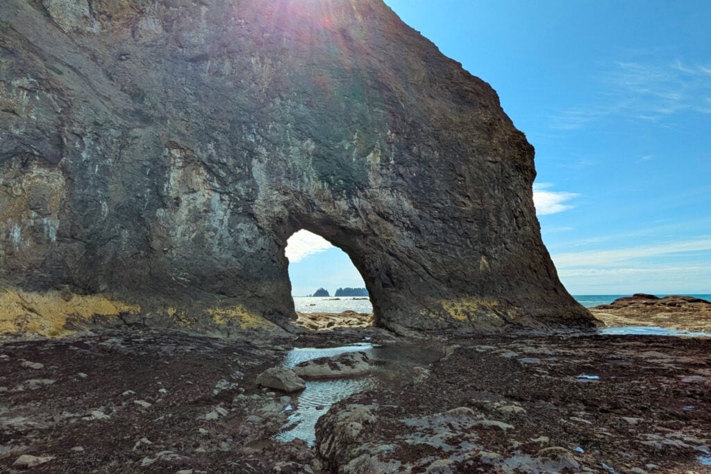
The Hole-in-the-Wall hike is located at Rialto Beach, 14 miles west of Forks. Rialto Beach does get pretty busy, but there is plenty of oceanfront parking.
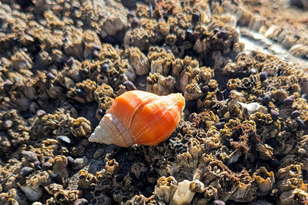
Hole-in-the-Wall Hike is one of the coolest beach hikes in Olympic National Park. You walk along the beach through sand and stones to reach a giant rock with a natural arch in it. Beyond this arch is a field of tide pools. What sets these tide pools apart from other ones in the park is the diversity and colors of the sea life inhabiting this space. You can find crabs and snails in brightly colored pink and orange shells. There are sea stars of every color of the rainbow, and if you’re lucky, you can see whales spouting in the distance.
PRO TIP: The tide pools here are covered in seaweed, so the surface is very slippery. Wear shoes with a grippy sole if you have them.
A couple of things to note about this hike: you can only reach the Hole-in-the-Wall at low tide, so check the tide charts posted in the parking lot before you head out. Also, there is a seasonal stream that you might have to cross, requiring you to remove your shoes and possibly wade through knee-deep water. There is a way to avoid the stream by climbing over a driftwood pile near the beginning of the hike.
There is a restroom in the parking lot. All other services, such as gas and food, are located in Forks or La Push.
13 road trip ideas across the West so you know where to go, how long to stay, and what to see
*Sample routes from 4–31 days across national parks and hidden gems
*Driving times + best stops so you don’t miss the good stuff
*Season + weather notes to avoid closed roads and peak‑crowd days
*Lodging ideas in the right spots so you cut backtracking
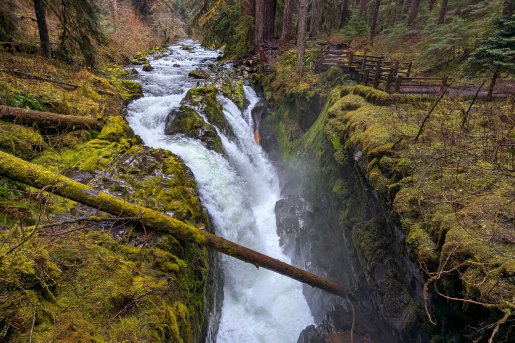
A trip to Olympic National Park wouldn’t be complete without hiking to the iconic Sol Duc Falls. Sol Duc Falls is located at the end of Sol Duc Hot Springs Road, 14 miles from Highway 101. The drive is scenic, taking you along the Sol Duc River through a dense forest of towering trees.
Sol Duc Falls is an easy 2.6-mile out-and-back hike that is mostly flat. The trail takes you through an old-growth forest, along the river, and over a couple of streams. You’ll walk along a cliffside with a canyon below you, showcasing the roaring waters of the Sol Duc River. The falls are located by a long bridge, which gives you views of the cascade dropping hundreds of feet below you. Follow the trail a little further to access platforms that give you a closer view of the falls. This is a mist zone, though, with water spraying off the falls and coating everything around.
Sol Duc Falls is located in a remote area of the park, with limited amenities. There are vault toilets at the trailhead, and the Sol Duc Hot Springs Resort has snacks and a small gift shop. The nearest gas station and restaurants are located near Lake Crescent. Lake Crescent Lodge has a dining room, serving up three delicious meals a day. Gas can be found at the Shadow Mountain RV Park located on the east side of Lake Crescent.
DON’T MISS: How to Visit the Sol Duc Valley
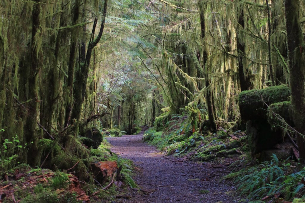
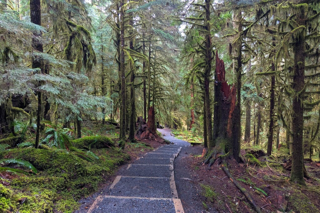
The Quinault Rain Forest Nature Trail is one of the best forest hikes in Olympic National Park. I prefer it to the Hall of Mosses in the Hoh Rain Forest. They are similar trails with educational plaques along the way in an old-growth forest, but this one is way less crowded, allowing you to enjoy a moment of solitude.
The Quinault Rain Forest Nature Trail is located at the beginning of the South Shore Road. The hike takes you along a roaring river, with a couple of overlooks allowing you to see down into the canyon. Ferns line the rock walls surrounding you. There are various informational signs along the way teaching you much about the ecosystem. You’ll learn about temperate rainforests, the animals that inhabit the area, and how the forest grows and thrives. This is a great trail for the whole family to enjoy nature and learn something new.
The park provides a flush toilet at the trailhead. The nearest gas station can be found in Amanda Park, which has some of the cheapest gas in the Olympic Peninsula, so fill up here! If you’re looking for a bite to eat, the Roosevelt Dining Room at the Lake Quinault Lodge serves up breakfast, lunch, and dinner.
CHECK OUT: How to Visit Quinault Lake in Olympic National Park
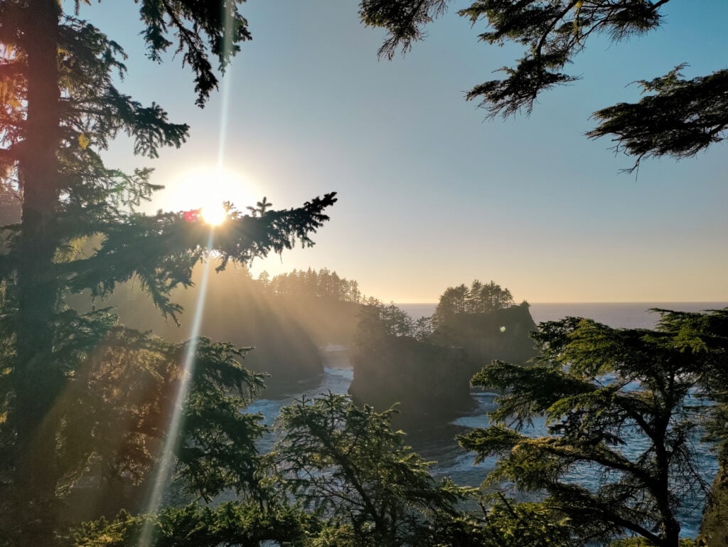
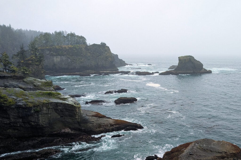
Cape Flattery is located near Neah Bay, 44 miles northwest of Highway 101. While this hike is technically not in Olympic National Park, it will always be worth the detour. This is one of my absolute favorite hikes on the Olympic Peninsula and one that I daydream about often.
The Cape Flattery trail is a mixture of a dirt walking path and a series of boardwalks. The hike starts by taking you through a forest of dense vegetation, then you’ll come to an opening where you’ll see several overlooks. Each overlook gives you a different perspective of the dramatic ocean below you. The end of this trail rewards you with views of crashing waves, large seastacks housing eagles, and sea stars lined along the cliffside surrounding you. There are even opportunities to see whales on their yearly migration.
Cape Flattery is known for its rainy days with dense fog along the coast. The trails are muddy year-round, so bring rain boots or waterproof hiking boots. Also, pack a rain jacket, because there is a high chance of getting wet on this hike.
Cape Flattery is on the Makah Reservation; you will need a Makah Recreation Pass to access this land. They are ~$20 per vehicle for a yearly pass. There is a restroom at the trailhead, but no other amenities. You will find gas and restaurants in Neah Bay, 7 miles away. If you’re looking for a bite to eat after your hike, check out Pat’s Place for some Indian Tacos.
Get our done‑for‑you, 7‑17 day route with exact drives, maps, and must‑see stops so you don’t waste time in traffic or miss the best views
Inside the guide:
*Day‑by‑day plan for Olympic, Mount Rainier, the Oregon Coast, & the Columbia River Gorge
*Details You Need: Time frames, driving routes, and where to sleep each night to reduce back-tracking
*Best Friend Guarantee: love it or get your money back
These seven hikes will allow you to experience every ecosystem within Olympic National Park. You’ll hike through old-growth forests, along sandy beaches, following the rushing waters of the Sol Duc River, and experience the subalpine terrain of Hurricane Ridge. There are endless trails to explore in Olympic, but I hope these trails leave you feeling inspired and rejuvenated, as they do with me.
Most travelers want to visit the most popular sites and still avoid the crowds. We created a step-by-step itinerary so you can visit the best places at the right times.
OLYMPIC TRIP PLANNER: To read or watch all of our content about Olympic National Park, check out our Olympic Homepage
THINGS TO DO: Don’t miss all that Olympic has to offer, including hikes, Lake Crescent, Kalaloch and Ruby beaches, the Hoh Rain Forest, Hurricane Ridge, and Sol Duc Hot Springs.
WHERE TO EAT: Don’t miss the best places to eat in Olympic National Park
GREAT CITIES TO STAY OR CHECK OUT: Learn about where to camp when visiting Olympic plus things to do in Port Angeles, Port Townsend, Sequim, and Forks.
KNOW BEFORE YOU GO: Find out how to get there, the best time to visit, which is the best entrance, and all about driving around Olympic