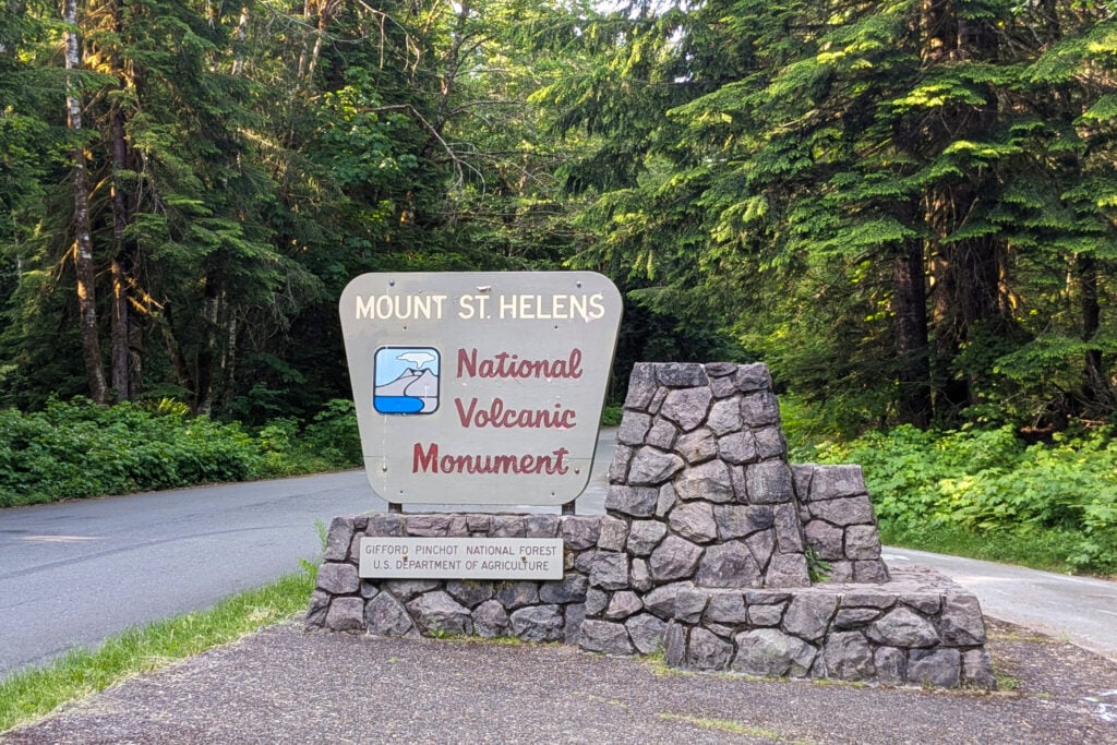
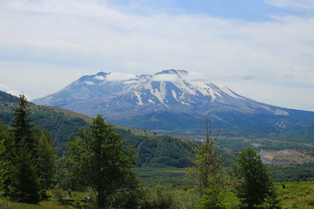
Mount St. Helens National Volcanic Monument is known for its catastrophic eruption on May 18, 1980. Since then, about 200,000 visitors each year come to see how the landscape has evolved over time.
I’ve been traveling to national parks and monuments all over Washington, spending some time at Mount St. Helens as well. In this article, I’ll tell you my top 9 things to do while visiting the area. There are many viewpoints, hiking trails, and visitor centers that will inspire and educate you about the eruption and how the ecosystem is still recovering today.
While a visit to Mount St. Helens can be done in a day, to see every part of the park, you’ll need to stay for a couple of days.
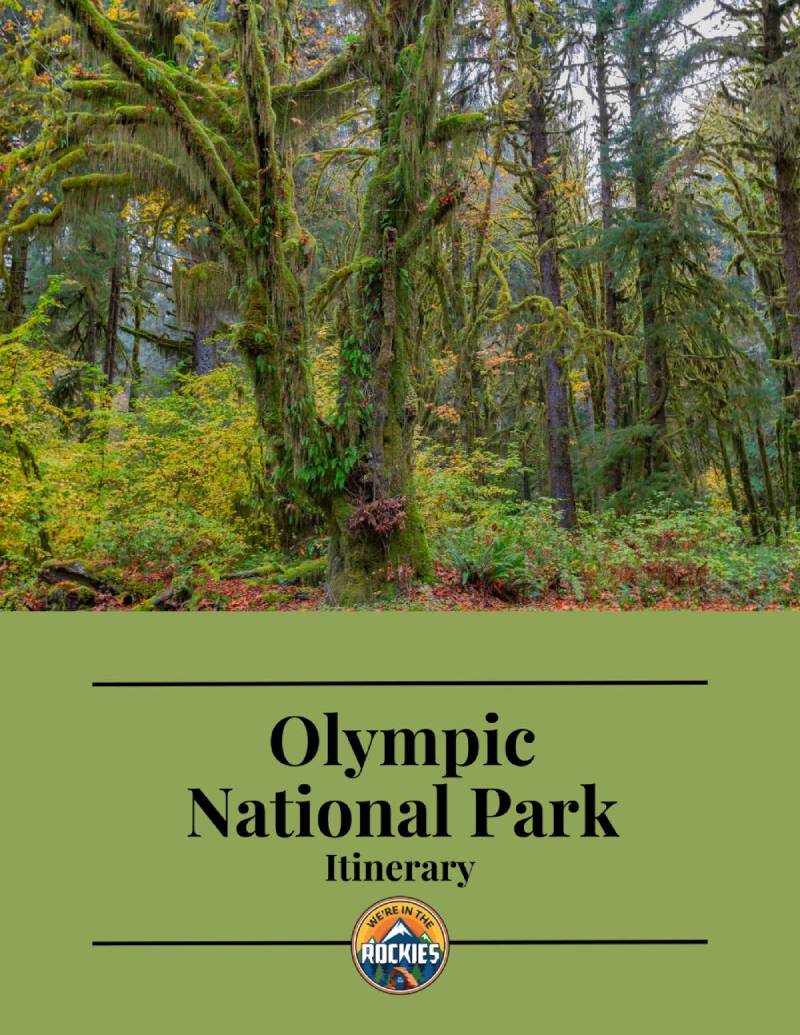
VISITING OLYMPIC NATIONAL PARK AND NEED A GAME PLAN? CHECK OUT OUR ITINERARY.
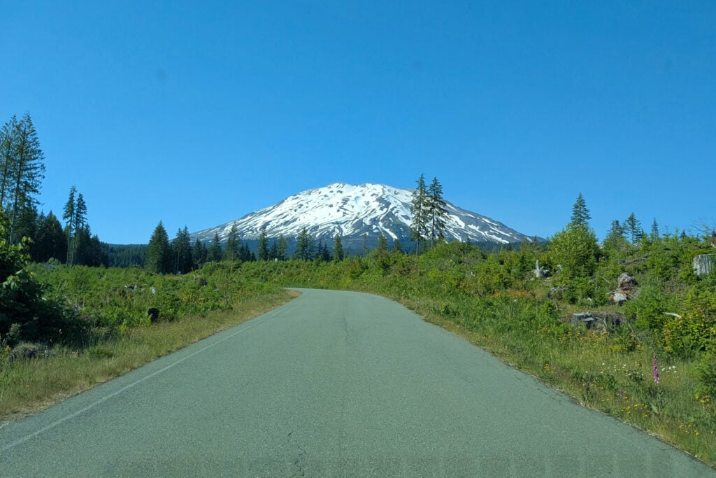
The Spirit Lake Highway is on Route 504, accessed via the Castle Rock exit on I-5. From here, the drive takes you 52 miles east, ending at the Johnson Ridge Observatory. Along this highway, you’ll get glimpses of Mount St. Helens in the distance, with many viewpoints to pull over and take in the scenery.
I really enjoyed this drive. It is a bit windy, but the roads are smooth and the views are incredible. Most of the drive is through a thick forest, so watch out for animals. You’ll also drive through Castle Rock, where many farmers set up stands with fresh produce and specialty items, like cider, for sale. I highly recommend bringing some cash with you to grab fresh cherries and berries for the drive.
The only gas station from here is located in Castle Rock, so be sure to gas up before you make the trek out into the park.
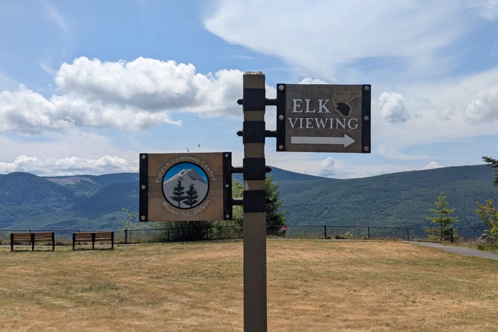
The Mount St. Helens Forest Learning Center is an interesting spot to stop along the Spirit Lake Highway. They have great views of Mount St. Helens towering over a valley down below. They have an elk viewing platform set up with spotting scopes to get a closer view of the valley.
The Forest Learning Center is a completely free museum, showcasing the history of logging in the area, with photos of Mount St. Helens after the eruption and how logging was important to help clean up the area after the disaster. There is also a movie playing, showing what happened on the day of the eruption. It’s quite informative.
The Forest Learning Center has clean restrooms, picnic tables, and information on the area. They are open daily from 10 am to 4 pm, mid-May through September.
Get our done‑for‑you, 7‑17 day route with exact drives, maps, and must‑see stops so you don’t waste time in traffic or miss the best views
Inside the guide:
*Day‑by‑day plan for Olympic, Mount Rainier, the Oregon Coast, & the Columbia River Gorge
*Details You Need: Time frames, driving routes, and where to sleep each night to reduce back-tracking
*Best Friend Guarantee: love it or get your money back
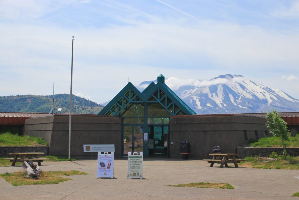
The Coldwater Science and Learning Center is a hands-on learning center with exhibits on how the mountain and surrounding areas are recovering after the eruption. The center mostly focuses on the animals and plant life that have returned to the area. There is a 20-minute video teaching all about the eruption and the ecosystem.
Be sure to check out the back deck. You will be eye-to-eye with Mount St. Helens, giving you beautiful photo opportunities. From here, you can walk the Winds of Change Trail, which features educational plaques telling you about the plants and animals in the area. This short walk is filled with wildflowers, with Mount St. Helens in the background.
This is a great spot to get updated areainformation, attend a ranger program, and browse the gift shop. The Coldwater Science and Learning Center is open weekends from 10 am to 4 pm, mid-May through early June. Open daily 10 am to 4 pm, June through October. This site has picnic tables, restrooms, and potable water
A quick guide to choosing between the Oregon Coast, Olympic, Mount Rainier, and the Columbia River Gorge
*See what you can realistically do in the time you have (3-13+ days)
*Choose the RIGHT regions for you. Do you like to hike, relax, eat good food, take scenic drives?
*Avoid the classic PNW mistakes that waste hours in the car
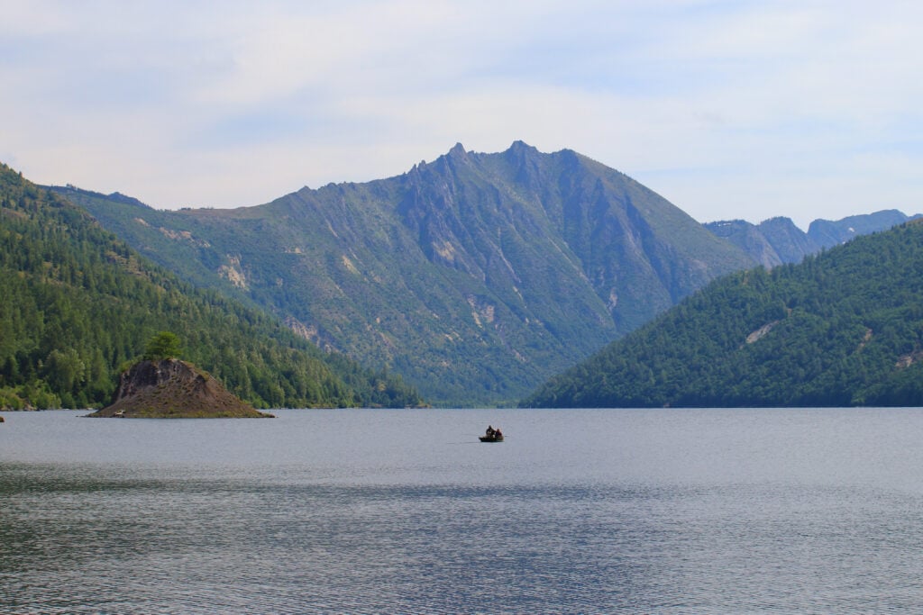
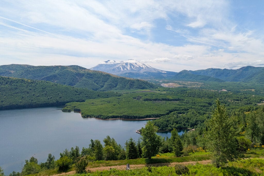
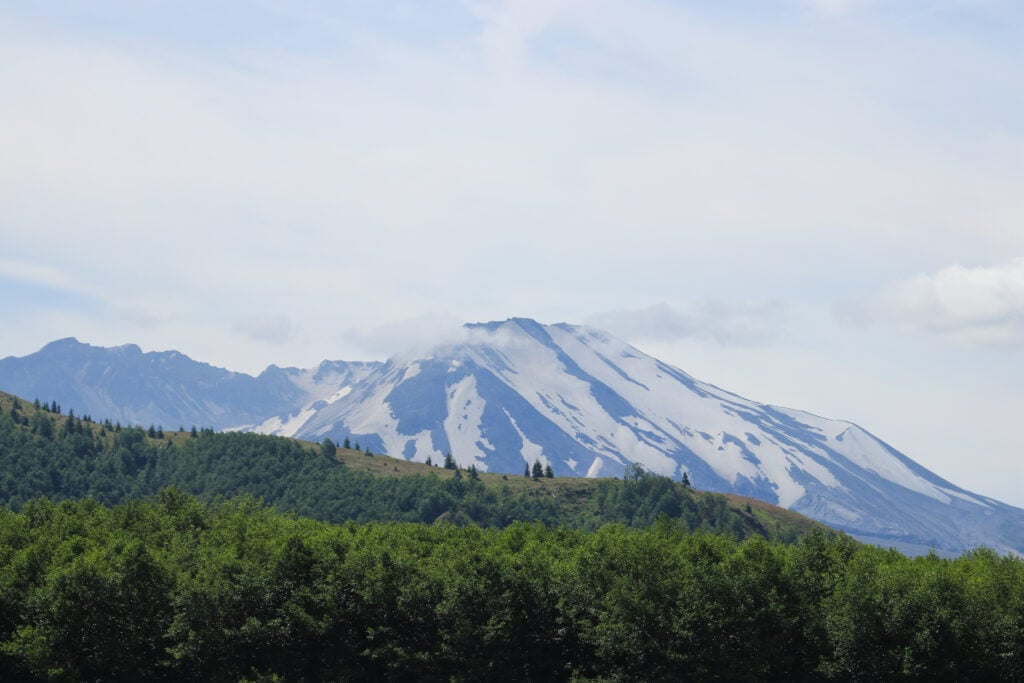
Spirit Lake is situated at the base of Mount St. Helens. This lake, which existed before the eruption, is now covered in logs that are a result of the aftermath. After the eruption, Spirit Lake’s water level grew over 200 feet and doubled its surface area. Spirit Lake is only open for viewing and not for recreational activities. The lake is being used for scientific research to document the changes after the eruption. The best viewpoint of the lake is from the Windy Ridge Viewpoint.
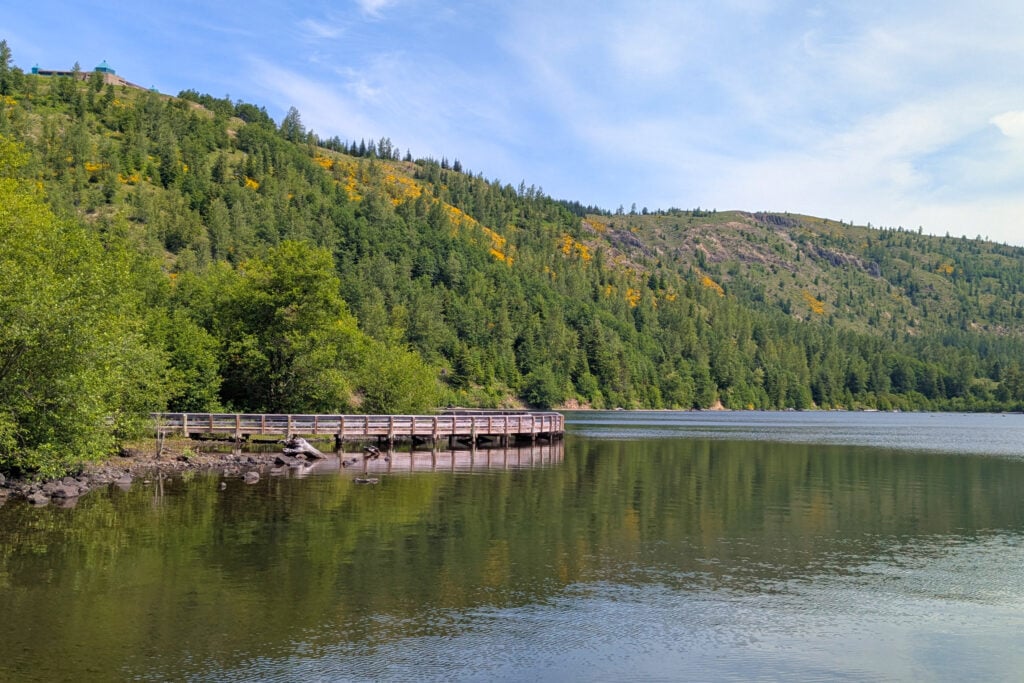
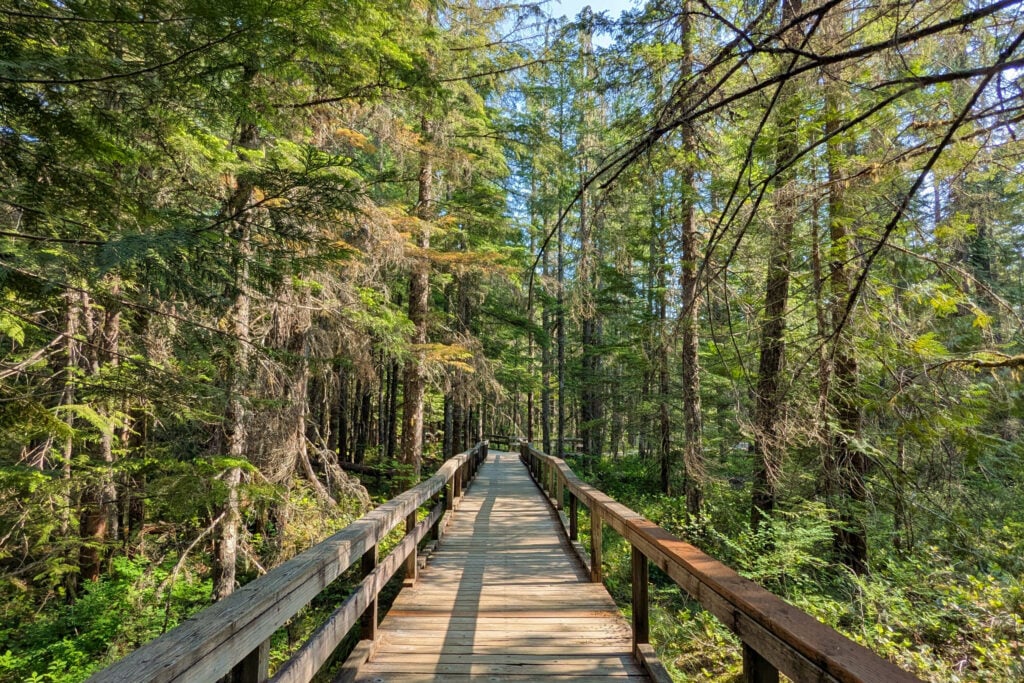
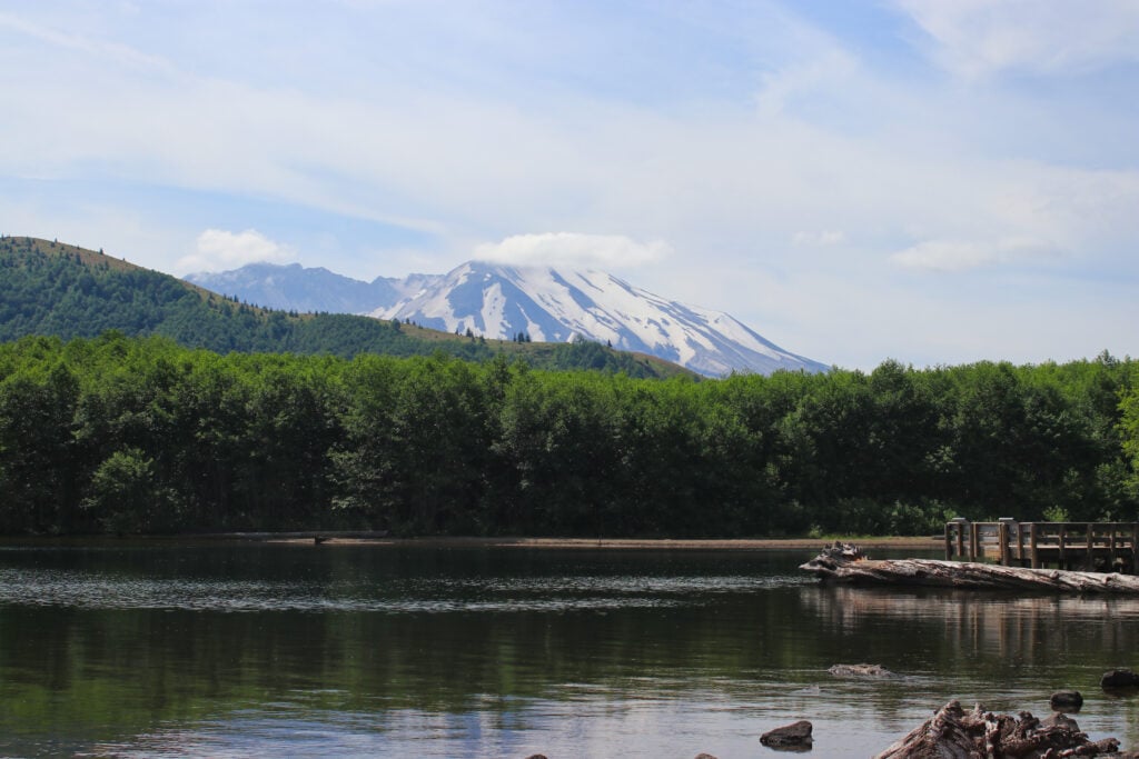
Coldwater Lake was created by the Mount St. Helens eruption. The lake is about 4.5 miles long and 190 feet deep in some areas. While it took years for creatures to inhabit the lake, it is now thriving with fish, salamanders, and frogs. There is a boat ramp on site, and many people fish or kayak in the lake. From here, you can take a boardwalk along the lake to walk the Birth of a Lake Interpretive Trail. This trail is a flat lake with interpretive signs telling you about the history of the lake and the creatures that inhabit it. You also get views of Mount St. Helens peering out over the treeline.
The Johnston Ridge Observatory is a visitor center overlooking the crater caused by the eruption of Mount St. Helens. The observatory is an educational site featuring exhibits, a rotating selection of films, and ranger-led talks. This is the closest you can get to the eruption site. The crater you see from here is 1.2 miles wide. Note: This area is closed through 2027 due to a landslide.
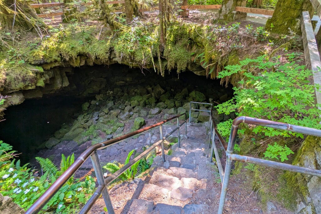
The Lava Tubes are located on the southern side of Mount St. Helens. Coming from I-5, you’ll take the Woodland exit and follow WA 503. Continue on for 35 miles before making a turn onto NF-83. There are plenty of signs leading you to the Ape Cave.
Once you get to the Ape Caves, there are two paths to choose from. The Lower Cave is a mild, 1.5-mile out-and-back hike with minimal elevation gain. This trail leads you through the cave to a dead end. This would be perfect to do with the whole family. There aren’t many objects in the cave that you need to maneuver around; it’s essentially just a straight walk.
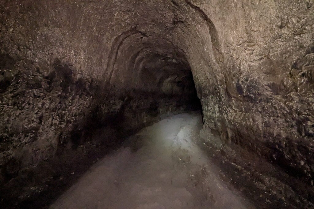
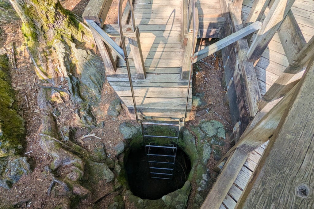
The Upper Cave, on the other hand, is a challenge! I had myself questioning several times what I was doing by myself in this dark cave. Yes, I hiked it solo, which I don’t recommend. This is a hard 1.5-mile trail from one end of the tunnel to the other, then you will exit the cave into a lava field, where you will walk another 1.5 miles back to the parking lot. The cave portion of the trail is not an easy feat. You will have to use your whole body to climb over several lava boulder fields. Some of the rocks are not sturdy, and the only light source you have is the one you bring with you, which ideally should be a headlamp.
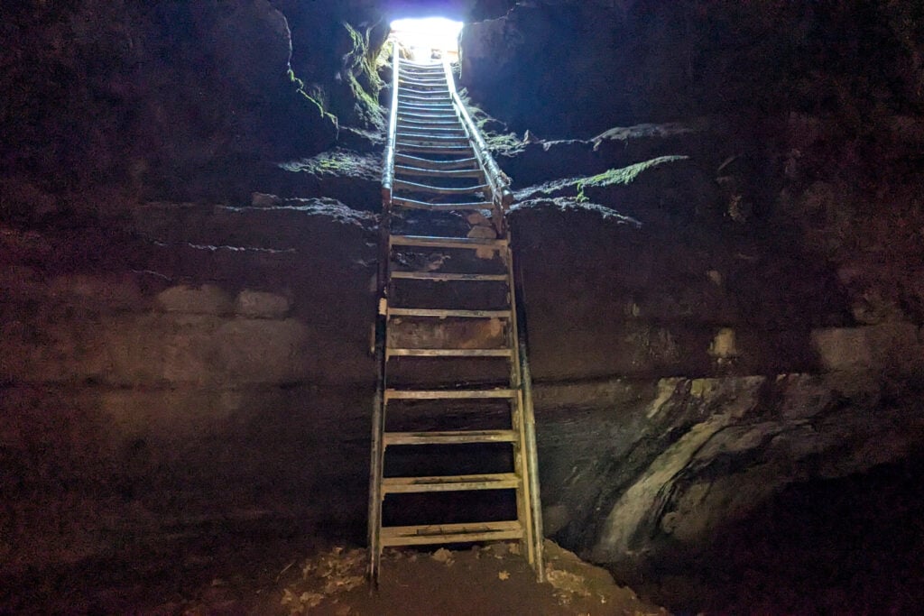
About 3/4th of the way through the trail, you will encounter an 8-foot wall, which you will have to climb. There is a rope there, but the Rangers advised me not to use it as it was placed by a random person, not the park. The only way I was able to get over the wall was because a kind stranger gave me a boost. After climbing the wall, you’ll encounter a few more boulder fields before finding the end with a rusty ladder leading you to the exit. The walk back to the car from here is very easy, taking you through the lava field and new growth forest.
The Upper Cave isn’t something that anyone can do. If you are afraid of tight, dark spaces or are not physically capable, I recommend hiking the Lower Cave instead.
Before visiting the Ape Caves, you need to have 2 light sources with you, and your cell phone does not count. This hike requires a reservation. I paid ~$2 for my reservation through recreation.gov. These are to limit the number of people in the cave so it does not become overcrowded. I was able to purchase my tickets one day in advance.
13 road trip ideas across the West so you know where to go, how long to stay, and what to see
*Sample routes from 4–31 days across national parks and hidden gems
*Driving times + best stops so you don’t miss the good stuff
*Season + weather notes to avoid closed roads and peak‑crowd days
*Lodging ideas in the right spots so you cut backtracking
The Windy Ridge Interpretive Site is a viewpoint for Mount St. Helens. From here, you get sweeping views of the eruption site, Spirit Lake, and on clear days, you can see Mount Adams and Mount Rainier in the distance. The interpretive site sits at an elevation of 4,200 feet, 4 miles from the eruption site.
From the parking lot, there is a staircase leading up to the site. You climb 368 steps to the viewpoint. There is no shade along the route. Once you arrive at the viewpoint, there is an option to continue hiking to additional viewpoints.
The road getting to Windy Ridge is a narrow forest service road with many holes and bumps along the way. It takes a minimum of 2 hours to access this site from the rest of the park. The road is usually snowed in until Late June. Due to the area’s remoteness, it is one of the least populated destinations in the park. Currently, Windy Ridge is only open on weekends throughout the summer.
There are no amenities at the interpretive site, and the restroom is currently under construction. Bringing food and water is recommended due to the remoteness of this site.
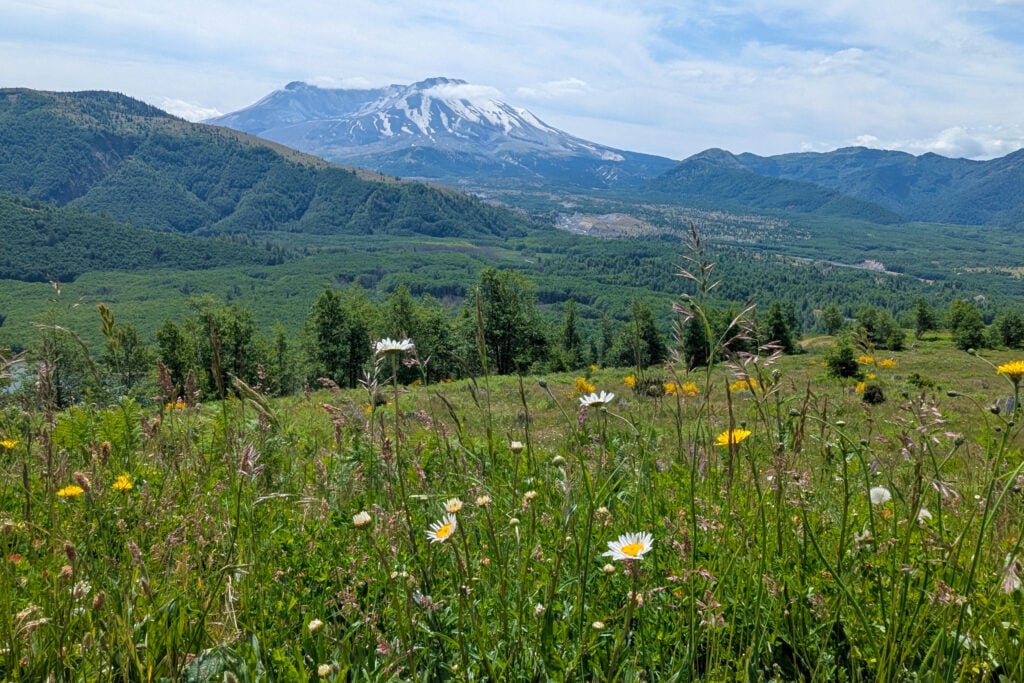
There are several viewpoints around Mount St. Helens National Monument. These viewpoints give you an advantage to see the valleys below, Mount St. Helens in the distance, and wildflowers surrounding you.
DON’T MISS: 7 Can’t-Miss Hikes in Olympic National Park: A Quick and Easy Guide
There are three main areas of Mount St. Helens: Johnson Ridge Observatory, Windy Ridge, and Lava Canyon. Each of these locations is on a different side of the mountain, with no direct roads connecting them. The drive time between each location is 2+ hours.
The road to the Johnson Ridge Observatory is located on the Spirit Lake Highway, Route 504, and is the most popular place to visit. Windy Ridge is on the east side of Mount St. Helens and requires you to drive down forest service roads for hours to reach. The Lava Canyon is located on the south side of the mountain, which gives you access to the lava tubes and lava fields.
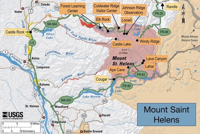
To reach Johnston Ridge Observatory, from I-5, turn onto SR-504/Spirit Lake Highway in Castle Rock and drive about 52 miles to the monument.
Due to a landslide, Johnson Ridge Observatory is closed through 2027. The Spirit Lake Highway currently ends at Coldwater Lake. There is still access to the Coldwater Science and Learning Center and hiking trails.
To get to Lava Canyon, take WA-503 E from I-5 to the town of Cougar, where the road turns into FR-90. From there, turn left on FR-83 and drive until you reach Lava Canyon at the end of the road.
Windy Ridge is accessible by driving South on FR-25 from Randle, WA, and turning right onto FR-99. Drive about 16 miles to the viewpoint.
Mount St. Helens National Monument requires a National Forest Recreation Pass. The passes are ~$5 per day or ~$30 annually. They also accept National Park Passes. The passes can be purchased online or in person at many of the kiosks located around Mount St. Helens.
Get our done‑for‑you, 7‑17 day route with exact drives, maps, and must‑see stops so you don’t waste time in traffic or miss the best views
Inside the guide:
*Day‑by‑day plan for Olympic, Mount Rainier, the Oregon Coast, & the Columbia River Gorge
*Details You Need: Time frames, driving routes, and where to sleep each night to reduce back-tracking
*Best Friend Guarantee: love it or get your money back
FIND OUT: Best Places to Camp In and Around Olympic National Park
Restaurants are limited around Mount St. Helens, so bringing plenty of food and water with you is important, especially if you’ll be camping in the area. If you’re visiting Route 504, through Castle Rock, there are a handful of restaurants available. If you are visiting the south side, the town of Cougar has two restaurants available.
CHECK OUT: Where to Eat In and Around Olympic National Park
Whether you are visiting Mount St. Helens for just a day or for a few days, there is much to see in the area, from waterfalls to mountain views to educational resources. I highly recommend adding this stop to your Washington itinerary.
CHECK OUT: A Perfect 6 Day Itinerary for Olympic (For First Timers)
Most travelers want to visit the most popular sites and still avoid the crowds. We have a detailed itinerary that gives you a step-by-step game plan so you can get to the best places at the right times.
OLYMPIC TRIP PLANNER: To read or watch all of our content about Olympic National Park, check out our Olympic Homepage
THINGS TO DO: Don’t miss all that Olympic has to offer, including hikes, Lake Crescent, Kalaloch and Ruby beaches, the Hoh Rain Forest, Hurricane Ridge, and Sol Duc Hot Springs.
WHERE TO EAT: Don’t miss the best places to eat in Olympic National Park
GREAT CITIES TO STAY OR CHECK OUT: Learn about where to camp when visiting Olympic plus things to do in Port Angeles, Port Townsend, Sequim, and Forks.
KNOW BEFORE YOU GO: Find out how to get there, the best time to visit, which is the best entrance, and all about driving around Olympic