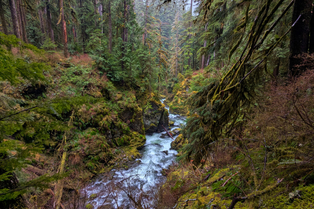
The Olympic Peninsula is a diverse wilderness housing many different ecosystems. Whether you are looking for old-growth forests to hike in, tide pools to explore, or mountains to climb, Olympic has much to offer.
This itinerary includes hikes, lodging, and where to eat during your stay. After your visit, you’ll get the full experience that the Olympic Peninsula has to offer.
I’ve been traveling to the Olympic Peninsula for years, hiking many trails and exploring the entire area. In this article, I’ll give you my recommendations for the perfect Olympic Peninsula road trip.
Which Entrance Should I Use For Olympic National Park? Olympic’s 5 Entrances Explained
Driving in Olympic: 10 Things You Need to Know
7 Can’t-Miss Hikes in Olympic National Park: A Quick and Easy Guide
Where to Eat In and Around Olympic National Park
The Best (and Worst) Times of Year to Visit Olympic National Park
To get the most out of your visit to the Olympic Peninsula, I recommend allowing yourself 7 days. A visit to Olympic can be done in fewer days; however, you may feel rushed to visit every area, or you may have to prioritize which locations you can fit into your timeline.
VISITING OLYMPIC NATIONAL PARK AND NEED A GAME PLAN? CHECK OUT OUR ITINERARY.
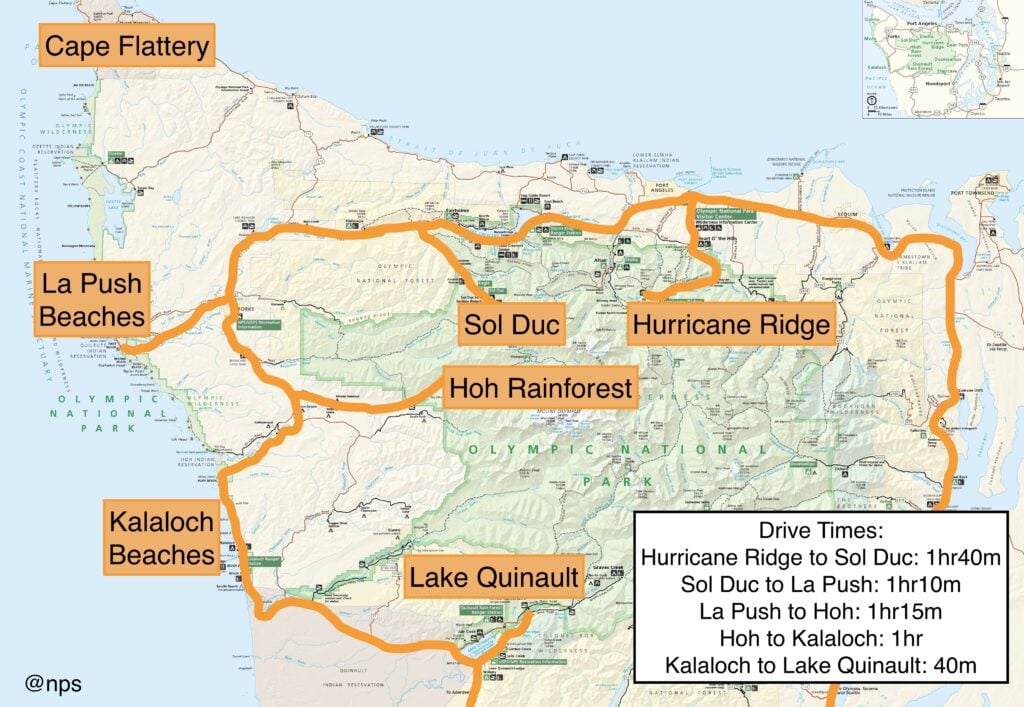
This itinerary starts at Port Angeles, which is a common starting point for visiting the Olympic Peninsula. Alternatively, you can begin at the Quinault Rain Forest if you’re coming from the south. The Olympic Peninsula can be driven as a circle, using Highway 101 as your guide, or it can be driven as an out-and-back from Port Angeles to Quinault.
The nearest international airport is the Seattle-Tacoma International Airport (SeaTac). From here, expect a 2.5+ hour drive to arrive at the Olympic Peninsula.
For visiting the Olympic Peninsula, it’s best to be a road trip warrior, changing campsites every day or two. The park is widely spread out, with popular destinations being 1+ hours away from each other. This makes for long days if you are having to trek back to the same camp every night. Each portion of this itinerary has camping or sleeping accommodations, so finding a place to stay is fairly easy.
My favorite time to visit the Olympic Peninsula is towards the end of September or the beginning of October. Summer crowds have settled, more solitude can be found throughout the park, and winter hasn’t rolled in yet, which means the park is still fully accessible.
–Cell Phone Service. Cell Service is limited throughout the park, so
having physical or offline maps downloaded is essential.
–A National Parks Pass is required for most of the locations on this itinerary. These can be purchased online or at the Olympic National Park Visitor Center in Port Angeles.
–Reservations. Reservations are required at most campgrounds
on the Olympic Peninsula from mid-May to mid-September.
–When to Start Your Days. When visiting popular places like the Hoh Rain Forest or
Hurricane Ridge, it’s advised to arrive before 8 am.
–What to Wear. Always pack many layers and a rain jacket. Check out our recommended gear.
–Don’t Bring Your Doggo. While dogs are allowed at campgrounds throughout the
Olympic Peninsula, dogs are not allowed on most trails.
–What if I have physical limitations? There are easy beaches to access with physical limitations, like Rialto Beach and First Beach in La Push. Many of the hiking trails, while flat, have tree roots and stairs, so hiking may not be the best option for you.
Get our done‑for‑you, 2-5 day plan with exact drives and must‑see stops so you don’t waste time in traffic or miss the best views
Inside the guide:
*Step-by-step plan that will take you to the best mountains, beaches, rainforests, and lakes
*Exact time-frames and star-ratings so you can make the best use of your time and money
*Best Friend Guarantee: love it or get your money back
*Visiting more in the PNW? Save big $ and get guides for Olympic, Mount Rainier, the Oregon Coast and the Columbia River Gorge with our PNW Bundle.
This itinerary is for anyone who wants to visit the Olympic Peninsula, but doesn’t know where to start. The itinerary is broken down by day and the areas you’ll visit. While this is written as a 7-day road trip, you can adjust it according to your ideal travel length.
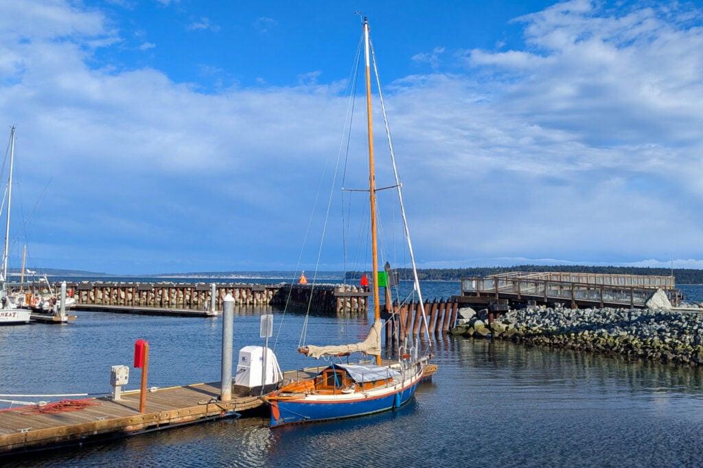
Port Townsend is my favorite town on the Olympic Peninsula, and one you should add to your list. This quaint town is filled with cute, artsy shops, delicious restaurants, and lots of history. Port Townsend is known for its wooden boats and even hosts a Wooden Boat Festival in September. Even if you aren’t visiting during that time, I recommend stopping at the Northwest Maritime Center to learn about the history of the wooden boats.
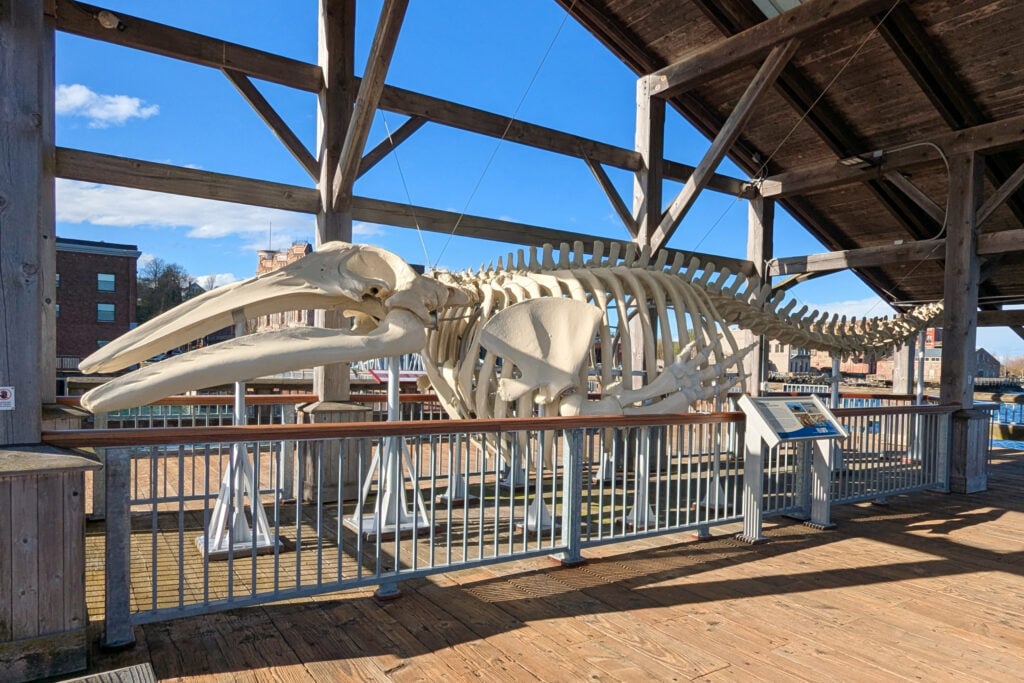
From here, you can park and discover Port Townsend on foot. Take a walk around Water Street, which is the main strip for shopping and admiring Port Townsend Bay. Here, you can go to the Union Wharf and see Gunther, a 42-foot whale skeleton, which was found washed up along the shores of Port Townsend.
Once you’ve spent some time exploring Port Townsend, you can grab a bite to eat. A great place to eat with beautiful views is the Bayview Restaurant. They serve a variety of options from breakfast to dinner, with their specialty being fresh fish.
From here, you’ll head to the Dungeness Recreation Area. The drive is 40 miles, or about an hour.
The Dungeness Recreation Area is a wildlife habitat with 50+ acres of tidelands to explore. You can walk out to the Dungeness Spit to visit one of the oldest operating lighthouses in Washington. The walk to the lighthouse isn’t a quick hike, though. It’s about 11 miles round trip and must be planned around the low tide. Once you arrive at the lighthouse, you can take a free tour. There is a recreation fee of ~$3 per family to visit the Dungeness Recreation Area.
One of the many draws to visiting this area is for birdwatching. With over 200 species of birds spotted here, it’s the perfect location for birders. Just don’t forget to pack your binoculars!
Dungeness Recreation Area Campground: This campground is located on a bluff overlooking the water. There are 66 sites total, with 31 being first-come, first-served. The others do require a reservation. Campsites start at ~$40 per night. There are no hook-ups, but there are full restrooms with coin-operated showers.
The drive to Port Angeles is 15 miles or 25 minutes.
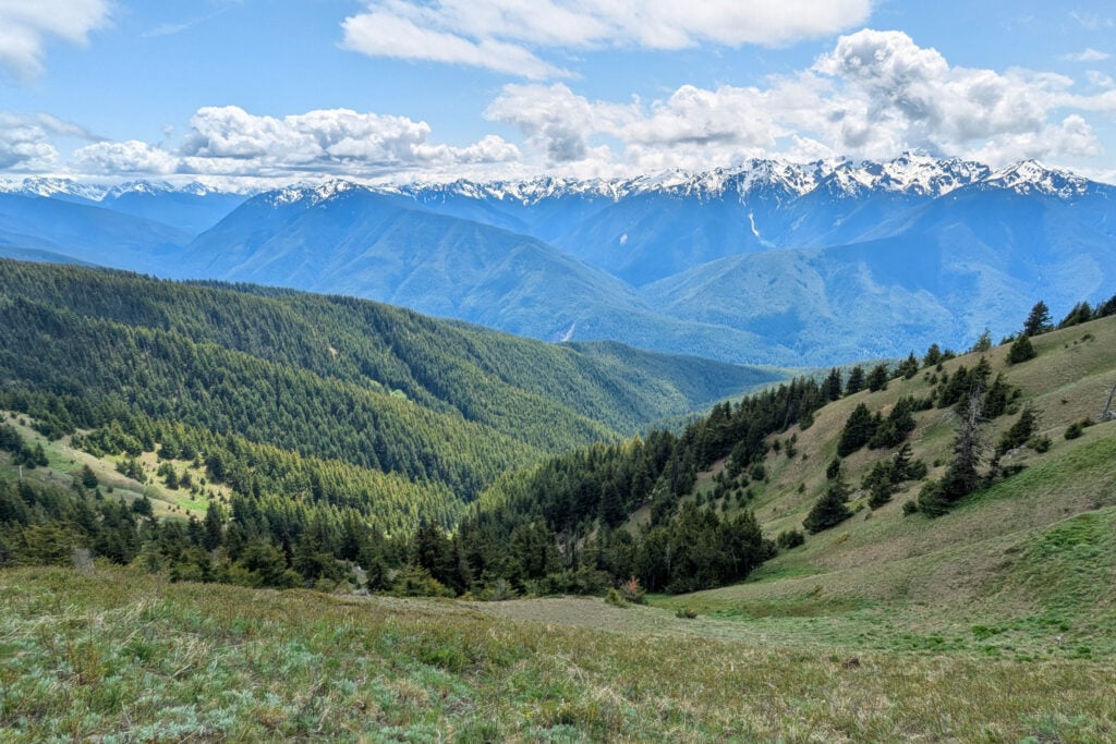
You’ll start day two by driving up to Hurricane Ridge. It’s 18 miles from Port Angeles. The drive takes you 5,000 feet up to the ridgeline of a mountain. From here, you’ll be face-to-face with the Olympic Mountain Range and Mount Olympus. There are many hiking trails at the Ridge, taking you deeper into the wilderness, or you can relax and take in the views from the parking lot.
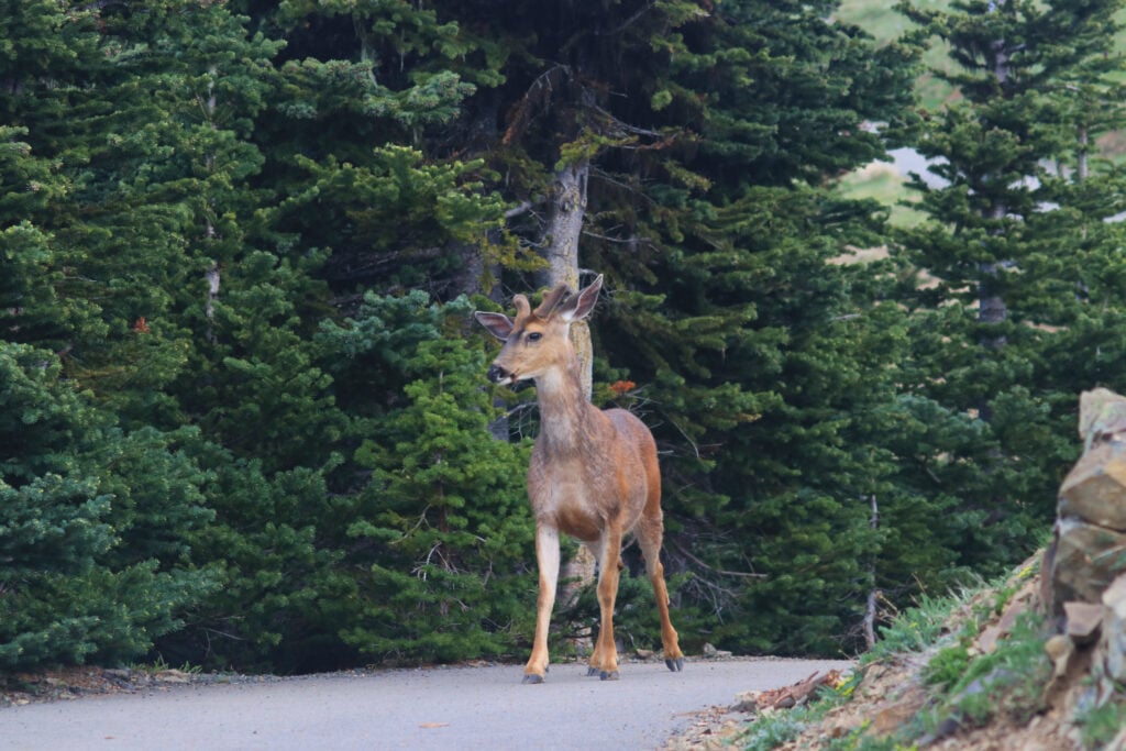
If you are looking for a rewarding hike that doesn’t take a lot out of you, I suggest hiking the Hurricane Hill Trail. This hike is a moderate, 3.4-mile out-and-back trail with 826 feet of elevation gain. This hike takes you through a subalpine terrain with incredible views of the mountains, the Strait of Juan de Fuca, and Lake Crescent. Wildlife is abundant on this hike, with deer walking the trails and marmots scurrying across the meadows.
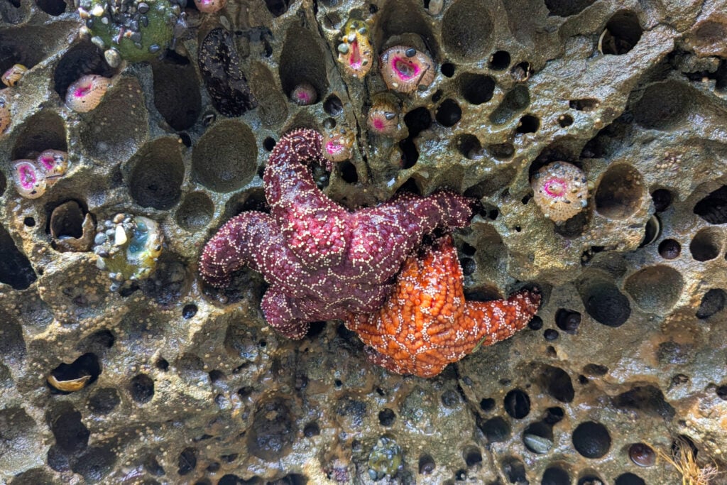
After your trip to Hurricane Ridge, you’ll explore Port Angeles, which is known as the Gateway to the Olympic National Park. In town, you’ll find local gift shops, the Port Angeles City Pier, and unique sightseeing spots like Ediz Hook or Salt Creek Recreation Area. If you visit Salt Creek, head out to Tongue Point. There are many tide pools to explore and trails to hike. Salt Creek is best visited during low tide.
PROP TIP: I recommend stopping by the grocery store in Port Angeles to pick up some snacks and meals for your travels, as the Olympic Peninsula is quite remote and some areas lack access to restaurants.
After a day of exploring, you may want to grab a bite to eat in Port Angeles. If pizza is on your mind, check out Strait Slice. This small pizza shop offers full pies and pizza by the slice. The portions are huge, and they have 4 specialty pizzas to choose from for the slices of the day.
Salt Creek Campground: The Salt Creek Recreation Area has a campground that offers tent sites or RV camping with full hook-ups. Many of the campsites have views of the water. There are 92 sites total. The amenities include full bathrooms with coin-operated showers, picnic tables, and a dump station. There is a mixture of first-come, first-served sites and reservation-only sites. Camping fees start at ~$45 per night.
Heart O’ the Hills Campground: If you’re staying in Port Angeles for the day, you can return to Heart O’ the Hills Campground, 5 miles outside of town.
A quick guide to choosing between the Oregon Coast, Olympic, Mount Rainier, and the Columbia River Gorge
*See what you can realistically do in the time you have (3-13+ days)
*Choose the RIGHT regions for you. Do you like to hike, relax, eat good food, take scenic drives?
*Avoid the classic PNW mistakes that waste hours in the car
Port Angeles to Lake Crescent is 22 miles, or about 30 minutes away.
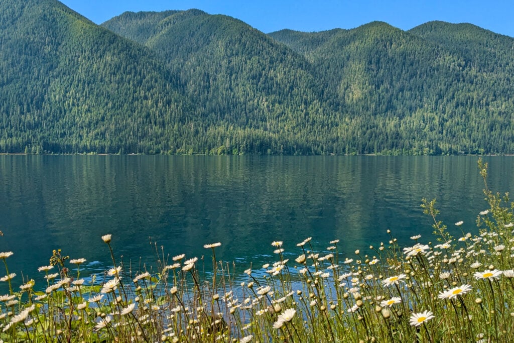
You’ll start your morning by driving to Lake Crescent. Lake Crescent has a variety of things to do, like hiking, kayaking, and swimming. The top trails for the area are Marymere Falls, Mount Storm King Trail, and the Spruce Railroad Trail. Kayak rentals are available through the Lake Crescent Lodge.
After visiting Lake Crescent, you’ll drive to Sol Duc. This is a 20-mile drive that takes roughly 30 minutes.
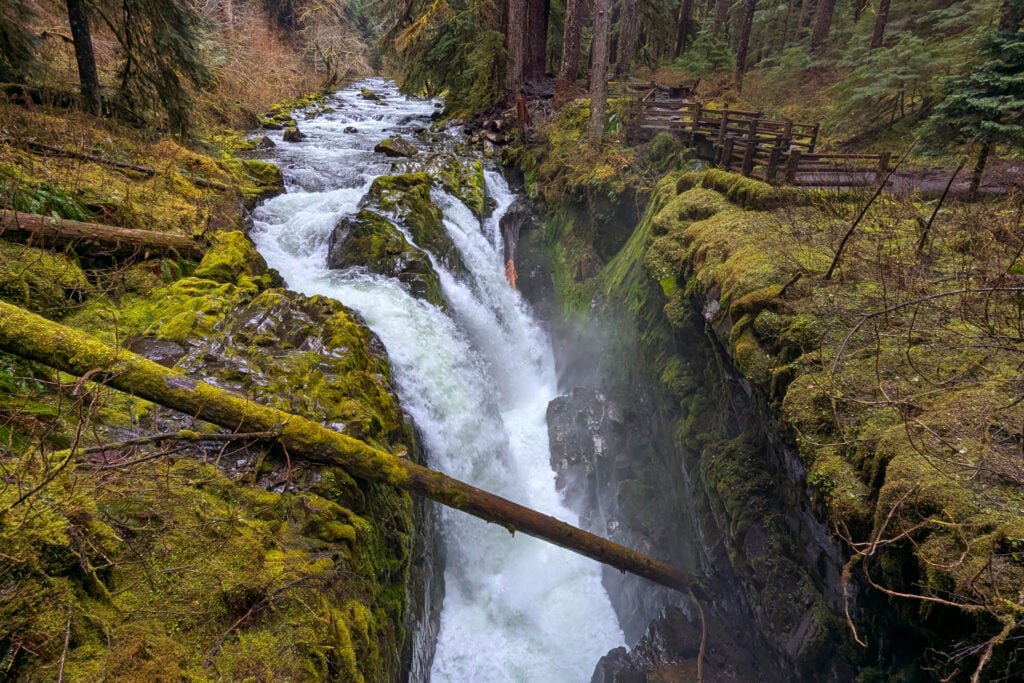

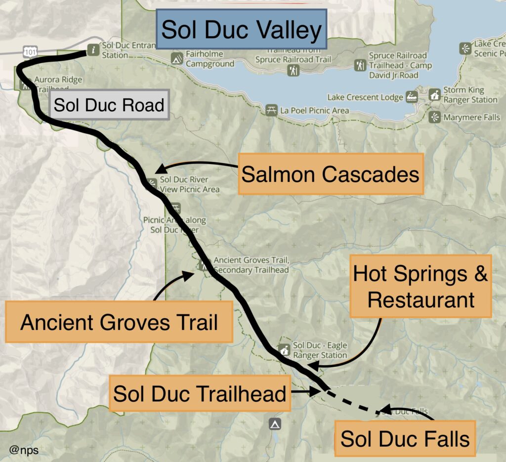
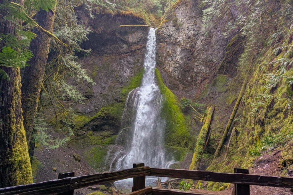
You’ll hike to the iconic Sol Duc Falls, which is located at the end of Sol Duc Hot Springs Road. This is an easy, 1.8-mile hike with 262 feet of elevation gain. This trail takes you through a beautiful old-growth forest to the falls, wth views of the Sol Duc River and other smaller falls along the way.
Other spots to check out in Sol Duc are the Ancient Groves Nature Trail, the Salmon Cascades Exhibit, and the Sol Duc Hot Springs.
Sol Duc Hot Springs Resort Campground: Located by the Sol Duc Falls. This is the only campground in Olympic National Park that has an RV park with hook-ups. This campground houses 82 campsites and 17 RV sites. This campground is open mid-March through October, and reservations are required. Sites start at ~$33 per night.
Sol Duc Hot Springs Resort (book here): This resort offers cabins and suites for rent. They are open from mid-March through November. They are a bit on the higher end, with rooms around $300 per night, but you do get complimentary access to the hot springs during your stay.
DON’T MISS: How to Visit the Sol Duc Valley
Lake Crescent to Cape Flattery is 67 miles, or about 1.5 hours away.
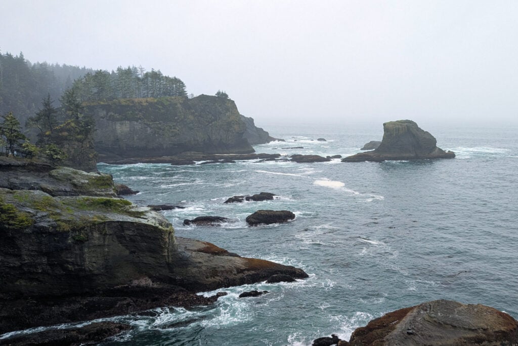
Cape Flattery is the northwesternmost point in the contiguous United States. This area is a bit of a detour from the rest of the Olympic Peninsula, but it’s well worth the drive! It’s a place unlike any other in the area. A walk will take you to a series of overlooks with dramatic views of seastacks, waves crashing into the cliffside, and wildlife like eagles, sea stars, and whales. The trail is an easy 1.2-mile round-trip walk with 229 feet of elevation gain.
You need a Makah Recreation Permit to access Cape Flattery and the majority of the surrounding areas. This permit is ~$20 per vehicle and can be purchased online or in person at various businesses around town.
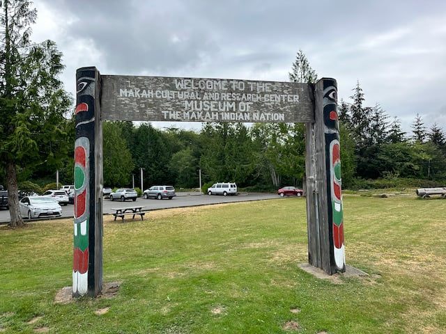
While you are in the area, take some time to check out Neah Bay. This is a small town that you’ll pass through on the way to Cape Flattery. Neah Bay has a handful of restaurants and the Makah Cultural & Research Center Museum. The museum is one of my favorite things to do in the area; it’s filled with so much information about the history of the Makah people and houses many artifacts dating back 500 years. Admission is ~$10 per person.
I recommend stopping by Pat’s Place, where they make indian tacos. Native Grounds Espresso is also a great spot to grab some coffee or pick up one of their daily breakfast and lunch specials.
An optional hike to add to your itinerary is Shi Shi Beach. This trail is a moderate 5-mile out-and-back trail with 515 feet of elevation gain. The trail takes you 2.5 miles through a dense forest to a secluded beach.
PRO TIP: This area can be extremely wet and muddy year-round. I highly recommend packing rain boots or waterproof hiking boots. Also, bring lots of layers and be prepared to get wet.
Hobuck Beach Resort: This is an oceanside resort offering first-come, first-served RV, tent camping, and cabins for rent. Amenities include a full bathhouse with showers, RV hook-ups, picnic tables, and a capacity for long vehicles. Sites start at ~$30 per night.
13 road trip ideas across the West so you know where to go, how long to stay, and what to see
*Sample routes from 4–31 days across national parks and hidden gems
*Driving times + best stops so you don’t miss the good stuff
*Season + weather notes to avoid closed roads and peak‑crowd days
*Lodging ideas in the right spots so you cut backtracking
Cape Flattery to Forks is 57 miles, or about a 1.5-hour drive.

Forks is a great stop to make for fueling up, grabbing groceries, or checking out the gift shops. Here you’ll find Forks Outfitters, which contains a grocery store, Ace Hardware, and a large selection of clothes and souvenirs. Other shops include Native to Twilight, a shop combining the love for Twilight fans with native artwork, and the Chinook Pharmacy, which is more than a pharmacy with a variety of souvenirs and locally made art.
For restaurants in Forks, I recommend the Longhouse Cafe, serving up delicious indian tacos while taking you into a full cultural experience, with native celebrations and songs playing on the TV and traditional native artwork covering the walls and tables.
After you’re done exploring Forks, you’ll head to La Push and Rialto Beach. Forks to La Push or Rialto is about 15 miles, or roughly 20 minutes away.

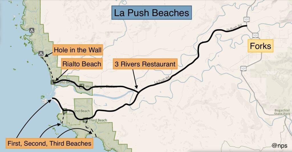
From here, you have a variety of beaches and hikes to explore. La Push is known for its hike-to beaches, taking you through a dense forest to pristine beaches, which are typically less crowded. There are three main beaches in La Push:
La Push to Rialto Beach is 11 miles, or about 20 minutes away.
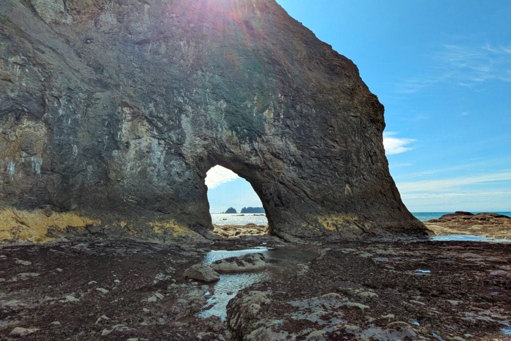
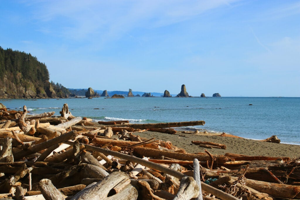
Rialto Beach offers oceanfront parking with a long beach to explore. This beach has the option for a hike to the Hole-in-the-Wall, which is a large rock with a natural arch that you can walk through to explore tide pools. This trail is a moderate, 3.3-mile out-and-back hike with minimal elevation gain. This trail is more of a walk along the beach than an actual hike. It must be completed at low tide; otherwise, the Hole-in-the-Wall is inaccessible.
Mora Campground: Located less than 2 miles from Rialto Beach, Mora Campground is my favorite place to camp in the area. This campground is heavily forested, with the sounds of nature lulling you to sleep. This campground is open year-round, with reservations required from mid-May through mid-September. Campsites are ~$24 per night with 94 sites to choose from. This campground features flush toilets, potable water, and a dump station.
3 Rivers Resort: This resort offers a mixture of sites with RV hook-ups, cabins, and tiny homes. They are conveniently located between Forks and La Push. Amenities include on-site laundry, showers, and complimentary wifi. Rates start at ~$45 per night.
Bogachiel State Park is located 5 miles, or about 10 minutes, from Forks.
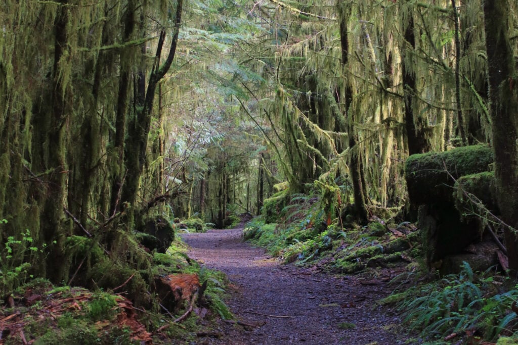
This state park is a less-visited area of the Olympic Peninsula and is often a replacement for visiting the more crowded Hoh Rain Forest. Here, you will find hiking trails leading you through an old-growth forest and along the Bogachiel River.
The Bogachiel Rain Forest Trail is an awesome hike to add to your itinerary. There are several access points for the trail, making it a create-your-own adventure hike. You’ll walk through a dreamy forest filled with moss and mushrooms. The trail also leads along the river, where elk like to hang out. This trail can be completed as a 3-mile loop or a longer out-and-back hike, as many paths lead in various directions.
After exploring the forest, it’s time to head to Kalaloch. The Bogachiel State Park to Kalaloch is a 30-mile drive, taking about 40 minutes.
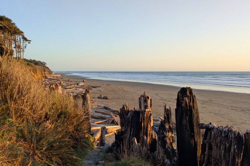
There are a few smaller hikes at Kalaloch, but my favorite thing to do here is explore the beaches. Kalaloch has over 5 miles of beaches, with different access points. I recommend stopping at Ruby Beach, 7 miles north of the Kalaloch Campground. Ruby Beach is great for tide pooling and admiring the sea stacks right off the coast.
The main beach is located right at the Kalaloch Campground, where you can park at the Day Use area and take a short staircase down to the ocean. Here, you’ll find the famous Tree of Life. This is my go-to sunset spot.
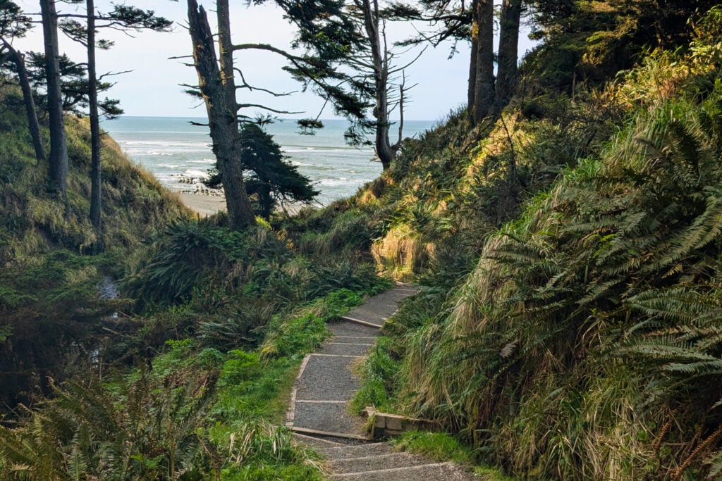
4th Beach is another great one to add to your list. A fairly steep walk down a staircase, mixed with a gravel walking path, leads you to the beach. This is one of the best tide-pooling locations that I’ve seen in the Olympic Peninsula. Just take it easy on the hike back up.
Kalaloch Campground: This campground is one of the busiest on the Olympic Peninsula, which makes sense because it’s situated right on the ocean front with incredible views. Kalaloch Campground is open year-round, with reservations required mid-May through late September. Campsites are ~$24 per night with 170 total sites. This campground offers flush toilets, potable water, and a dump station.
Kalaloch Lodge: This lodge has cabins, rooms, and group campsites available. They are located right on the beachfront, giving you incredible views.
On the final day exploring the Olympic Peninsula, you’ll head to the Quinault Rain Forest. Kalaloch Campground to the Quinault Rain Forest is 33 miles, or about a 40-minute drive.
There are two roads leading you into the Quinault Rain Forest, North Shore Road and South Shore Road. I prefer to explore the south shore area because there are more hikes and waterfalls to explore. The South Shore is located in the Olympic National Forest, which requires a Discover Pass or an America the Beautiful Pass.
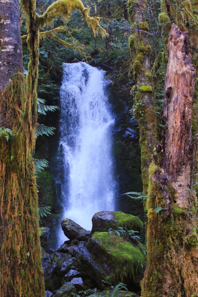
In Quinault, you can park at the Ranger Station as a starting point for many hikes. Here, you can hike the Quinault Loop, which takes you by Falls Creek, Lake Quinault, and through the Quinault Rain Forest featuring Cascade Falls. This loop is an easy, 3.4-mile trail with 364 feet of elevation gain.
My favorite trail in Quinault is the Rain Forest Nature Trail. This is an easy 0.9-mile loop with 121 feet of elevation gain. This trail is a peaceful walk through the woods, featuring informational signs along the way teaching you about temperate rainforests and the flora and fauna that call this area home.
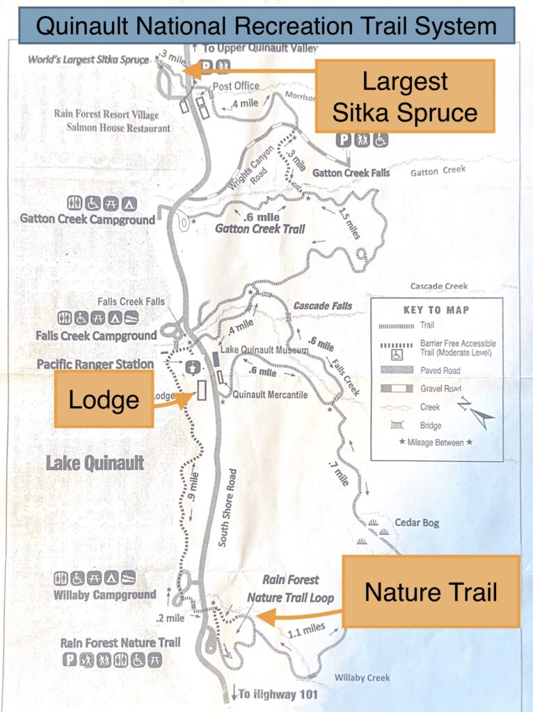
Other stops to mention:
After exploring Quinault, you have the option of staying the night or heading outside of the park. From here, SeaTac is 135 miles, or roughly 2.5 hours away.
Falls Creek Campground: This campground is run by the National Forest Service. It offers 21 drive-up sites and 10 hike-in sites. Restrooms and potable water are available. Falls Creek Campground is open mid-May to mid-September, with reservations required.
Lake Quinault Lodge (book here): Nestled right on Lake Quinault, this historic lodge offers a dreamy getaway. They have various lodge rooms to choose from. Plus, you get access to the pool and sauna during your stay.
Get our done‑for‑you, 7‑17 day route with exact drives, maps, and must‑see stops so you don’t waste time in traffic or miss the best views
Inside the guide:
*Day‑by‑day plan for Olympic, Mount Rainier, the Oregon Coast, & the Columbia River Gorge
*Details You Need: Time frames, driving routes, and where to sleep each night to reduce back-tracking
*Best Friend Guarantee: love it or get your money back
A longer Washington National Park road trip can be combined with your visit to Olympic National Park. Mount Rainier National Park is about 3.5 hours from Olympic and is a great option for seeing the volcano close up with fields of wildflowers and wildlife viewing. North Cascades National Park is perfect for someone seeking solitude with incredible mountains and untouched wilderness. North Cascades National Park is about 4-5 hours away from Olympic, depending on your route.

We’ve written a step-by-step guide for visiting Olympic National Park. This guide contains 32 pages with over 60 maps, charts, and images. We’ll walk you through every area of Olympic National Park with restaurant recommendations, tips for traveling, and amazing, can’t-miss hikes.
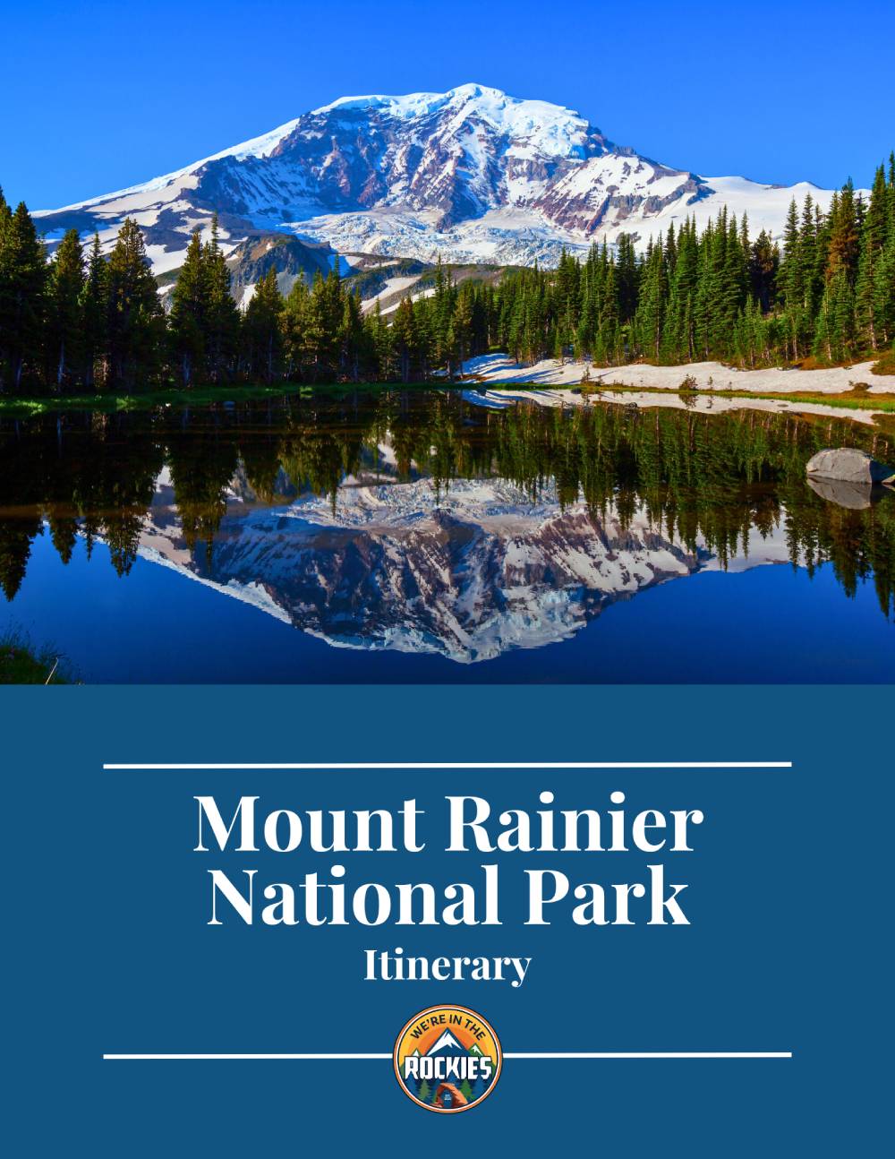
Which Entrance Should I Use to Visit Mount Rainier?
Best (and Worst) Times of Year to Visit Mount Rainier (+ Wildflowers & Reservations)
Quick and Easy Guide to Hiking in Mount Rainier
How to Visit Mount St. Helens: 9 Things To Do
Driving the Oregon Coast HWY 101: 10 Things to Know Before You Go